by Mounsieur Sanson ; rendred into English and illustrated by Richard Blome ; Francis Lamb Sculpit.Covers also portions of Spain, Sicily, Greece, Crete, Turkey and Cyprus.Relief shown pictorially.Includes ill. and index.In English, translated from French.
by Mounsieur Sanson ; rendred into English and illustrated by Richard Blome ; Francis Lamb Sculpit.Covers also portions of Spain, Sicily, Greece, Crete, Turkey and Cyprus.Relief shown pictorially.Includes ill. and index.In English, translated from French.
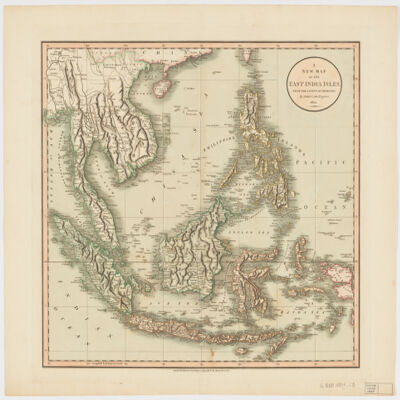
by John Cary.Relief shown pictorially and with shading.Prime meridian: Greenwich.Covers Sumatra, Java, Borneo, Sulawesi, the Philippines, Papua new Guinea and portions of China, Burma and Malaysia.Shows boundaries, rivers, roads and settlements.Electronic reproduction. Cambridge, Mass. : Harvard Geospatial Library, 2009. Georeferenced image for use in a GIS.Electronic reproduction. Cambridge, Mass. : Harvard College Library Digital Imaging Group, 2009. (Open Collections Program at Harvard University. Islamic Heritage Project). Copy digitized: Map Coll (Pusey) : MAP-LC G8000 1801 .C3.
This layer is a georeferenced raster image of the historic paper map entitled: Routen der wichtigsten und neuesten Reisen in Afrika. It was published by Ed. Hölzels geogr. Inst. in 1884. Scale [ca. 1:40,000,000]. The image inside the map neatline is georeferenced to the surface of the earth and fit to a non-standard 'World Sinusoidal' projection with the central meridian at 20 degrees east. All map collar and inset information is also available as part of the raster image, including any inset maps, profiles, statistical tables, directories, text, illustrations, index maps, legends, or other information associated with the principal map. This map shows features such as drainage, cities and other human settlements, expedition routes, and more. This layer is part of a selection of digitally scanned and georeferenced historic maps from the Harvard Map Collection and the Harvard University Library as part of the Open Collections Program at Harvard University project: Organizing Our World: Sponsored Exploration and Scientific Discovery in the Modern Age. Maps selected for the project correspond to various expeditions and represent a range of regions, originators, ground condition dates, scales, and purposes.Historic paper maps can provide an excellent view of the changes that have occurred in the cultural and physical landscape. The wide range of information provided on these maps make them useful in the study of historic geography, and urban and rural land use change. As this map has been georeferenced, it can be used in a GIS as a source or background layer in conjunction with other GIS data.None planned
This layer is a georeferenced raster image of the historic paper map entitled: Nova Africae tabula, auctore Jodoco Hondio. It was published by Excusum in aedibus auctoris ca. between 1611 and 1612. Scale [ca. 1:24,000,000]. Covers Africa and small portions of Europe and the Middle East. Map in Latin.The image inside the map neatline is georeferenced to the surface of the earth and fit to the Africa Sinusoidal projected coordinate system. All map collar and inset information is also available as part of the raster image, including any inset maps, profiles, statistical tables, directories, text, illustrations, index maps, legends, or other information associated with the principal map. This map shows features such as drainage, cities and other human settlements, territorial boundaries, shoreline features, and more. Relief shown pictorially. Includes notes.This layer is part of a selection of digitally scanned and georeferenced historic maps from the Harvard Map Collection. These maps typically portray both natural and manmade features. The selection represents a range of originators, ground condition dates, scales, and map purposes.Historic paper maps can provide an excellent view of the changes that have occurred in the cultural and physical landscape. The wide range of information provided on these maps make them useful in the study of historic geography, and urban and rural land use change. As this map has been georeferenced, it can be used in a GIS as a source or background layer in conjunction with other GIS data.None planned
This layer is a georeferenced raster image of the historic paper map entitled: L'Afrique, dressée sur les observations de Mrs. de l'Académie royale des sciences et quelques autres, et sur les mémoires les plus récens, par G. De L'Isle. It was published by chez l'autheur, rue des Canettes prez St. Sulpice in 1700. Scale [ca. 1:21,250,000]. Covers Africa and portions of Europe, the Middle East, and Asia. Map in French.The image inside the map neatline is georeferenced to the surface of the earth and fit to the Africa Sinusoidal projected coordinate system. All map collar and inset information is also available as part of the raster image, including any inset maps, profiles, statistical tables, directories, text, illustrations, index maps, legends, or other information associated with the principal map. This map shows features such as drainage, cities and other human settlements, roads and routes, territorial boundaries, shoreline features, and more. Relief shown pictorially. Includes notes.This layer is part of a selection of digitally scanned and georeferenced historic maps from the Harvard Map Collection. These maps typically portray both natural and manmade features. The selection represents a range of originators, ground condition dates, scales, and map purposes.Historic paper maps can provide an excellent view of the changes that have occurred in the cultural and physical landscape. The wide range of information provided on these maps make them useful in the study of historic geography, and urban and rural land use change. As this map has been georeferenced, it can be used in a GIS as a source or background layer in conjunction with other GIS data.None planned
This layer is a georeferenced raster image of the historic paper map entitled: Africae in tabula geographica delineatio : admentem novissimorum corumq. optimorum geographorum emendata, indicibus utilissimis aucta et adusum tyronum imprimis geographicorum, variis compendiosae methodi adminiculis accomodata opera A. F. Zürneri Reg: maj: Pol: et el: Sax: provinciarum finiumq. commissarii et geographi ut et Reg: Soc: Sci: B. M. It was published by ex officina Petri Schenkii in platea vulgo de Warmoes straat sub signo N. Visschers atlas, between 1730 and 1740. Scale [ca. 1:19,250,000]. Covers Africa and parts of Europe and the Middle East. Map in Latin.The image inside the map neatline is georeferenced to the surface of the earth and fit to the Africa Sinusoidal projected coordinate system. All map collar and inset information is also available as part of the raster image, including any inset maps, profiles, statistical tables, directories, text, illustrations, index maps, legends, or other information associated with the principal map. This map shows features such as drainage, cities and other human settlements, roads and routes, territorial boundaries, shoreline features, and more. Relief shown pictorially.This layer is part of a selection of digitally scanned and georeferenced historic maps from the Harvard Map Collection. These maps typically portray both natural and manmade features. The selection represents a range of originators, ground condition dates, scales, and map purposes.Historic paper maps can provide an excellent view of the changes that have occurred in the cultural and physical landscape. The wide range of information provided on these maps make them useful in the study of historic geography, and urban and rural land use change. As this map has been georeferenced, it can be used in a GIS as a source or background layer in conjunction with other GIS data.None planned
This layer is a georeferenced raster image of the historic paper map entitled: L'Afrique, revüe, corrigée et publiée par M. Moithey, ingénieur géographe du Roi. It was published by chez Crepy, rüe St. Jacques à Saint Pierre, près la rue de la parcheminerie in 1785. Scale [ca. 1:14,500,000]. This layer is image 2 of 2 total images of the two sheet source map, representing the eastern portion of the map. Covers Africa and small portions of southern Europe, the Middle East, and South America. Map in French. The image inside the map neatline is georeferenced to the surface of the earth and fit to the Africa Sinusoidal projected coordinate system. All map collar and inset information is also available as part of the raster image, including any inset maps, profiles, statistical tables, directories, text, illustrations, index maps, legends, or other information associated with the principal map. This map shows features such as drainage, cities and other human settlements, roads, territorial boundaries, shoreline features, and more. Relief shown pictorially. Includes also text and notes.This layer is part of a selection of digitally scanned and georeferenced historic maps from the Harvard Map Collection. These maps typically portray both natural and manmade features. The selection represents a range of originators, ground condition dates, scales, and map purposes.Historic paper maps can provide an excellent view of the changes that have occurred in the cultural and physical landscape. The wide range of information provided on these maps make them useful in the study of historic geography, and urban and rural land use change. As this map has been georeferenced, it can be used in a GIS as a source or background layer in conjunction with other GIS data.None planned
This layer is a georeferenced raster image of the historic paper map entitled: Karte von Afrika, Nach Vaugondy neu verzeichnet herausgegeben von Franz Joh. Jos. Von Reilly ; gestochen von Hier. Benedicti. It was published by Reilly'sches Landkarten und Kunstwerke Verschleiss Komptoir in 1795. Scale [ca. 1:17,500,000]. Covers Africa. Map in German.The image inside the map neatline is georeferenced to the surface of the earth and fit to the Africa Sinusoidal projected coordinate system. All map collar and inset information is also available as part of the raster image, including any inset maps, profiles, statistical tables, directories, text, illustrations, index maps, legends, or other information associated with the principal map. This map shows features such as drainage, cities and other human settlements, territorial boundaries, shoreline features, and more. Relief shown pictorially. Includes also notes. This layer is part of a selection of digitally scanned and georeferenced historic maps from the Harvard Map Collection. These maps typically portray both natural and manmade features. The selection represents a range of originators, ground condition dates, scales, and map purposes.Historic paper maps can provide an excellent view of the changes that have occurred in the cultural and physical landscape. The wide range of information provided on these maps make them useful in the study of historic geography, and urban and rural land use change. As this map has been georeferenced, it can be used in a GIS as a source or background layer in conjunction with other GIS data.None planned
This layer is a georeferenced raster image of the historic paper map entitled: Charte von Africa, nach astronomischen Beobachtungen, auch alten und neuen Nachrichten, ingleichen den Charten von Sayer, Rennel, Arrowsmit u.a.m. neu entworfen von F.L. Güssefeld. It was published by bey den Homannischen Erben in 1797. Scale [ca. 1:20,050,000]. Covers Africa and a small portion of Europe and the Middle East. Map in German. The image inside the map neatline is georeferenced to the surface of the earth and fit to the Africa Sinusoidal projected coordinate system. All map collar and inset information is also available as part of the raster image, including any inset maps, profiles, statistical tables, directories, text, illustrations, index maps, legends, or other information associated with the principal map. This map shows features such as drainage, cities and other human settlements, territorial boundaries, roads, shoreline features, and more. Relief shown by hachures.This layer is part of a selection of digitally scanned and georeferenced historic maps from the Harvard Map Collection. These maps typically portray both natural and manmade features. The selection represents a range of originators, ground condition dates, scales, and map purposes.Historic paper maps can provide an excellent view of the changes that have occurred in the cultural and physical landscape. The wide range of information provided on these maps make them useful in the study of historic geography, and urban and rural land use change. As this map has been georeferenced, it can be used in a GIS as a source or background layer in conjunction with other GIS data.None planned
This layer is a georeferenced raster image of the historic paper map entitled: Africa. It was published by Calcogafia Vignozzi in 1800. Scale [ca. 1:30,000,000]. The image inside the map neatline is georeferenced to the surface of the earth
and fit to a non-standard 'World Aitoff' projection with the central meridian at 20 degrees east. All map collar and inset information is also available as part of the raster image, including any inset maps, profiles, statistical tables, directories,
text, illustrations, index maps, legends, or other information associated with the principal map. This map shows features such as drainage, cities and other human settlements, territorial boundaries, shoreline features, and more. Relief is shown
pictorially.This layer is part of a selection of digitally scanned and georeferenced historic maps from the Harvard Map Collection and the Harvard University Library as part of the Open Collections Program at Harvard University project: Organizing
Our World: Sponsored Exploration and Scientific Discovery in the Modern Age. Maps selected for the project correspond to various expeditions and represent a range of regions, originators, ground condition dates, scales, and purposes.Historic paper maps can provide an excellent view of the changes that have occurred in the cultural and physical landscape. The wide range of information provided on these maps make them useful in the study of historic geography, and urban
and rural land use change. As this map has been georeferenced, it can be used in a GIS as a source or background layer in conjunction with other GIS data.None planned
This layer is a georeferenced raster image of the historic paper map entitled: A new map of Africa : from the latest authorities, by John Cary, engraver. It was published by J. Cary, Engraver and Map-Seller, 181 Strand in June 1st., 1805. Scale [ca. 1:17,500,000]. Covers also a small portion of Europe and the Middle East. The image inside the map neatline is georeferenced to the surface of the earth and fit to the Africa Sinusoidal projected coordinate system. All map collar and inset information is also available as part of the raster image, including any inset maps, profiles, statistical tables, directories, text, illustrations, index maps, legends, or other information associated with the principal map. This map shows features such as drainage, cities and other human settlements, territorial boundaries, roads, shoreline features, and more. Relief shown pictorially and with shading. Includes alsoThis layer is part of a selection of digitally scanned and georeferenced historic maps from the Harvard Map Collection. These maps typically portray both natural and manmade features. The selection represents a range of originators, ground condition dates, scales, and map purposes.Historic paper maps can provide an excellent view of the changes that have occurred in the cultural and physical landscape. The wide range of information provided on these maps make them useful in the study of historic geography, and urban and rural land use change. As this map has been georeferenced, it can be used in a GIS as a source or background layer in conjunction with other GIS data.None planned
This layer is a georeferenced raster image of the historic paper map entitled: Smith's new map of Africa : comprising the most recent researches, Picket sculpt. It was printed for C. Smith, Mapseller and Publisher in Jany. 6th, 1815. Scale [ca. 1:12,000,000]. Covers also a small portion of Europe and the Middle East. The image inside the map neatline is georeferenced to the surface of the earth and fit to the Africa Sinusoidal projected coordinate system. All map collar and inset information is also available as part of the raster image, including any inset maps, profiles, statistical tables, directories, text, illustrations, index maps, legends, or other information associated with the principal map. This map shows features such as drainage, cities and other human settlements, territorial boundaries, roads, shoreline features, and more. Relief shown by hachures. This layer is part of a selection of digitally scanned and georeferenced historic maps from the Harvard Map Collection. These maps typically portray both natural and manmade features. The selection represents a range of originators, ground condition dates, scales, and map purposes.Historic paper maps can provide an excellent view of the changes that have occurred in the cultural and physical landscape. The wide range of information provided on these maps make them useful in the study of historic geography, and urban and rural land use change. As this map has been georeferenced, it can be used in a GIS as a source or background layer in conjunction with other GIS data.None planned
This layer is a georeferenced raster image of the historic paper map entitled: Carte détaillée (en deux feuilles), de l'Afrique et des îles qui en dependent (partie septentrionale), par A. Broué, Géographe du Roi, d'après les observations astronomiques, les découvertes et les hypothèses les plus récentes. Revue en 1834. It was published by Chez l'Auteur in 1828, i.e. 1834. Scale [ca. 1:16,250,000]. Covers Africa and a small portion of Europe and the Middle East. Map in French.The image inside the map neatline is georeferenced to the surface of the earth and fit to the Africa Sinusoidal projected coordinate system. All map collar and inset information is also available as part of the raster image, including any inset maps, profiles, statistical tables, directories, text, illustrations, index maps, legends, or other information associated with the principal map. This map shows features such as drainage, cities and other human settlements, territorial boundaries, roads, mines, shoreline features, and more. Relief shown by hachures. Includes notes and insets: Extrémité Sud de l'Afrique, ou Colonie du Cap, Pays des Hottentots et Betjouanas; Archipel du Nord-Est de Madagascar; Abyssinie et Pays des Gallas, etc.This layer is part of a selection of digitally scanned and georeferenced historic maps from the Harvard Map Collection. These maps typically portray both natural and manmade features. The selection represents a range of originators, ground condition dates, scales, and map purposes.Historic paper maps can provide an excellent view of the changes that have occurred in the cultural and physical landscape. The wide range of information provided on these maps make them useful in the study of historic geography, and urban and rural land use change. As this map has been georeferenced, it can be used in a GIS as a source or background layer in conjunction with other GIS data.None planned
This layer is a georeferenced raster image of the historic paper map entitled: Afrique : d'apres les documents les plus recents et les derniers traites, dressee par E. Giffault ; grave et imp. par Erhard Fres. It was published by Le Temps Bureaux in 1890. Scale 1:18,000,000. Map in French.The image inside the map neatline is georeferenced to the surface of the earth and fit to a non-standard 'World Sinusoidal' projection with the central meridian at 20 degrees east. All map collar and inset information is also available as part of the raster image, including any inset maps, profiles, statistical tables, directories, text, illustrations, index maps, legends, or other information associated with the principal map. This map shows features such as drainage, roads, caravan routes, cities and other human settlements, territorial boundaries, colonial possessions, and more. Relief is shown by hachures and spot heights. This layer is part of a selection of digitally scanned and georeferenced historic maps from the Harvard Map Collection and the Harvard University Library as part of the Open Collections Program at Harvard University project: Organizing Our World: Sponsored Exploration and Scientific Discovery in the Modern Age. Maps selected for the project correspond to various expeditions and represent a range of regions, originators, ground condition dates, scales, and purposes.Historic paper maps can provide an excellent view of the changes that have occurred in the cultural and physical landscape. The wide range of information provided on these maps make them useful in the study of historic geography, and urban and rural land use change. As this map has been georeferenced, it can be used in a GIS as a source or background layer in conjunction with other GIS data.None planned
This layer is a georeferenced raster image of the historic paper map entitled: Tiré de l'ouvrage les missions catholiques d'Afrique en 1889, par le Baron Léon Bethune. It was published by Société de St. Augustin in 1889. Scale 1:20,000,000. Map in French.The image inside the map neatline is georeferenced to the surface of the earth and fit to a non-standard 'World Sinusoidal' projection with the central meridian at 20 degrees east. All map collar and inset information is also available as part of the raster image, including any inset maps, profiles, statistical tables, directories, text, illustrations, index maps, legends, or other information associated with the principal map. This map shows features such as drainage, cities and other human settlements, colonial possessions, ecclesiastical districts, and more. Relief is shown by hachures. Includes index.This layer is part of a selection of digitally scanned and georeferenced historic maps from the Harvard Map Collection and the Harvard University Library as part of the Open Collections Program at Harvard University project: Organizing Our World: Sponsored Exploration and Scientific Discovery in the Modern Age. Maps selected for the project correspond to various expeditions and represent a range of regions, originators, ground condition dates, scales, and purposes.Historic paper maps can provide an excellent view of the changes that have occurred in the cultural and physical landscape. The wide range of information provided on these maps make them useful in the study of historic geography, and urban and rural land use change. As this map has been georeferenced, it can be used in a GIS as a source or background layer in conjunction with other GIS data.None planned
This layer is a georeferenced raster image of the historic paper map entitled: Africa : divisa in suas principales partes, nempè : imperia, monarchias, regna, principatus, et insulas, per Sr. Sansonium, geographum Regis Galliae ordinarium ; [cartouche] Sigmund Gabriel Hipschmann scul. It was published by Johannem Hoffmannum between 1680 and 1689. Scale [ca. 1:16,500,000]. Covers Africa and small portions of southern Europe, the Middle East, and South America. Map in Latin.The image inside the map neatline is georeferenced to the surface of the earth and fit to the Africa Sinusoidal projected coordinate system. All map collar and inset information is also available as part of the raster image, including any inset maps, profiles, statistical tables, directories, text, illustrations, index maps, legends, or other information associated with the principal map. This map shows features such as drainage, cities and other human settlements, roads, shoreline features, and more. Relief shown pictorially.This layer is part of a selection of digitally scanned and georeferenced historic maps from the Harvard Map Collection. These maps typically portray both natural and manmade features. The selection represents a range of originators, ground condition dates, scales, and map purposes.Historic paper maps can provide an excellent view of the changes that have occurred in the cultural and physical landscape. The wide range of information provided on these maps make them useful in the study of historic geography, and urban and rural land use change. As this map has been georeferenced, it can be used in a GIS as a source or background layer in conjunction with other GIS data.None planned
This layer is a georeferenced raster image of the historic paper map entitled: Africa vetus, autore N. Sanson. It was published by J. Cóvens & C. Mortier ca. 1725. Scale [ca. 1:25,000,000]. Covers Africa and small portions of Europe and the Middle East. Map in Latin. The image inside the map neatline is georeferenced to the surface of the earth and fit to the Africa Sinusoidal projected coordinate system. All map collar and inset information is also available as part of the raster image, including any inset maps, profiles, statistical tables, directories, text, illustrations, index maps, legends, or other information associated with the principal map. This map shows features such as drainage, cities and other human settlements, territorial boundaries, shoreline features, and more. Relief shown pictorially. This layer is part of a selection of digitally scanned and georeferenced historic maps from the Harvard Map Collection. These maps typically portray both natural and manmade features. The selection represents a range of originators, ground condition dates, scales, and map purposes.Historic paper maps can provide an excellent view of the changes that have occurred in the cultural and physical landscape. The wide range of information provided on these maps make them useful in the study of historic geography, and urban and rural land use change. As this map has been georeferenced, it can be used in a GIS as a source or background layer in conjunction with other GIS data.None planned
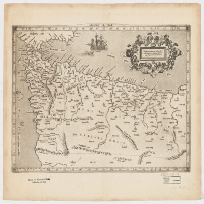
[Gerardus Mercator].Attributed to Mercator.Also covers a portion of Southern Spain.Relief shown pictorially.In an ornamental cartouche: "Medius meridianus J6, reliqui ad hunc inclinati funt pro ratione parallelorum 29 BL 34 ad circulum maximum."Probably originally published with a second map entitled "Africae II Tab." covering Malta, Sicily, Sardinia, Tunisia and Libya.Includes note and index on verso.Electronic reproduction. Cambridge, Mass. : Harvard College Library Digital Imaging Group, 2009. (Open Collections Program at Harvard University. Islamic Heritage Project). Copy digitized: Map Coll (Pusey) : MAP-LC G8220 1619 .A4.
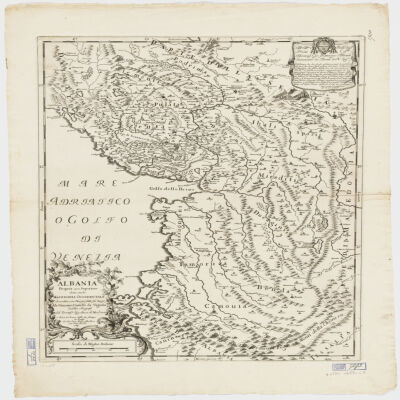
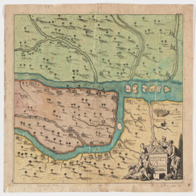
descritta con disegni fatti sul luogo da Giacomo Cantelli da Vignola suddito e geografo del Sereniss. Sig. Duca di Modena.Covers also portions of Croatia, Montenegro and Serbia.Relief shown pictorially.Includes a note in decorative cartouche and ill.Electronic reproduction. Cambridge, Mass. : Harvard College Library Digital Imaging Group, 2009. (Open Collections Program at Harvard University. Islamic Heritage Project). Copy digitized: Map Coll (Pusey) : MAP-LC G6830 1689 .C3.
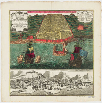
cura et sumptibus Matth. Seutteri.Birds-eye view.Appears in: Atlas novus sive tabulæ geographicæ totius orbis faciem, partes, imperia, regna et provincias exhibentes / exactissima cura iuxta recentissimas observation Matthaeo Seutter, [1745?]. Vol.1, map No. 137.Includes a close-up view of Algiers and index.In German with a title in Latin.Electronic reproduction. Cambridge, Mass. : Harvard College Library Digital Imaging Group, 2009. (Open Collections Program at Harvard University. Islamic Heritage Project). Copy digitized: Map Coll (Pusey) : MAP-LC G8244.A6 A3 1730 .S4.
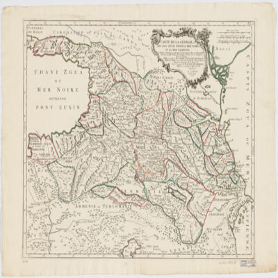
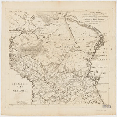
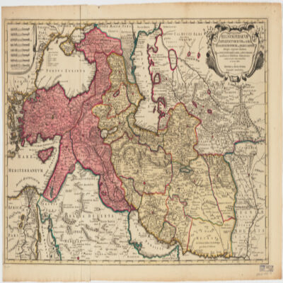
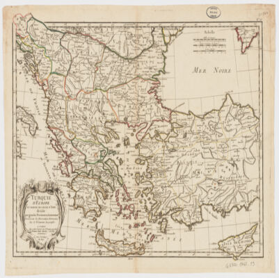
traduit du Géorgien en François par le Secrétaire du Roy de Géorgie.Covers also portions of Turkey, Armenia, Azerbaijan and Russia.Relief shown pictorially.Colored in outline."Publiée en 1766 par M. Joseph Nicolas de Lisle, Doyen des Proffesseurs royaux de l'Académie Royale des Sciences, Premier Astronome Géographe de la Marine &a. Sous les auspices de M. le Duc de Choiseul, Ministre et Secrétaire d'État &a &a.""P. II".Includes ill.In French, translated from Georgian.Electronic reproduction. Cambridge, Mass. : Harvard College Library Digital Imaging Group, 2009. (Open Collections Program at Harvard University. Islamic Heritage Project). Copy digitized: XXXXX Library: [call no.].
dressée au Service géographique de l'armée.Covers also a portion of Algeria and Libya.Relief shown by shading and spot heights. Depth shown by isolines.In French with place names in Arabic and Latin in Latin script.Table of Contents: "Tunisie (800 000e) Flle Nord" -- "Tunisie (800 000e) Flle Sud".
dressée au Service géographique de l'armée.Covers also a portion of Algeria and Libya.Relief shown by shading and spot heights. Depth shown by isolines.In French with place names in Arabic and Latin in Latin script.Table of Contents: "Tunisie (800 000e) Flle Nord" -- "Tunisie (800 000e) Flle Sud".
dressée au Service géographique de l'armée.Covers also a portion of Algeria and Libya.Relief shown by shading and spot heights. Depth shown by isolines.In French with place names in Arabic and Latin in Latin script.Table of Contents: "Tunisie (800 000e) Flle Nord" -- "Tunisie (800 000e) Flle Sud".
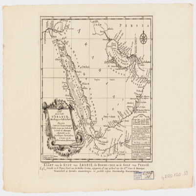
J. V. Schley.Prime meridian: Ferro.Depths shown by shading.Appears in: Histoire générale des voyages / Antoine-François Prevost. 1747-67. Vol. 1.Includes note.Map in French and Deutsch.Electronic reproduction. Cambridge, Mass. : Harvard Geospatial Library, 2009. Georeferenced image for use in a GIS.Electronic reproduction. Cambridge, Mass. : Harvard College Library Digital Imaging Group, 2009. (Open Collections Program at Harvard University. Islamic Heritage Project). Copy digitized: Map Coll (Pusey) : MAP-LC G7520 1740 .S3.
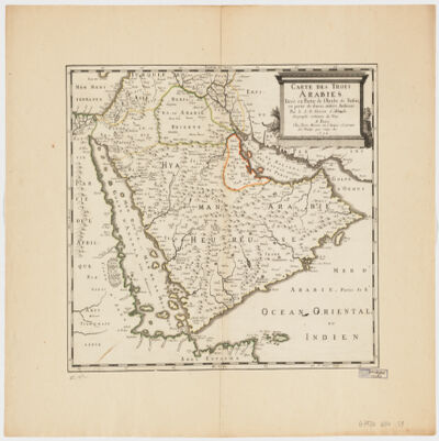
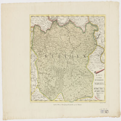
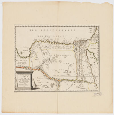
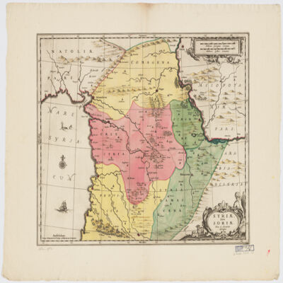
par le S. N. Sanson d'Abbeville Geographe ordinaire du Roy ; J. Somer sculp.Relief shown pictorially.Colored in outline.Place names in Latin and French.Electronic reproduction. Cambridge, Mass. : Harvard Geospatial Library, 2009. Georeferenced image for use in a GIS.Electronic reproduction. Cambridge, Mass. : Harvard College Library Digital Imaging Group, 2009. (Open Collections Program at Harvard University. Islamic Heritage Project). Copy digitized: Map Coll (Pusey) : MAP-LC G7520 1654 .S3 .
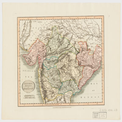
by John Cary.Covers Central and Northern India.Relief shown by hachures.Electronic reproduction. Cambridge, Mass. : Harvard Geospatial Library, 2009. Georeferenced image for use in a GIS.
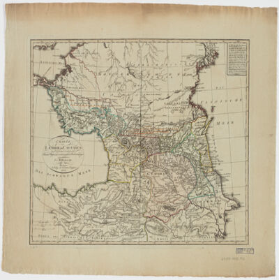
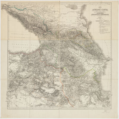
Charten, Reisen und astronomischen Orstbestimugen gezeichnet von I. C. M. Reinecke.Covers Azerbaijan, Georgia and portions of Armenia and the Russian Federation.Relief shown by hachures.Colored in outline.Includes note.Electronic reproduction. Cambridge, Mass. : Harvard Geospatial Library, 2009. Georeferenced image for use in a GIS.Electronic reproduction. Cambridge, Mass. : Harvard College Library Digital Imaging Group, 2009. (Open Collections Program at Harvard University. Islamic Heritage Project). Copy digitized: Map Coll (Pusey) MAP-LC G7120 1802 .R4.
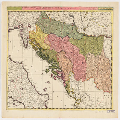
Venundantur per Gerardum et Leonardum Valk, cum Priv.Covers Croatia, Bosnia and Hercegovina, Serbia, Montenegro and portions of Italy, Albania, Greece, Macedonia and Hungary.Relief shown pictorially.Includes note.In Latin with place names in ItalianElectronic reproduction. Cambridge, Mass. : Harvard College Library Digital Imaging Group, 2009. (Open Collections Program at Harvard University. Islamic Heritage Project). Copy digitized: Map Coll (Pusey) MAP-LC G6800 1710 .V3.
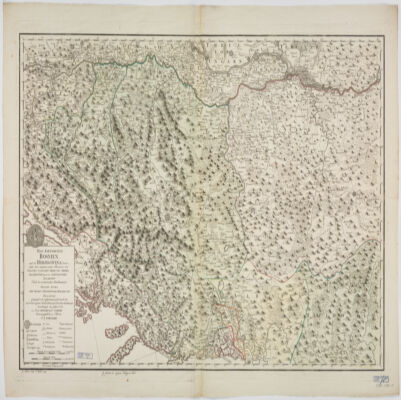
nach den militœrischen Handkarten des Prinzen Eugen der Grafen Khevenhüller, Marsigli und Pallavicini geographisch aufgetragen, und nach den zuverloessigsten Nachrichten, und Reisebeschreibungen berichtiget im Jahre 1788 von Herrn Maximilian Schimek ; J. Alberti Sculp. ; F. Müller Scrip.Shows locations and dates of battles.Covers Serbia, Albania, Bosnia, Croatia, Dalmatia and portions of Macedonia and Hungary.Relief shown pictorially.Prime meridian: Ferro.North oriented toward the left.Includes ill.
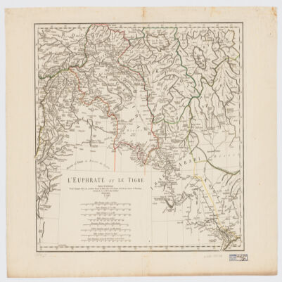
[Olfert Dapper].Covers a portion of southeastern Iraq where the Euphrates and the Tigris Rivers converge.Relief shown pictorially.From: Naukeurige beschryving van Asie: behelsende de gewesten van Mesopotamie, Babylonie, Assyrie, Anatolie, of Klein Asie: beneffens eene volkome beschrijving van gansch gelukkigh, woest, en petreesch of steenigh Arabie / Olfert Dapper. 1680.Oriented with North toward the left.Electronic reproduction. Cambridge, Mass. : Harvard College Library Digital Imaging Group, 2009. (Open Collections Program at Harvard University. Islamic Heritage Project). Copy digitized: Map Coll (Pusey) : MAP-LC G7610 1680 .D3.
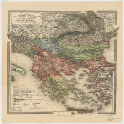
entworfen von C. Vogel ; bearbeitet von B. Domann ; gestochen von Kern, Kühn u. Weiler.Covers Bosnia und Herzegovina, Croatia, Montenegro, Greece, Serbia, Romania, Bulgaria, Macedonia and portions of Turkey.North oriented toward the right.Relief shown by hachures. Depths shown by bathymetry."No. 52" and "Stielers Hand-Atlas No. 54".Includes index.Insets: Constantinopel (Scale 1:150,000) -- Athens und Piraeus (Scale 1:150,000) -- Das Nördliche Rümanien im Anschluss and die Hauptkarte (Scale 1:1,500,000) -- Strasse der Dardanellen (Scale 1:150,000) -- Der Bosporus (Scale 1:150,000).Originally issued on 4 sheets.Electronic reproduction. Cambridge, Mass. : Harvard Geospatial Library, 2011. Georeferenced image for use in a GIS.
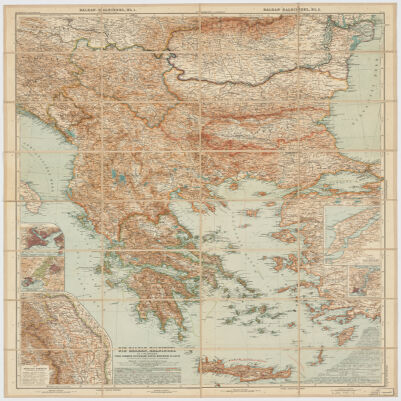
Redigiert v. Dr. K. Peucker ; Rudolph Maschek sculps ; Kartogr. Anst. v. Th. Bannwarth.Covers Romania, Bosnia and Hercegovina, Montenegro, Bulgaria, Macedonia, Albania, Greece, Cyprus and portions of Russia, Hungary, Croatia and Italy.Relief shown by hachures and spot heights. Depth shown by hachures.From: Scheda & Steinhauser Atlas. Sudost-Europa (Balkanländer) No. XV.Prime meridian: Greenwich and Ferro.Electronic reproduction. Cambridge, Mass. : Harvard College Library Digital Imaging Group, 2009. (Open Collections Program at Harvard University. Islamic Heritage Project). Copy digitized: Map Coll (Pusey) : MAP-LC G6800 1903 .P4.Electronic reproduction. Cambridge, Mass. : Harvard Geospatial Library, 2011. Georeferenced image for use in a GIS.
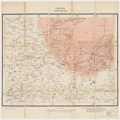
specially prepared for the Foreign Department, from India ; published under direction of Colonel F. B. Longe, R. E., Surveyor General of India.Covers Xinjiang (also known as Chinese Turkestan or Uyghuristan) and portions of Russian Turkestan, Pakistan and India.Relief shown by spot heights.Includes a note : "The Longitudes are referrible to the Greenwich Meridian, taking that of Madras Observatory as 80°-17'-21'' East. They require a correction of --2'-27'' to make them with the most recent value of the Geodetic Longitude of that Observatory, uiz, 80°-14'-54''.""Litho., S.I.O., Calcutta."Electronic reproduction. Cambridge, Mass. : Harvard College Library Digital Imaging Group, 2009. (Open Collections Program at Harvard University. Islamic Heritage Project). Copy digitized: Map Coll (Pusey) : MAP-LC G7405 1908 .S8.Electronic reproduction. Cambridge, Mass. : Harvard Geospatial Library, 2014. Georeferenced image for use in a GIS.
dressée d'après le Salnamé 1899/1317 par R. Huber.Covers Turkey, Lebanon, Crete and portions of Israel, Syria, Iraq, Iran,Originally published on four sheets.Colored in outline.Includes index and tables with population statistics.Insets: Crete -- [Vilayets Andrinople, Salonique, Monastir, Janina, Uskub, Scoutari, Constantinople] -- [Beyrouth] -- [Basra].Electronic reproduction. Cambridge, Mass. : Harvard Geospatial Library, 2009. Georeferenced image for use in a GIS.Electronic reproduction. Cambridge, Mass. : Harvard College Library Digital Imaging Group, 2009. (Open Collections Program at Harvard University. Islamic Heritage Project). Copy digitized: Map Coll (Pusey) : MAP-LC G7430 1899 .H8.
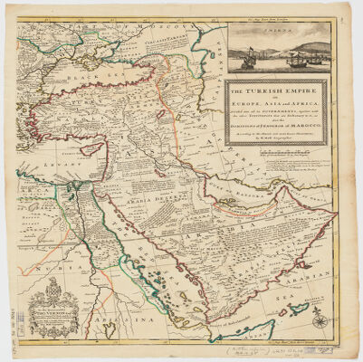
dressé par les Frères Lotter.Covers Egypt, the Arabian Peninsula, Israel, Lebanon, Syria, Iraq, Turkey, Greece, the Balkan Peninsula and Cyprus, and portions of Libya, Tunisia, Sudan, Iran, Azerbaijan, Georgia, Armenia, Russia and Italy.Relief shown pictorially.Includes list of countries and ill.Electronic reproduction. Cambridge, Mass. : Harvard Geospatial Library, 2009. Georeferenced image for use in a GIS.Electronic reproduction. Cambridge, Mass. : Harvard College Library Digital Imaging Group, 2009. (Open Collections Program at Harvard University. Islamic Heritage Project). Copy digitized: Map Coll (Pusey) : MAP-LC G7430 1790 .L6.
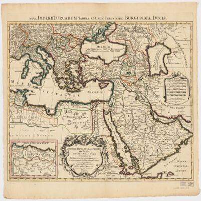
dressé sur les plus nouvelles relations a l'usage de Monseigneur le Duc de Bourgogne par son tres humble et tres obeissant serviteur H. Iaillot.Electronic reproduction. Cambridge, Mass. : Harvard College Library Digital Imaging Group, 2009. (Open Collections Program at Harvard University. Islamic Heritage Project). Copy digitized: Map Coll (Pusey) : MAP-LC G7430 1696 .J3.
This layer is a georeferenced raster image of the historic paper map entitled: Toonneel des oorlogs in't zuider deel van Europa, door Carel Allard = Theatre de la guerre dans l'Europe meridionale, par Charles Allard. It was published by C. Allard in 1705. Scale [ca. 1:6,800,000]. Covers a portion of Europe and the Mediterranean Sea region. This layer is image 2 of 2 total images of the two sheet source map, representing the eastern portion of the map. Map in Dutch and French. The image inside the map neatline is georeferenced to the surface of the earth and fit to the World Miller Cylindrical projected coordinate system. All map collar and inset information is also available as part of the raster image, including any inset maps, profiles, statistical tables, directories, text, illustrations, index maps, legends, or other information associated with the principal map. This map shows features such as drainage, cities and other human settlements, territorial boundaries, shoreline features, and more. Relief shown pictorially.This layer is part of a selection of digitally scanned and georeferenced historic maps from the Harvard Map Collection. These maps typically portray both natural and manmade features. The selection represents a range of originators, ground condition dates, scales, and map purposes.Historic paper maps can provide an excellent view of the changes that have occurred in the cultural and physical landscape. The wide range of information provided on these maps make them useful in the study of historic geography, and urban and rural land use change. As this map has been georeferenced, it can be used in a GIS as a source or background layer in conjunction with other GIS data.None planned
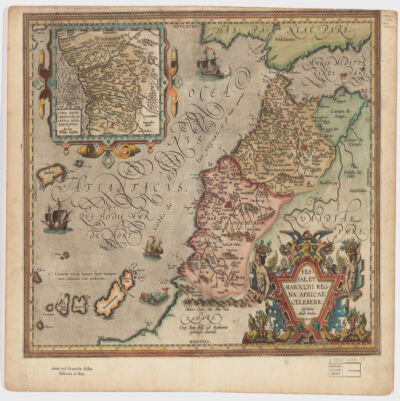
describebat Abrah. Ortelius.Covers Morocco and portions of Spain, West Sahara and Algeria.Relief shown pictorially and by hachures.Prime meridian: Ferro.Inset of West Africa: Congi Regni Christiani, in Africa, nova descriptio / Auctore Filippo Pigafetta (Scale [ca. 1:11,000,000]).Includes ill. in col.On verso: two texts entitled "Fessae et Marocchi Regna" and "Congi Regnum"."Cum Imp. Reg. et Brabantiæ privilegio decennali".Electronic reproduction. Cambridge, Mass. : Harvard College Library Digital Imaging Group, 2009. (Open Collections Program at Harvard University. Islamic Heritage Project). Copy digitized: Map Coll (Pusey) : MAP-LC G8230 1595 .O7.
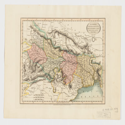
by John Cary.Covers Northeast India, Bangladesh and Nepal.Relief shown by hachures.Electronic reproduction. Cambridge, Mass. : Harvard College Library Digital Imaging Group, 2009. (Open Collections Program at Harvard University. Islamic Heritage Project). Copy digitized: Map Coll (Pusey) : MAP-LC G7652.I5 1816 .C3.Electronic reproduction. Cambridge, Mass. : Harvard Geospatial Library, 2009. Georeferenced image for use in a GIS.
Nach Russischen und and Handschriften entworsen Strasburg bey Joh. Georg Treuttel ; I. P. Kremer delin ; B. F. Leizelt sc.Relief shown by hachures and pictorially.Prime meridian: Ferro.Includes ill.Map in German and French.Electronic reproduction. Cambridge, Mass. : Harvard College Library Digital Imaging Group, 2009. (Open Collections Program at Harvard University. Islamic Heritage Project). Copy digitized: Map Coll (Pusey) : MAP-LC G7060 1765 .T7.Electronic reproduction. Cambridge, Mass. : Harvard Geospatial Library, 2009. Georeferenced image for use in a GIS.
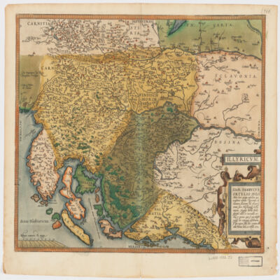
Ioan. Sambucus Ortelio suo, S Mitto hanc quòque tabellam qua nesessaria confinia Pannoniæ declarantur, fluviorum et aliquot locorum situs Hirschvogelii recte mutaui, Angelini autem studio plurima adieci, et inualla correxi, vt parum quis si cum Hirschvogelig hæc conjugat desiderarit si qui errores sint, dies certiora docebit.Covers Istria, Croatia, Slovenia, Bosnia and Herzegovina, Dalmatia, and part of Hungary.Relief shown pictorially."Cum temporaris et Regis Maiestaris Privilegio".Includes ill.On verso: text entitled "Illyricvm".
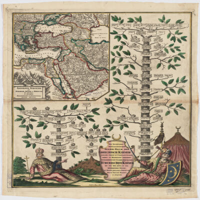
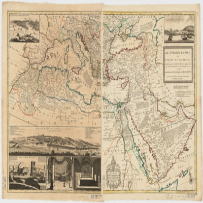
Covers Libya, Egypt, Sudan, the Arabian Peninsula, Lebanon, Syria, Iraq, Iran, the Balkan Peninsula, Turkey, Greece, Armenia, Azerbaijan and portions of Ethiopia and Russia.Relief shown by hachures and pictorially.Colored in outline.Inset: Neu Inventiert. Genealogischer Stamm-Baum Der Griechisch. Kaÿser Welche Theils Zu Constantinopel Theils Zu Trapezunt Residiret : desgleichen ein StammBaum Der Türckischen Kaÿser Bis Auf Den Heüt Zu Tag Regierenden Sultan / ins Kupfer gebracht u. verlegt von Matth. Seütter.Includes ill.In German and Latin.Electronic reproduction. Cambridge, Mass. : Harvard College Library Digital Imaging Group, 2009. (Open Collections Program at Harvard University. Islamic Heritage Project). Copy digitized: XXXXX Library: [call no.].
This layer is a georeferenced raster image of the historic paper map entitled: Nova tabula Indiae Orientalis. It was published by Carolus Allard excudit, between 1690 and 1710. Scale [ca. 1:5,500,000]. Covers the Indian Ocean Region. Map in Latin. The image inside the map neatline is georeferenced to the surface of the earth and fit to the World Miller Cylindrical projected coordinate system. All map collar and inset information is also available as part of the raster image, including any inset maps, profiles, statistical tables, directories, text, illustrations, index maps, legends, or other information associated with the principal map. This map shows features such as drainage, roads, cities and other human settlements, territorial boundaries, shoreline features, and more. Relief shown pictorially.This layer is part of a selection of digitally scanned and georeferenced historic maps from the Harvard Map Collection. These maps typically portray both natural and manmade features. The selection represents a range of originators, ground condition dates, scales, and map purposes.Historic paper maps can provide an excellent view of the changes that have occurred in the cultural and physical landscape. The wide range of information provided on these maps make them useful in the study of historic geography, and urban and rural land use change. As this map has been georeferenced, it can be used in a GIS as a source or background layer in conjunction with other GIS data.None planned
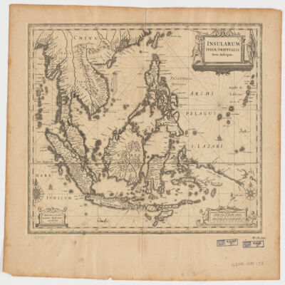
Ioannis Ianssonius.Covers Sumatra, Java, Borneo, Suwalesi, the Philippines, Papua New Guinea and portions of China, Burma and Malaysia.Relief shown pictorially.Includes ill.Electronic reproduction. Cambridge, Mass. : Harvard College Library Digital Imaging Group, 2009. (Open Collections Program at Harvard University. Islamic Heritage Project). Copy digitized: Map Coll (Pusey) : MAP-LC G8000 1650 .J3.Electronic reproduction. Cambridge, Mass. : Harvard Geospatial Library, 2009. Georeferenced image for use in a GIS.
bearbeitet und gezeichnet von H. Kiepert.Relief shown by hachures and spot heights.Prime meridian Greenwich and Ferro.Colored in outline.Electronic reproduction. Cambridge, Mass. : Harvard College Library Digital Imaging Group, 2009. (Open Collections Program at Harvard University. Islamic Heritage Project). Copy digitized: Map Coll (Pusey) : MAP-LC G7120 1854 .K5.Electronic reproduction. Cambridge, Mass. : Harvard Geospatial Library, 2009. Georeferenced image for use in a GIS.
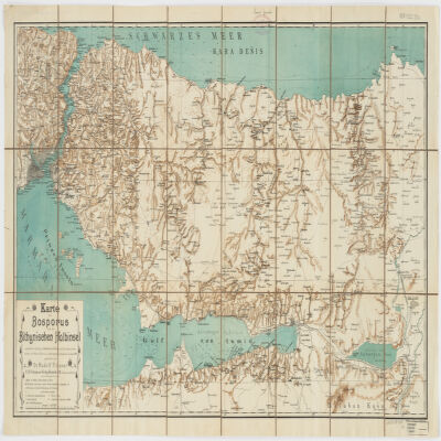
nach älteren Quellen (v. Moltke, Heinrich Kiepert, Brit. Admiralitätskarten, v. d. Goltz, v. Diest u.a.) und eigenen Aufnahmen im Jahre 1900 gezeichnet von Rudolf Fitzner ; Hof. Stdr. v. J. G. Tiedmann Nachf.Relief shown by hachures. Depths shown by contours.Includes index.Electronic reproduction. Cambridge, Mass. : Harvard College Library Digital Imaging Group, 2009. (Open Collections Program at Harvard University. Islamic Heritage Project). Copy digitized: Map Coll (Pusey) : MAP-LC G7433.I8 1900 .F5.Electronic reproduction. Cambridge, Mass. : Harvard Geospatial Library, 2014. Georeferenced image for use in a GIS.
Gestochen von F. Müller.Covers also portions of Albania, Macedonia, Bulgaria, Hungary, Romania, Croatia and Bosnia and Hercegovina.Relief shown pictorially.Includes ill.
par le Sr. d'Anville ; Guill. De La Haye.Covers portions of Jordan, Syria, Lebanon, Israel, Turkey, Azerbaijan, Iran and Iraq.Relief shown pictorially.Colored in outline.In French with many place names also given with Roman-era Latin forms.Electronic reproduction. Cambridge, Mass. : Harvard College Library Digital Imaging Group, 2009. (Open Collections Program at Harvard University. Islamic Heritage Project). Copy digitized: XXXXX Library: [call no.].Electronic reproduction. Cambridge, Mass. : Harvard Geospatial Library, 2009. Georeferenced image for use in a GIS.
le très humble et très obéissant serviteur Étienne Briffaut.Shows battle places with date.Covers Bosnia and Hercegovina, and portions of Hungary, Croatia, Albania and Yugoslavia.Relief shown pictorially.Includes note and ill."Je me suis fais un devoir de Publier cette Carte Sous les Auspices de V. E. étant un des Capitaines de S.M.I. et Cath. qui entend mieux le métier de la guerre et qui marche sur les mêmes principes que le défunt Prince Eugène ayant le flême et la prudence come elle en a donné des preuves par les dernières campagnes d'Italie, et en dernier lieu par le combat contre les trouppes ottomanes arrivé le 28 7bris 737 près de la rivière de la Timock et suis avec un parfait dévouement et un pronfond respect de V. E.".In French with place names and a legend in Latin.Electronic reproduction. Cambridge, Mass. : Harvard College Library Digital Imaging Group, 2009. (Open Collections Program at Harvard University. Islamic Heritage Project). Copy digitized: XXXXX Library: [call no.].
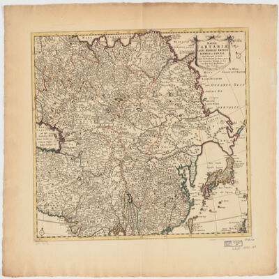
ampliss viri D. N. Witsen pro majori parte aliis auctoribus excerpta et dita per F. de Witt.Covers Northeastern Russia, China, Korea, Japan, Turkestan, Kazakhstan, Tajikistan, Kyrgyzstan, Mongolia, Uzbekistan, Afghanistan, Pakistan and portions of Iran, India, China.Relief shown pictorially.Colored in outline.Appears in: Atlas nouveau contenant toutes les parties du monde, où sont exactement marqués les empires, monarchies, royaumes, états républiques &c; le tout recueilli par les meilleurs géographes. [1683-1761]. Vol. 8, map no.108.In Latin with place names in Russian, Turkish, Persian and Arabic in Latin script.Electronic reproduction. Cambridge, Mass. : Harvard College Library Digital Imaging Group, 2009. (Open Collections Program at Harvard University. Islamic Heritage Project). Copy digitized: Map Coll (Pusey) : MAP-LC G7400 1725 .W5.
Per F. de Witt.Covers portions of the Middle East, South and Central Asia and China.Appears in: Atlas Major / Frederick de Wit. 1707. Map no. 118.Relief shown pictorially.Includes ill.Electronic reproduction. Cambridge, Mass. : Harvard College Library Digital Imaging Group, 2009. (Open Collections Program at Harvard University. Islamic Heritage Project). Copy digitized: Map Coll (Pusey) : MAP-LC G7625 1707 .W5.
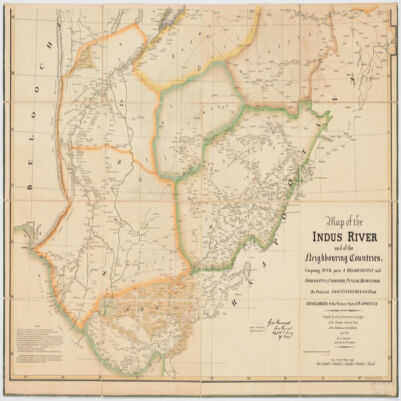
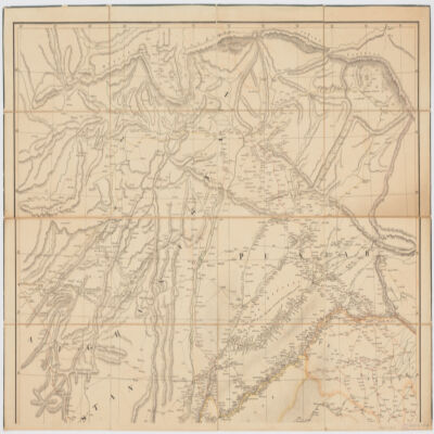
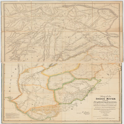
compiled by order of Government in the Office of the Surveyor General of India [Geo. Everest] from authentic and recent materials April 1834 by J. Graham ; drawn by Ed. Winston and D. F. Chill.Covers portions of Pakistan, India and Afghanistan.Relief shown by hachures and shading.Colored in outline.Includes bibliography.
compiled by order of Government in the Office of the Surveyor General of India [Geo. Everest] from authentic and recent materials April 1834 by J. Graham ; drawn by Ed. Winston and D. F. Chill.Covers portions of Pakistan, India and Afghanistan.Relief shown by hachures and shading.Colored in outline.Includes bibliography.
compiled by order of Government in the Office of the Surveyor General of India [Geo. Everest] from authentic and recent materials April 1834 by J. Graham ; drawn by Ed. Winston and D. F. Chill.Covers portions of Pakistan, India and Afghanistan.Relief shown by hachures and shading.Colored in outline.Includes bibliography.
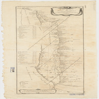
delineatus a C. Niebuhr ; Defehrt sc..Covers the Red Sea Coast including parts of Djibouti.North oriented toward the right.Relief shown pictorially. Depths shown by shading.Includes index."Tab: XX".Electronic reproduction. Cambridge, Mass. : Harvard College Library Digital Imaging Group, 2009. (Open Collections Program at Harvard University. Islamic Heritage Project). Copy digitized: Map Coll (Pusey) : MAP-LC G5687.R3 1772 .N5.
This layer is a georeferenced raster image of the historic paper map entitled: A map of the countries between Constantinople and Calcutta : including Turkey in Asia, Persia, Afghanistan and Turkestan. It was published by Edward Stanford in 1903. Scale 1:6,969,600. The image inside the map neatline is georeferenced to the surface of the earth and fit to the Asia North Lambert Conformal Conic coordinate system. All map collar and inset information is also available as part of the raster image, including any inset maps, profiles, statistical tables, directories, text, illustrations, index maps, legends, or other information associated with the principal map. This map shows features such as drainage, cities and other human settlements, territorial boundaries, roads, railroads, ferry routes, shoreline features, and more. Relief shown by hachures and spot heights. This layer is part of a selection of digitally scanned and georeferenced historic maps from the Harvard Map Collection. These maps typically portray both natural and manmade features. The selection represents a range of originators, ground condition dates, scales, and map purposes.Historic paper maps can provide an excellent view of the changes that have occurred in the cultural and physical landscape. The wide range of information provided on these maps make them useful in the study of historic geography, and urban and rural land use change. As this map has been georeferenced, it can be used in a GIS as a source or background layer in conjunction with other GIS data.None planned
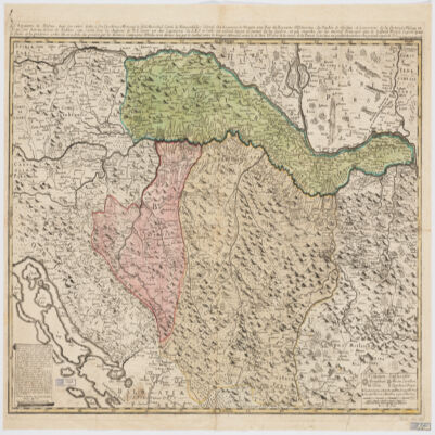
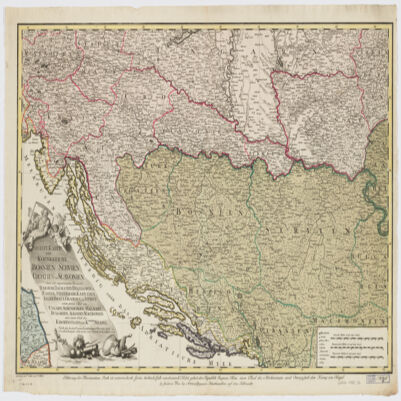
nach den besten Originalzeichnungen Charten und Beschreibungen entworfen von Herrn Carl Schütz ; gestochen von C. Schütz und F. Müller.Covers Bosnia and Hercegovina, Slovenia, Croatia, Serbia and portions of Italy, Hungary, Bulgaria, Albania and Macedonia.Relief shown pictorially.Includes ill."C. Priv. S.C.M.""Erklærung der Illumination - Roth ist oesterreichisch, Grün türkisch , Gelb venetiatisch, Violet gehert der Republik Ragusa, Blau einen Theil des Kirchenstaats, und Orangefarb dem Koenig von Naepel."Electronic reproduction. Cambridge, Mass. : Harvard College Library Digital Imaging Group, 2009. (Open Collections Program at Harvard University. Islamic Heritage Project). Copy digitized: XXXXX Library: [call no.].
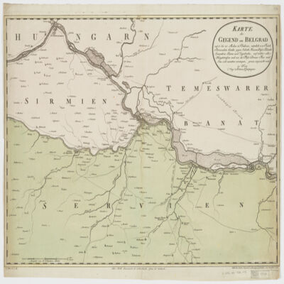
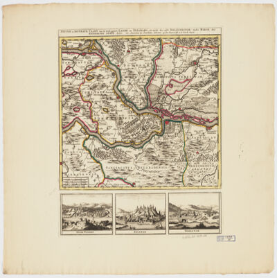
by Joachim Ottens.Relief shown pictorially.Colored in outline.Shows military points of interest related to the Battle of Belgrade, 1717.Includes ill. and views: Peter Wardein -- Belgrad -- Temeswar.Place names in Latin.Electronic reproduction. Cambridge, Mass. : Harvard College Library Digital Imaging Group, 2009. (Open Collections Program at Harvard University. Islamic Heritage Project). Copy digitized: Map Coll (Pusey) MAP-LC G6854.B5 1717 .O8.
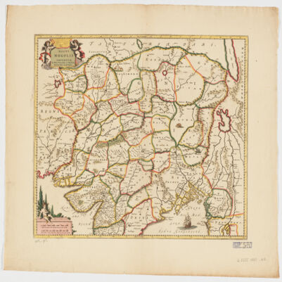
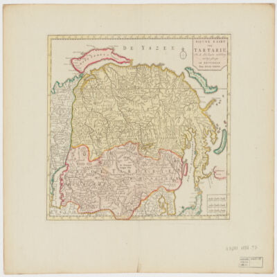
door Isaak Tirion ; J. Keyser get. on gesn.Covers Mongolia, Korea and portions of Russia, Iran, China and Japan.Relief shown by shading and pictorially.Electronic reproduction. Cambridge, Mass. : Harvard College Library Digital Imaging Group, 2009. (Open Collections Program at Harvard University. Islamic Heritage Project). Copy digitized: Map Coll (Pusey) : MAP-LC G7270 1732 .T5.
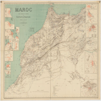
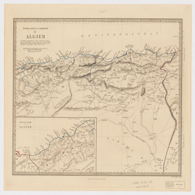
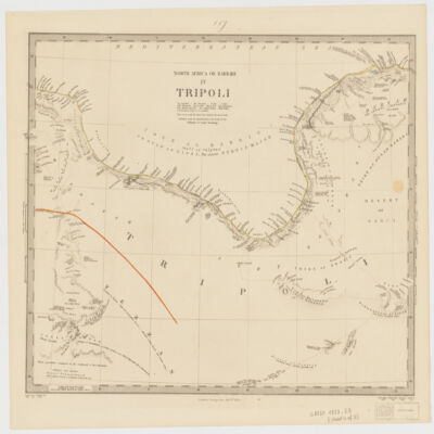
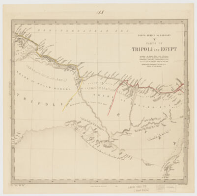
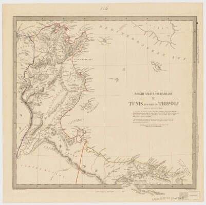
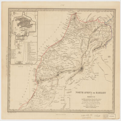
Society for the Diffusion of Useful Knowledge ; engraved by J. & C. Walker.Relief shown by hachures.Colored in outline.Marocco sheet includes Inset: Plan of the city of Marocco (Scale [ca. 1:32,000]) and Algier sheet includes inset Continuation of Algier (Scale [ca. 1:2,000,000]).Some sheets with sources in lower margin.Table of Contents: I. Marocco (Scale [ca. 1:2,800,000]) -- II. Algier (Scale [ca. 1:2,000,000]) -- III. Tunis and part of Tripoli (Scale [ca. 1:2,000,000]) -- IV. Tripoli (Scale [ca. 1:2,000,000]) -- V. Parts of Tripoli and Egypt (Scale [ca. 1:2,000,000]).
Society for the Diffusion of Useful Knowledge ; engraved by J. & C. Walker.Relief shown by hachures.Colored in outline.Marocco sheet includes Inset: Plan of the city of Marocco (Scale [ca. 1:32,000]) and Algier sheet includes inset Continuation of Algier (Scale [ca. 1:2,000,000]).Some sheets with sources in lower margin.Table of Contents: I. Marocco (Scale [ca. 1:2,800,000]) -- II. Algier (Scale [ca. 1:2,000,000]) -- III. Tunis and part of Tripoli (Scale [ca. 1:2,000,000]) -- IV. Tripoli (Scale [ca. 1:2,000,000]) -- V. Parts of Tripoli and Egypt (Scale [ca. 1:2,000,000]).
Society for the Diffusion of Useful Knowledge ; engraved by J. & C. Walker.Relief shown by hachures.Colored in outline.Marocco sheet includes Inset: Plan of the city of Marocco (Scale [ca. 1:32,000]) and Algier sheet includes inset Continuation of Algier (Scale [ca. 1:2,000,000]).Some sheets with sources in lower margin.Table of Contents: I. Marocco (Scale [ca. 1:2,800,000]) -- II. Algier (Scale [ca. 1:2,000,000]) -- III. Tunis and part of Tripoli (Scale [ca. 1:2,000,000]) -- IV. Tripoli (Scale [ca. 1:2,000,000]) -- V. Parts of Tripoli and Egypt (Scale [ca. 1:2,000,000]).
Society for the Diffusion of Useful Knowledge ; engraved by J. & C. Walker.Relief shown by hachures.Colored in outline.Marocco sheet includes Inset: Plan of the city of Marocco (Scale [ca. 1:32,000]) and Algier sheet includes inset Continuation of Algier (Scale [ca. 1:2,000,000]).Some sheets with sources in lower margin.Table of Contents: I. Marocco (Scale [ca. 1:2,800,000]) -- II. Algier (Scale [ca. 1:2,000,000]) -- III. Tunis and part of Tripoli (Scale [ca. 1:2,000,000]) -- IV. Tripoli (Scale [ca. 1:2,000,000]) -- V. Parts of Tripoli and Egypt (Scale [ca. 1:2,000,000]).
Society for the Diffusion of Useful Knowledge ; engraved by J. & C. Walker.Relief shown by hachures.Colored in outline.Marocco sheet includes Inset: Plan of the city of Marocco (Scale [ca. 1:32,000]) and Algier sheet includes inset Continuation of Algier (Scale [ca. 1:2,000,000]).Some sheets with sources in lower margin.Table of Contents: I. Marocco (Scale [ca. 1:2,800,000]) -- II. Algier (Scale [ca. 1:2,000,000]) -- III. Tunis and part of Tripoli (Scale [ca. 1:2,000,000]) -- IV. Tripoli (Scale [ca. 1:2,000,000]) -- V. Parts of Tripoli and Egypt (Scale [ca. 1:2,000,000]).
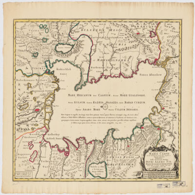
in qua itinera Regia et alia notabiliora accurate denotantur per A. Maas ; reductio mappæ haijus a majore in hanc monirem formam facta est per Iohannem Petrum van Ghelen.Covers portions of Uzbekistan, Kazakhstan, Afghanistan, Turkmenistan, Russia, Azerbaijan and Iran.Relief shown pictorially. Depth shown by soundings.Includes notes and ill."Cum Priv. S. C. M.".Electronic reproduction. Cambridge, Mass. : Harvard College Library Digital Imaging Group, 2009. (Open Collections Program at Harvard University. Islamic Heritage Project). Copy digitized: Map Coll (Pusey) : MAP-LC G5692.C3 1735 .M3.
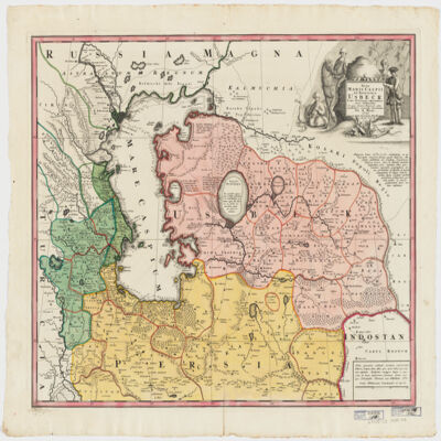
immenso labore et maximis sumptibus facta, atque ex autographo in lucem edita per Reinerum Ottens geographum Amstelaedam ; Iacob Keyser sculp.Covers portions of Iran, Turkmenistan, Kazakhstan, Russia and Azerbaijan.Relief shown pictorially. Depth shown by soundings.Oriented with North to the left.Colored in outline.Includes ill.Appears in: Atlas maior cum generales omnium totius orbis regnorum rerumpubl. atque insularum tum particulares praecipuarum in iis provinciarum ducatuum comitatuum ceterarum que minorum regionum ac divisionum tabulas geographicas continens ex optimis ac novissimis quibusque variorum autorum tabulis collectus et eleganti ordine dispositus / Reiner Ottens. [1641-1729]. Vol. 7, map No. 23.In Latin with a publication note in Dutch and place names in Greek, Russian, Persian, Arabic, and Turkish in Latin script.Electronic reproduction. Cambridge, Mass. : Harvard College Library Digital Imaging Group, 2009. (Open Collections Program at Harvard University. Islamic Heritage Project). Copy digitized: XXXXX Library: [call no.].
This layer is a georeferenced raster image of the historic paper map entitled: Chart of part of the South Sea, shewing the tracts & discoveries made by His Majestys Ships Dolphin, Commodore Byron & Tamer, Capn. Mouat, 1765, Dolphin, Capn. Wallis, & Swallow, Capn. Carteret, 1767, and Endeavour, Lieutenant Cooke, 1769 ; engraved by W. Whitchurch. It was published by W. Strahan & T. Cadell in 1773. Scale [ca. 1: 50,000,000]. Covers Oceania and Australasia.The image inside the map neatline is georeferenced to the surface of the earth and fit to a non-standard 'Mercator' projection with the central meridian at 160.0000 degrees west. All map collar and inset information is also available as part of the raster image, including any inset maps, profiles, statistical tables, directories, text, illustrations, index maps, legends, or other information associated with the principal map. Note: The central meridian of this map is not the same as the Prime Meridian and may wrap the International Date Line or overlap itself when displayed in GIS software.This map shows features such as drainage, cities and other human settlements, tracks of exploration voyages (the Dolphin by Samuel Wallis & John Byron, the Tamer (i.e. Tamar) by Patrick Mouat, the Swallow by Philip Carteret, and the Endeavor by James Cook), shoreline features, and more. Includes note. This layer is part of a selection of digitally scanned and georeferenced historic maps from the Harvard Map Collection and the Harvard University Library as part of the Open Collections Program at Harvard University project: Organizing Our World: Sponsored Exploration and Scientific Discovery in the Modern Age. Maps selected for the project correspond to various expeditions and represent a range of regions, originators, ground condition dates, scales, and purposes.Historic paper maps can provide an excellent view of the changes that have occurred in the cultural and physical landscape. The wide range of information provided on these maps make them useful in the study of historic geography, and urban and rural land use change. As this map has been georeferenced, it can be used in a GIS as a source or background layer in conjunction with other GIS data.None planned
This layer is a georeferenced raster image of the historic paper map entitled: Oceanie dressee par C. V. Monin ; grave sur acier par Ales ; Jules Berthelemier scrip. It was published by Armand Aubree Libraire editeur Rue Taranne No. 14 in 1836. Scale [ca. 1:27,500,000]. Covers the Pacific Ocean and South Pacific islands, Australia, and a portion of Southeast Asia. Map in French.The image inside the map neatline is georeferenced to the surface of the earth and fit to a non-standard 'Mercator' projection with the central meridian at 180 degrees west. All map collar and inset information is also available as part of the raster image, including any inset maps, profiles, statistical tables, directories, text, illustrations, index maps, legends, or other information associated with the principal map. Note: The central meridian of this map is not the same as the Prime Meridian and may wrap the International Date Line or overlap itself when displayed in GIS software.This map shows features such as drainage, cities and other human settlements, territorial divisions, shoreline features, islands, and more. Insets: Details de la partie sud-ouest de L'Australie -- Details de la partie sud-est de L'Australie. Relief shown by hachures.This layer is part of a selection of digitally scanned and georeferenced historic maps from the Harvard Map Collection and the Harvard University Library as part of the Open Collections Program at Harvard University project: Organizing Our World: Sponsored Exploration and Scientific Discovery in the Modern Age. Maps selected for the project correspond to various expeditions and represent a range of regions, originators, ground condition dates, scales, and purposes.Historic paper maps can provide an excellent view of the changes that have occurred in the cultural and physical landscape. The wide range of information provided on these maps make them useful in the study of historic geography, and urban and rural land use change. As this map has been georeferenced, it can be used in a GIS as a source or background layer in conjunction with other GIS data.None planned
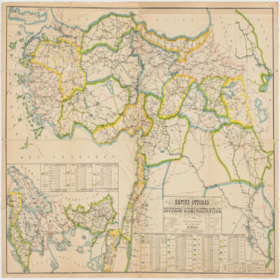
This layer is a georeferenced raster image of the historic paper map entitled: Empire Ottoman : division administrative, dressee d'apres le Salname 1899/1317 par R. Huber. It was published by F. Loeffler in 1899. Scale 1:1,500,000. Covers the Ottoman Empire. Map in French. The image inside the map neatline is georeferenced to the surface of the earth and fit to a modified 'Europe Lambert Conformal Conic' projection with a central meridian of 38 degrees East projection. All map collar and inset information is also available as part of the raster image, including any inset maps, profiles, statistical tables, directories, text, illustrations, index maps, legends, or other information associated with the principal map. This map shows features such as drainage, cities and other human settlements, roads, railroads, territorial and administrative boundaries, shoreline features, and more. Includes index, tables of statistics and insets: Crete -- [Vilayets Andrinople, Salonique, Monastir, Janina, Uskub, Scoutari, Constantinople] -- [Beyrouth] -- [Basra].This layer is part of a selection of digitally scanned and georeferenced historic maps from the Harvard Map Collection as part of the Open Collections Program at Harvard University project: Islamic Heritage Project. Maps selected for the project represent a range of regions, originators, ground condition dates, scales, and purposes. The Islamic Heritage Project consists of over 100,000 digitized pages from Harvard's collections of Islamic manuscripts and published materials. Supported by Prince Alwaleed Bin Talal and developed in association with the Prince Alwaleed Bin Talal Islamic Studies Program at Harvard University.Historic paper maps can provide an excellent view of the changes that have occurred in the cultural and physical landscape. The wide range of information provided on these maps make them useful in the study of historic geography, and urban and rural land use change. As this map has been georeferenced, it can be used in a GIS as a source or background layer in conjunction with other GIS data.None planned
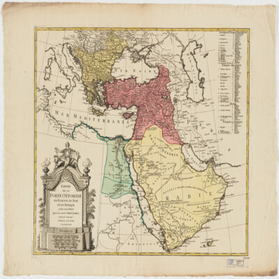
This layer is a georeferenced raster image of the historic paper map entitled: Empire de la Porte ottomane en Europe, en Asie et en Afrique avec les pays qui lui sont tributaires, dresse par les Freres Lotter. It was published by Freres Lotter ca. 1790. Scale [ca. 1:9,000,000]. Covers the Ottoman Empire. Map in French. The image inside the map neatline is georeferenced to the surface of the earth and fit to a modified 'Europe Lambert Conformal Conic' projection with a central meridian of 38 degrees East projection. All map collar and inset information is also available as part of the raster image, including any inset maps, profiles, statistical tables, directories, text, illustrations, index maps, legends, or other information associated with the principal map. This map shows features such as drainage, cities and other human settlements, territorial and provincial boundaries, shoreline features, and more. Relief shown pictorially. This layer is part of a selection of digitally scanned and georeferenced historic maps from the Harvard Map Collection as part of the Open Collections Program at Harvard University project: Islamic Heritage Project. Maps selected for the project represent a range of regions, originators, ground condition dates, scales, and purposes. The Islamic Heritage Project consists of over 100,000 digitized pages from Harvard's collections of Islamic manuscripts and published materials. Supported by Prince Alwaleed Bin Talal and developed in association with the Prince Alwaleed Bin Talal Islamic Studies Program at Harvard University.Historic paper maps can provide an excellent view of the changes that have occurred in the cultural and physical landscape. The wide range of information provided on these maps make them useful in the study of historic geography, and urban and rural land use change. As this map has been georeferenced, it can be used in a GIS as a source or background layer in conjunction with other GIS data.None planned
par E. Andriveau ; gravé le trait et les montagnes par Gérin, les écritures par P. Rousset, les eaux par Mme Fontaine.Covers portions of Israel, Jordan, Syria and Lebanon.Relief shown by hachures. Depth shown by sounding and isolines.Insets: [Sinai] (Scale [ca. 1:2,600,000]) -- Golfe de Suez -- [Cross section of the Palestine from the source of the Jordan to the Red Sea] -- [Panoramic view of the mountains of Palestine] -- Jérusalem d'après le plan de G. Williams (Scale [ca. 1:80,000])."No. 18"."Atlas usuel No. 23"."Atlas universel No.36".Includes notes and index.In French with place names in Latin, Arabic and Hebrew in Latin script.Electronic reproduction. Cambridge, Mass. : Harvard Geospatial Library, 2009. Georeferenced image for use in a GIS.
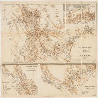
nach dessen Originalskizzen redigirt von H. Kiepert.Covers portions of Turkey, Iraq and Iran.Relief shown by shading.Prime meridian: Greenwich and Paris.Inset: Route in Nord-Persien (Scale 1:600,000).Ancillary maps: Türkish-Persischer Grenzbezirk in Kurdistan im doppelten Maβstab der Hauptkarte (Scale 1:400,000), Der mittlere Theil der Hauptkarte im doppeltem Maβstabe (Scale 1:400,000)."Druck v. Fr. Schwabe, Berlin".Includes lexicon German-Turkish-Persian.In German with place names in Turkish and Persian.Electronic reproduction. Cambridge, Mass. : Harvard College Library Digital Imaging Group, 2009. (Open Collections Program at Harvard University. Islamic Heritage Project). Copy digitized: XXXXX Library: [call no.].
This layer is a georeferenced raster image of the historic paper map entitled: Carte de l'Egypte, de la Nubie, de l'Abyssinie &c., par Guillaume de l'Isle, de l'Academie Royal a Paris. It was published by Chez Henri de Leth, a l'enseigne du Pecheur ca. 1730. Scale [ca. 1:9,250,000]. Covers the Red Sea region, North Africa including portions of the Middle East and Europe. Map in French.The image inside the map neatline is georeferenced to the surface of the earth and fit to the Africa Sinusoidal projected coordinate system. All map collar and inset information is also available as part of the raster image, including any inset maps, profiles, statistical tables, directories, text, illustrations, index maps, legends, or other information associated with the principal map. This map shows features such as drainage, major roads, cities and other human settlements, territorial boundaries, shoreline features, and more. Relief shown pictorially. This layer is part of a selection of digitally scanned and georeferenced historic maps from the Harvard Map Collection. These maps typically portray both natural and manmade features. The selection represents a range of originators, ground condition dates, scales, and map purposes.Historic paper maps can provide an excellent view of the changes that have occurred in the cultural and physical landscape. The wide range of information provided on these maps make them useful in the study of historic geography, and urban and rural land use change. As this map has been georeferenced, it can be used in a GIS as a source or background layer in conjunction with other GIS data.None planned
ex variis observationibus in lucem edita a Reinero et Josua Ottens.Covers the Middle East, Southern Caucasus, Central Asia and portions of Egypt, the Arabian Peninsula and Southeastern Europe.Relief shown pictorially.Electronic reproduction. Cambridge, Mass. : Harvard College Library Digital Imaging Group, 2009. (Open Collections Program at Harvard University. Islamic Heritage Project). Copy digitized: Map Coll (Pusey) : MAP-LC G7420 1730 .R2.
par le Sr. Sanson d'Abbeville.Covers also portions of Libya, Israel, Lebanon and Saudi Arabia.Relief shown pictorially.Colored in outline.Includes ill."I.S.P. Sculp."Electronic reproduction. Cambridge, Mass. : Harvard College Library Digital Imaging Group, 2009. (Open Collections Program at Harvard University. Islamic Heritage Project). Copy digitized: XXXXX Library: [call no.].
This raster grid datalayer consists of global 30 arc-second resolution slope data derived from SRTM30 (Shuttle Radar Topography Mission) data, supplemented with GTOPO30 elevation data, ETOPO2 depth data, and other data sources. Slope (the incline or steepness of a surface) values in this datalayer are measured as degrees (0-90) from horizontal. The datalayer was produced by ISciences and published in 2003 as part of the TerraViva! SRTM30 global enhanced : elevation, slope and aspect, data set. SRTM30 data was collected February 11-22, 2000.From the ISciences Web site:"SRTM30 Enhanced Global Map is a global elevation and depth data set from ISciences at 30 arc-second resolution that includes an elevation map, slope angle map, slope aspect map, and source map. Each pixel represents an area ranging from one sixth of a square mile at 60 degrees to one third of a square mile at the equator. To get a view of your world as good as this you'd need a map 18 feet high and 36 feet wide! SRTM30 Enhanced Global Map was created by combining 27 SRTM30 elevation files, identifying and correcting anomalies, supplementing with elevation data from an alternate source for land areas not included in SRTM30, and adding depth data. The result -- a beautifully blended, high-quality, stunning global elevation and depth map suitable for display at scales to1:3,000,000."The ISciences enhanced global map data builds on SRTM data by offering a global composite, complete global coverage elevation dataset with rectified anomalies, computed slope and aspect data, and additional depth data.From SRTM Web site:"The objective of the SRTM project is to produce digital topographic data for 80% of the Earth's land surface (all land areas between 60° north and 56° south latitude), with data points located every 1-arc-second (approximately 30 meters) on a latitude/longitude grid. The absolute vertical accuracy of the elevation data will be 16 meters (at 90% confidence). This radar system will gather data that will result in the most accurate and complete topographic map of the Earth's surface that has ever been assembled.What can the data be used for?Space Shuttle Landing.These data can be tailored to meet the needs of the military, civil, and scientific user communities. But other uses of this data include improved water drainage modeling, more realistic flight simulators, better locations for cell phone towers, navigation safety, and even improved maps for backpackers.Just about any project that requires accurate knowledge of the shape and height of the land can benefit from this data. Some examples are flood control, soil conservation, reforestation, volcano monitoring, earthquake research, and glacier movement monitoring."None planned
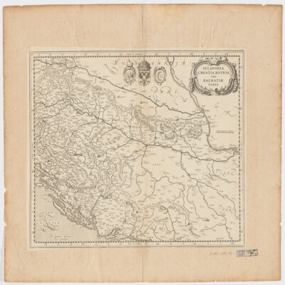
per Gerardum Mercatorem cum privilegio.Apperas in: Nieuwen atlas ofte werelt-beschrijvinge vertoonende de voornaemste rijckenende lande des gheheelen aerdt-bodems / Ioannem Ianssonium. 1657-[87]. Vol. 1, map No. 138.Covers Slovenia, Croatia, Bosnia and Hercegovina and portions of Hungary, Serbia and Montenegro.Relief shown pictorially.Includes coats of arms.Electronic reproduction. Cambridge, Mass. : Harvard College Library Digital Imaging Group, 2009. (Open Collections Program at Harvard University. Islamic Heritage Project). Copy digitized: Map Coll (Pusey) : MAP-LC G6800 1630 .M4.
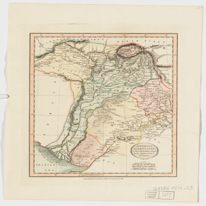
by John Cary.Covers portions of Northwest India, Pakistan, Afghanistan and Kashmir.Relief shown by hachures.Electronic reproduction. Cambridge, Mass. : Harvard Geospatial Library, 2009. Georeferenced image for use in a GIS.
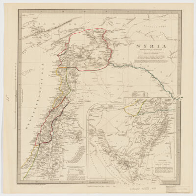
by W. Hughes.Covers also Lebanon and portions of Israel, Jordan, Turkey, Iraq and Egypt.Relief shown by hachures.Published under the superintendence of the Society for the Diffusion of useful knowledge.Colored in outline.Inset: Continuation from the Dead Sea top Mount Sinai (Scale [ca. 1:2,200,000]).Includes note and references ("Chesney-Robinson-Ainsworth-Burckhardt-Rennell &c.").Electronic reproduction. Cambridge, Mass. : Harvard Geospatial Library, 2009. Georeferenced image for use in a GIS.Electronic reproduction. Cambridge, Mass. : Harvard College Library Digital Imaging Group, 2009. (Open Collections Program at Harvard University. Islamic Heritage Project). Copy digitized: Map Coll (Pusey) : MAP-LC G7460 1853 .H8.
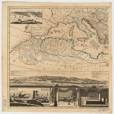
by H. Moll.Covers Spain, North Africa, the Arabian Peninsula, the Middle East, the Balkan Peninsula, Italy, Switzerland and portions of Russia and France.Relief shown pictorially.Prime meridian: London and Ferro.Dedication: To the honourable Tho. Vernon Esqr. one of ye Commissrs. of Trade for ye Plantations, of His Majesty of Gr. Britain. This map is most humbly dedicated by your most Humble Servant Her. Moll Geographer.Insets: Plan of Constantinople -- Draught of the City of Jerusalem as it is now, taken from the south east by Corneille Le Bruyn -- Church of the Holy Sepulcre (3 views), J. Harris, fecit. -- Smirna.Includes notes.
by H. Moll.Covers Spain, North Africa, the Arabian Peninsula, the Middle East, the Balkan Peninsula, Italy, Switzerland and portions of Russia and France.Relief shown pictorially.Prime meridian: London and Ferro.Dedication: To the honourable Tho. Vernon Esqr. one of ye Commissrs. of Trade for ye Plantations, of His Majesty of Gr. Britain. This map is most humbly dedicated by your most Humble Servant Her. Moll Geographer.Insets: Plan of Constantinople -- Draught of the City of Jerusalem as it is now, taken from the south east by Corneille Le Bruyn -- Church of the Holy Sepulcre (3 views), J. Harris, fecit. -- Smirna.Includes notes.
by H. Moll.Covers Spain, North Africa, the Arabian Peninsula, the Middle East, the Balkan Peninsula, Italy, Switzerland and portions of Russia and France.Relief shown pictorially.Prime meridian: London and Ferro.Dedication: To the honourable Tho. Vernon Esqr. one of ye Commissrs. of Trade for ye Plantations, of His Majesty of Gr. Britain. This map is most humbly dedicated by your most Humble Servant Her. Moll Geographer.Insets: Plan of Constantinople -- Draught of the City of Jerusalem as it is now, taken from the south east by Corneille Le Bruyn -- Church of the Holy Sepulcre (3 views), J. Harris, fecit. -- Smirna.Includes notes.
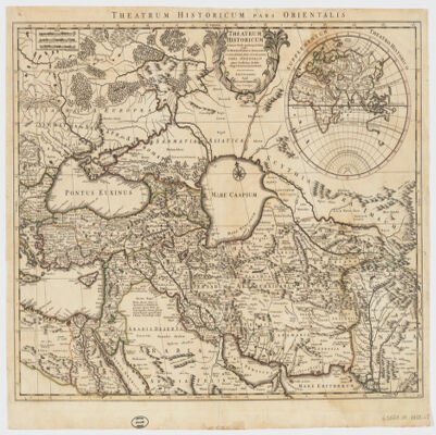
Auctore Guillelmo Delisle.Covers the Middle East, Southeastern Europe and portions of Russia, Egypt, India and the Arabian Peninsula."100."Colored in outline.Inset map: Supplementum theatro historico.Relief shown pictorially.Engraved on woven paper.Includes note.Electronic reproduction. Cambridge, Mass. : Harvard College Library Digital Imaging Group, 2009. (Open Collections Program at Harvard University. Islamic Heritage Project). Copy digitized: Map Coll (Pusey) : MAP-LC G5671.S1 1759 .L5.
ex novissimis subsidiis ac relationibus ad normam legitimae proiectionis in usum belli praesentis delineata impensis homannianorum heredum.Covers Eastern Turkey, Cyprus, Syria, Lebanon, Israel, Jordan, Iraq, Armenia, Azerbaijan, Georgia and portions of Egypt, the Arabian Peninsula, Iran, Greece and Russia.Relief shown pictorially.In Latin with a title in French.Electronic reproduction. Cambridge, Mass. : Harvard Geospatial Library, 2009. Georeferenced image for use in a GIS.Electronic reproduction. Cambridge, Mass. : Harvard College Library Digital Imaging Group, 2009. (Open Collections Program at Harvard University. Islamic Heritage Project). Copy digitized: Map Coll (Pusey) : MAP-LC G7420 1771 .H6.
dressée sur les observations astronomiq. par le Sr. Janvier, geographe."No. 23."Covers Croatia, Montenegro, Albania, Greece, Macedonia, Serbia, Bulgaria, Romania, Turkey, Cyprus and a portion of Hungary.Relief shown pictorially and by hachures.Colored in outline.Relief shown pictorially.Electronic reproduction. Cambridge, Mass. : Harvard College Library Digital Imaging Group, 2009. (Open Collections Program at Harvard University. Islamic Heritage Project). Copy digitized: Map Coll (Pusey) : MAP-LC G6800 1760 .J3.
This layer is a georeferenced raster image of the historic paper map entitled: The world, on Mercator's projection, by David H. Burr. It was published by J. Haven, 86 State St. in 1850. Scale [ca. 1:74,000,000]. The image inside the map neatline is georeferenced to the surface of the earth and fit to a non-standard 'Mercator' projection with the central meridian at 90 degrees west. All map collar and inset information is also available as part of the raster image, including any inset maps, profiles, statistical tables, directories, text, illustrations, index maps, legends, or other information associated with the principal map. "Showing the different routes to California, and distance by each, routes of different navigators, route of the contemplated Pacific R. Road, distances to China, Europe, & c."This map shows features such as drainage, cities and other human settlements, shoreline features, and more. Relief shown by abbreviated form lines. Includes historical notes, ship ill., tables of distances, "Nicaragua route" distances, and text on "Pacific Railroad." Insets: Map of the Nicaragua route -- Map of the proposed rail road from St. Louis to the bay of St. Francisco.This layer is part of a selection of digitally scanned and georeferenced historic maps from the Harvard Map Collection and the Harvard University Library as part of the Open Collections Program at Harvard University project: Organizing Our World: Sponsored Exploration and Scientific Discovery in the Modern Age. Maps selected for the project correspond to various expeditions and represent a range of regions, originators, ground condition dates, scales, and purposes.Historic paper maps can provide an excellent view of the changes that have occurred in the cultural and physical landscape. The wide range of information provided on these maps make them useful in the study of historic geography, and urban and rural land use change. As this map has been georeferenced, it can be used in a GIS as a source or background layer in conjunction with other GIS data.None planned
This layer is a georeferenced raster image of the historic paper map entitled: Planisphere : elementaire et illustre indiquant la description geographique des parties connues de la terre, l'epoque des grandes decouvertes des navigateurs les colonies Europeennes, les principaux parcours des paquebots, l'epoque des departs, la duree du trajet, &c[a]., dresee par Vuillemin, geographie ; grave par Langevin. It was published by Fatout in 1853. Scale [ca. 1:50,000,000]. Map in French.The image inside the map neatline is georeferenced to the surface of the earth and fit to the the 'World Mercator' projection. All map collar and inset information is also available as part of the raster image, including any inset maps, profiles, statistical tables, directories, text, illustrations, index maps, legends, or other information associated with the principal map. This map shows features such as drainage, cities and other human settlements, territorial boundaries, shoreline features, and more. Shows voyage routes of exploration and discovery. Relief shown pictorially and by spot heights. Includes historical notes, explanations, and ill. of sea vessels and scenes of exploration. Includes insets at lower margin: Costumes des differentes races qui peuplent la terre -- [Chart of Mt. heights in Europe] -- Hauteur des principales montagnes du monde -- [Chart of Mt. heights in Asia] -- Tableau faisant voir que le Planisphere n'est que le developpement figure du globe sur une surface plane -- Longueurs sources et embouchures des principaux fleuves du monde -- Costumes des differentes races qui peuplent la terre.This layer is part of a selection of digitally scanned and georeferenced historic maps from the Harvard Map Collection and the Harvard University Library as part of the Open Collections Program at Harvard University project: Organizing Our World: Sponsored Exploration and Scientific Discovery in the Modern Age. Maps selected for the project correspond to various expeditions and represent a range of regions, originators, ground condition dates, scales, and purposes.Historic paper maps can provide an excellent view of the changes that have occurred in the cultural and physical landscape. The wide range of information provided on these maps make them useful in the study of historic geography, and urban and rural land use change. As this map has been georeferenced, it can be used in a GIS as a source or background layer in conjunction with other GIS data.None planned
This layer is a georeferenced raster image of the historic paper map entitled: Nova totius terrarum orbis geographica ac hydrographica tabula, autore N.I. Piscator, from the Frederik de Wit's untitled Dutch Sea Atlas. It was published by F. de Wit in 1654. Scale [ca. 1:100,000,000]. Map in Latin.The image inside the map neatline is georeferenced to the surface of the earth and fit to the World Geodetic System 1984 (WGS 84) coordinate system. All map collar and inset information is also available as part of the raster image, including any inset maps, profiles, statistical tables, directories, text, illustrations, index maps, legends, or other information associated with the principal map. This map shows features such as drainage, cities and other human settlements, territorial boundaries, shoreline features, and more. Relief shown pictorially. This layer is part of a selection of digitally scanned and georeferenced historic maps from the Harvard Map Collection. These maps typically portray both natural and manmade features. The selection represents a range of originators, ground condition dates, scales, and map purposes.Historic paper maps can provide an excellent view of the changes that have occurred in the cultural and physical landscape. The wide range of information provided on these maps make them useful in the study of historic geography, and urban and rural land use change. As this map has been georeferenced, it can be used in a GIS as a source or background layer in conjunction with other GIS data.None planned
This layer is a georeferenced raster image of the historic paper map entitled: Carte generale de toutes les costes du Monde : et les pays nouvellement decouvert, dresse sur les relations les plus nouvelles et principalement sur le carte que Monsieur N. Witsen a donnee au public. It was published by Iean Covens et Corneille Mortier Libraires in [1725]. Scale [ca. 1:450,000]. This layer is image 2 of 2 total images of the two sheet source map representing the eastern portion of the map. Text in French.The image inside the map neatline is georeferenced to the surface of the earth and fit to the 'World Mercator' projection. All map collar and inset information is also available as part of the raster image, including any inset maps, profiles, statistical tables, directories, text, illustrations, index maps, legends, or other information associated with the principal map. This map shows features such as drainage, cities and other human settlements, territorial boundaries, shoreline features, and more.This layer is part of a selection of digitally scanned and georeferenced historic maps from the Harvard Map Collection and the Harvard University Library as part of the Open Collections Program at Harvard University project: Organizing Our World: Sponsored Exploration and Scientific Discovery in the Modern Age. Maps selected for the project correspond to various expeditions and represent a range of regions, originators, ground condition dates, scales, and purposes.Historic paper maps can provide an excellent view of the changes that have occurred in the cultural and physical landscape. The wide range of information provided on these maps make them useful in the study of historic geography, and urban and rural land use change. As this map has been georeferenced, it can be used in a GIS as a source or background layer in conjunction with other GIS data.None planned
This layer is a georeferenced raster image of the historic paper map entitled: Allgemeine Weltkarte auf welcher alle neue Entdeckungen eines Pérouse, Wilson, Vancouver, Mungo-Park, Brown etc. dargestellt sind : nach Marcators Projection und den zuverlässigsten Astronomishcen Bestimungen entworsen. It was published by Simon Schropp et Comp. in 1801. Scale [ca. 1:55,000,000]. Map in German and French.The image inside the map neatline is georeferenced to the surface of the earth and fit to a non-standard 'Mercator' projection with the central meridian at 152.3315 degrees east. The central meridian of this map is not the same as the Prime Meridian and may wrap or overlap itself when displayed in GIS software. All map collar and inset information is also available as part of the raster image, including any inset maps, profiles, statistical tables, directories, text, illustrations, index maps, legends, or other information associated with the principal map. This map shows features such as drainage, cities and other human settlements, territorial boundaries, shoreline features, and more. Relief is shown by hachures. This layer is part of a selection of digitally scanned and georeferenced historic maps from the Harvard Map Collection and the Harvard University Library as part of the Open Collections Program at Harvard University project: Organizing Our World: Sponsored Exploration and Scientific Discovery in the Modern Age. Maps selected for the project correspond to various expeditions and represent a range of regions, originators, ground condition dates, scales, and purposes.Historic paper maps can provide an excellent view of the changes that have occurred in the cultural and physical landscape. The wide range of information provided on these maps make them useful in the study of historic geography, and urban and rural land use change. As this map has been georeferenced, it can be used in a GIS as a source or background layer in conjunction with other GIS data.None planned