73. Carte de la Tunisie Creator: Institut géographique national (France) (Creator) Date: Date Issued: 1895 Language: FrenchArabicLatin Geographic region: Place of Production: fr, France, ParisTunisia Extent: 1 map on 2 sheets : col. ; 110 x 65 cm., sheet 58 x 71 cm.
74. Carte de la Tunisie Creator: Institut géographique national (France) (Creator) Date: Date Issued: 1895 Language: FrenchArabicLatin Geographic region: Place of Production: fr, France, ParisTunisia Extent: 1 map on 2 sheets : col. ; 110 x 65 cm., sheet 58 x 71 cm.
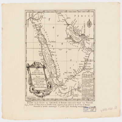
75. Carte de la coste d'Arabie, Mer Rouge et Golfe de Persetirée de la Carte de l'Océan Oriental publiée en 1740 par Ordre de Mgr le Comte de Maurepas augmentée sur des remarques particulières et dressée sur des observations astronomiques = Kaart van de Kust van Arabië, de Roode-Zee en de Gulf van Persië Gemaakt na de Fransse-Kaart van den Ooster-Ocean uitgegeven A. 1740 op Bevel van den Hre Grave de Maurepas Vermeederd op byzondere Aanmerkingen, en geschikt volgens Sterrekundige-Waarnemingen Creator: Schley, Jacobus van der, 1715-1779 (المنشئ) Date: Date Issued: between 1747 and 1767] Language: FrenchDutch Geographic region: Place of Production: ne, Netherlands, [HagueArabian Peninsula Extent: 1 map ; 24 x 21 cm.
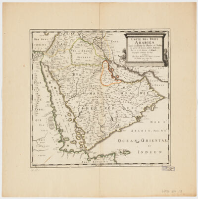
76. Carte des trois Arabiestirée en partie de l'Arabe de Nubie, en partie de diuers autres autheurs Creator: Sanson, Nicolas, 1600-1667 (المنشئ) Date: Date Issued: 1654 Language: French Geographic region: Place of Production: fr, France, ParisArabian Peninsula Extent: 1 map : hand col. ; 39 x 47 cm.
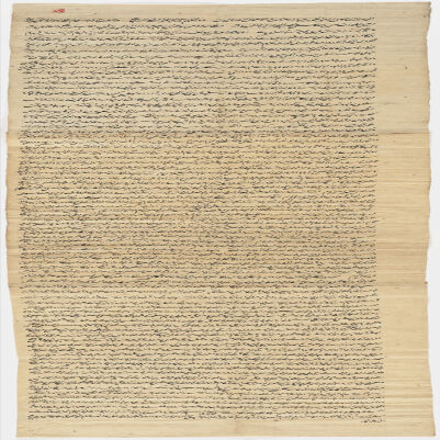
77. Central Asian documents : manuscript, 1558-1804 Date: Date Issued: 1558 Language: ChagataiPersian Geographic region: Place of Production: cc, ChinaAsia, CentralXinjiang Uygur Zizhiqu (China)Kashi (China)Shache (China) Extent: 13 documents in 1 box
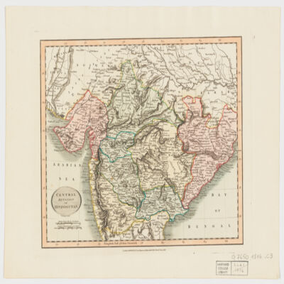
78. Central division of Hindoostan Creator: Cary, John, approximately 1754-1835 (المنشئ) Date: Date Issued: June 1, 1816 Language: English Geographic region: Place of Production: enk, England, LondonIndia Extent: 1 map : hand col. ; 22 x 27 cm.
79. Ceride-yi mehakim-i adliye Date: Date Issued: 1319 [1901]- Language: Turkish, Ottoman (1500-1928) Geographic region: Place of Production: tu, Turkey, DersaadetTurkey Extent: 1 v. ([556] p.) ; 39 cm.
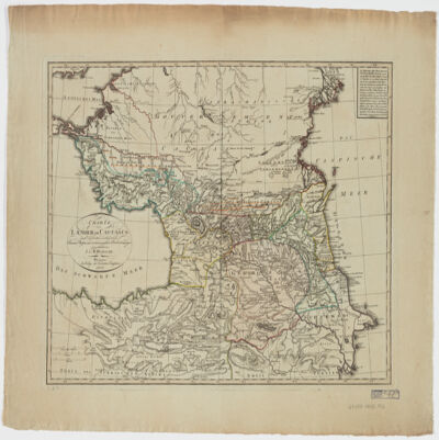
80. Charte der Laender am Caucasus nach den besten vorhandenen Creator: Reinecke, J. C. M. (Johann Christoph Matthias), 1770-1818 (المنشئ) Date: Date Issued: 1802 Language: German Geographic region: Place of Production: gw, Germany, WeimarCaucasus, SouthRussiaTurkey Extent: 1 map : hand col. ; 42 x 54 cm.
81. Commonplace book : manuscript, 1820-1841 Contributor: Abdullah, Munshi, 1796-1854 (كاتب) Date: Date Issued: 1820 Language: Malay Geographic region: Place of Production: xx, No place, unknown, or undetermined Extent: 1 v. (38 leaves) ; 22 cm.
82. Compedium of astrology, numerology and fortune-telling : manuscript, undated Language: PersianArabic Geographic region: Place of Production: ii, India Extent: 1 v. (75 leaves) : ill. ; 10 x 15 cm.
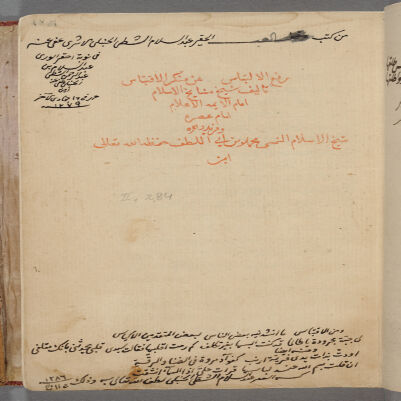
83. Dafʻ al-iltibās ʻan munkar al-iqtibās Creator: Ibn Abī al-Luṭf, Muḥammad, -1584 (المنشئ) Date: Date Created: 1585 Language: Arabic Geographic region: Place of Production: xx, No place, unknown, or undetermined Extent: 7 leaves ; 20 cm.
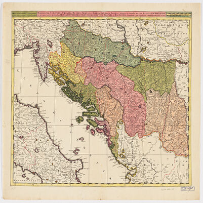
84. Dalmatia, Sclavonia, Croatia, Bosnia, Servia, et Istriadistributa in singulares ditiones et diœceses, una cum Republica Ragusana, et circumjacentibus regionibus, Hungaria, Venetiis, statu ecclesiastico, Napoli et Macedonia Creator: Valck, G. (Gerard), 1651-1726 (Creator) Date: Date Issued: [1710?] Language: LatinItalian Geographic region: Place of Production: ne, Netherlands, [Amsterdam]Balkan PeninsulaAdriatic Coast (Balkan Peninsula)Adriatic Coast (Italy) Extent: 1 map : hand col. ; 45 x 57 cm.