Skip to search
Skip to main content
Skip to first result
Digital Library of the Middle East
Show facets
Hide facets
English
العربية
Contact us
Contact us
To contact us about any matter related to DLME, please use the form below.
Message
Your name
Ignore this text box. It is used to detect spammers. If you enter anything into this text box, your message will not be sent.
Your email
Cancel
Digital Library of the Middle East
Preserve. Access. Inspire.
Home
Explore
Contributors
About
Search in
Everything
Title
Creator / Contributor
Identifier
search for
Search
Home
Search results
Search
Search Constraints
Start Over
You searched for:
Type
Image:Drawings
✖
Remove constraint Type: Image:Drawings
Language
English
✖
Remove constraint Language: English
« Previous |
1
-
96
of
98
|
Next »
Sort
by Relevance
Relevance
Title
Creator
Date (old to new)
Date (new to old)
Number of results to display per page
96
per page
per page
12
per page
24
per page
48
per page
96
per page
View results as:
List
Gallery
Slideshow
Search Results
×
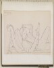
‘Abou-Shehr or Bushire, Persian Gulf’ / ‘On the road to Dalkin [Daliki] from Bushire showing the mirage’ by Joseph D'Arcy (1780–1846)
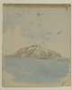
1 of 98
‘My Scrap Book volume V’. Artist: Augustus Fortunatus Bellasis (1822–1872)
2 of 98
‘My Scrap Book volume III’ Artist: Augustus Fortunatus Bellasis (1822–1872)
3 of 98
'NORTH OF PAS PAR DALUN CARAVANSARAI LOOKING E.-N.-E.'
4 of 98
‘Al Husen, stronghold of Shekh Awas Al Ahmadi in the Wadi Tiban.’
5 of 98
'The main pass, Aden.' By Sir Henry Yule (1820-1899)
6 of 98
‘Plate I. Showing Officers Badges of Rank on Shoulder Straps (Field Service Order) with Colours of Branches of Service.’
7 of 98
‘Plate II. Plate showing Badges of Rank of Non-Commissioned Officers. Field Service Order.’
8 of 98
‘Plate III. Plate showing Pattern of Numerals as worn on Shoulder Straps of Regiments’
9 of 98
‘Plate VI. Plate showing Badges of Rank of Police Officers.’
10 of 98
‘Eastern entrance to Mudariba Valley (looking N.) Showing the Alkami range of J. Am Ibdar.’
11 of 98
‘Musemir looking North from below camp of the Hants Regt. January and February 1904.’
12 of 98
‘The Camp at Dalkie [Daliki] on the Road from Bushire to Shiraz’ by Joseph D'Arcy (1780–1846)
13 of 98
‘Mafalis looking N. from the Nijd Rifad.’
14 of 98
‘Makalla’
15 of 98
'The North Pass of Aden or Baab el Yemen. Inside' by Stafford Bettesworth Haines
16 of 98
‘Capt C. at Marshag. May 22nd 71’
17 of 98
'Babelmandel', by Sir Henry Yule (1820-1899)
18 of 98
‘Panorama west from Wali Hassan’
19 of 98
‘Panorama looking west over Turkish territory from the pass at the head of the Wadi Hilhal.’
20 of 98
‘Balhaf’
21 of 98
'TOWN AND FORT OF GIRASH'
22 of 98
‘Radfan Hills from Wali Hassan.’
23 of 98
‘Jibel el Teer – Red Sea. 13 Novr 1850’
24 of 98
'Gibel Tir', by Sir Henry Yule (1820-1899)
25 of 98
‘Jibel Jan – 13 Novr 1850.’
26 of 98
‘Isabera Islands – Red Sea – 13 Novr 1850’
27 of 98
‘Rough Sketch of Soor’
28 of 98
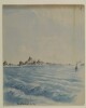
‘Sketch to illustrate positions of Flagstaffs at Elphinstone Inlet [Khawr ash Shamm] and Sheep Island [Jazīrat Umm al Ghanam]’
29 of 98
'Conventionalized sketch of Fao estate'
30 of 98
‘Head of Haiki Valley (Ghail Samada) looking E. J. Hawab in background.’
31 of 98
‘Rough Sketch of Knee Drawer Table’
32 of 98
'Rough Pencil Sketch from the Point Bungalo Ras Marbut, Aden' by Stafford Bettesworth Haines
33 of 98
‘Colonel D’arcy Drawings Made During the Embassy to Persia 1810–12’ by Joseph D’Arcy (1780–1846)
34 of 98
'ZANGU MAMELAY, LOOKING NORTH IN THE MARZ HAFTAWAN VALLEY'
35 of 98
'SHAH GIRAN, LOOKING SOUTH-WEST'
36 of 98
‘Chota Aden 11 Novr 1850’
37 of 98
‘The Rock and Village of Balas (Jabal Jihaf) Looking East from Camp of Hants Regt.’
38 of 98
‘Aden 11. June going out of Harbour’ and ‘Trajan’s Bridge on the Danube. 16 June 1856’. Artist: Augustus Fortunatus Bellasis
39 of 98
‘Aden. Port as seen on approach from Bombay' by Godfrey Thomas Vigne (1801–63)
40 of 98
'KUH KALA LAR, LOOKING N.-N. -W.'
41 of 98
'FAO Telegraph Station and Post Office' by Wilfrid Malleson
42 of 98
‘Entrance to the Gulf, and Musandim Island’
43 of 98
‘Entering the Kotils from Bushire’ by Joseph D'Arcy (1780–1846)
44 of 98
'Maskat from the Harbour Entrance' by Wilfrid Malleson
45 of 98
‘View to the south from near the top of Jabal Mafari.’
46 of 98
‘View east from top of Jabal Harir.’
47 of 98
‘View east from J Abab at head of Wadi Kurim, opposite Al Husen’
48 of 98
‘View north from At Thamer near Jimell’
49 of 98
‘Panorama showing ground traversed by Anglo-Turkish boundary ‘Haushabi-Humar’ to N. of ‘Ad Dareja’’
50 of 98
‘Scene entering the Kotils from Bushire’ by Joseph D'Arcy (1780–1846)
51 of 98
‘View up the Tiban N. from Lijma, showing Jabal Warwa.’
52 of 98
‘View from Al Kabar’
53 of 98
‘View from near ‘As Sueda’ in Uzlat of the Mafari, looking west.’
54 of 98
‘View from village of Lakmat Magharam (ruined) about 1½ miles west of Sanah [Ṣanʻā']’
55 of 98
‘Narrow strait of Bab-Al-Mandab and Shekh Said Hills taken from Obstruction Point Perim.’
56 of 98
‘Straits of Babelmandel. 12 Novr 1850.’
57 of 98
'GWADAR AERODROME'
58 of 98
'A Mussulman Temple, Aden' by Stafford Bettesworth Haines
59 of 98
‘Battle of Nasiriyah'
60 of 98
‘Battle of Nasiriyah’
61 of 98
‘Battle of Nasiriyah'
62 of 98
‘Hardaba Blockhouse.’
63 of 98
'From Calcutta to Bombay (by B. I. steamer).' By: Kate Toynbee (fl. 1879-80)
64 of 98
‘BEIT AL FALAJ L. G. MUSCAT’
65 of 98
‘Wadi Hidaba at well above Al ’Ashar (looking South up the Wadi). Juheli hills in background.’
66 of 98
‘The Wadi ’Ubil at Mijza (Shumaya) from high ground on the right bank.’
67 of 98
‘The Wadi Ma’din looking South from near Sanawi on right bank.’
68 of 98
‘The Wadi Ma’din looking E. from near Sanawi.’
69 of 98
‘Gorge and stream in Wadi Ziyak. (near Haushabi, N.W. border).’
70 of 98
[Unidentified maritime scene, probably in Red Sea]
71 of 98
Album of 154 drawings, most made in the Punjab hills, Kashmir, Baltistan and Afghanistan by Godfrey Thomas Vigne (1801-63)
72 of 98
Third of 3 Journals (1867–73) of Jeffery Charles Amherst (1844–77), fourth son of 2nd Earl Amherst
73 of 98
Yemeni man
74 of 98
Three views of the coastal towns of Hodeida, Loheia and El Cassar by Thomas Elwon (1793/4–1835)
75 of 98
A rough sketch of the sections of Shaikh Ahmad's estate in Fao
76 of 98
Sketch of village of Mazub Habil Al Khadar looking North into Turkish [Ottoman] Territory
77 of 98
Rough sketch of the neighbourhood of Sistan
78 of 98
Sketch of the site of a motorcycle accident
79 of 98
Hand-drawn sketch of the villages of Shakhab, Kalaba, Mazoob Habil al Khada and Dthala
80 of 98
Tracing of ‘Rough Sketch of proposed buildings at Angaum [Jazīreh-ye Hengām]’
81 of 98
Illustration of the Russian bombardment of the Imam Reza Shrine in Mashhad, 1912
82 of 98
Drawings of the coast around Aden and along the Red Sea made during Elwon’s survey to establish the best course for steamers travelling to and from Suez by Thomas Elwon (1793/4-1835)
83 of 98
Drawings of the coast around Aden and along the Red Sea made during Elwon’s survey to establish the best course for steamers travelling to and from Suez by Thomas Elwon (1793/4-1835)
84 of 98
Six views of the Red Sea coastline and flysheet of a sketchbook by Thomas Elwon (1793/4–1835)
85 of 98
‘Aden – Oct 22nd /71’
86 of 98
Draft pencil sketches of Nejd [Najd] territory
87 of 98
View of a coastal town by Thomas Elwon (1793/4–1835)
88 of 98
View of Suakin and of a peak on the Red Sea coast by Thomas Elwon (1793/4–1835)
89 of 98
View of Hodedda [Al Hodeida] and a fort by Thomas Elwon (1793/4–1835)
90 of 98
Two views of the Red Sea coastline by Thomas Elwon (1793/4–1835)
91 of 98
Two views of the Red Sea coastline by Thomas Elwon (1793/4–1835)
92 of 98
Two views of the Red Sea coastline by Thomas Elwon (1793/4–1835)
93 of 98
Two views of the coast of Babelmandel Cape [Ras Bab-el-Mandeb] by Thomas Elwon (1793/4–1835)
94 of 98
Houses at the foot of mountains, probably Aden
95 of 98
Landing ground at Sukra Bay
96 of 98
« Previous
Next »
1
2
![‘Abou-Shehr or Bushire, Persian Gulf’ / ‘On the road to Dalkin [Daliki] from Bushire showing the mirage’ by Joseph D'Arcy (1780–1846)](https://iiif.qdl.qa/iiif/images/81055/vdc_100023808006.0x000001/WD3274_0001.jp2/full/80,100/0/default.jpg)
![‘Sketch to illustrate positions of Flagstaffs at Elphinstone Inlet [Khawr ash Shamm] and Sheep Island [Jazīrat Umm al Ghanam]’](https://iiif.qdl.qa/iiif/images/81055/vdc_100000000365.0x0003dc/IOR_L_PS_10_23_0001.jp2/full/80,100/0/default.jpg)


![Sketch of village of Mazub Habil Al Khadar looking North into Turkish [Ottoman] Territory](https://iiif.qdl.qa/iiif/images/81055/vdc_100000000365.0x0003d3/IOR_L_PS_10_14_0001.jp2/full/80,100/0/default.jpg)
![Tracing of ‘Rough Sketch of proposed buildings at Angaum [Jazīreh-ye Hengām]’](https://iiif.qdl.qa/iiif/images/81055/vdc_100000000365.0x00037b/IOR_L_PS_10_38_0001.jp2/full/80,100/0/default.jpg)
![Draft pencil sketches of Nejd [Najd] territory](https://iiif.qdl.qa/iiif/images/81055/vdc_100000001524.0x0003c6/Mss Eur F126_59_0001.jp2/full/80,100/0/default.jpg)