Skip to search
Skip to main content
Skip to first result
Digital Library of the Middle East
Show facets
Hide facets
English
العربية
Contact us
Contact us
To contact us about any matter related to DLME, please use the form below.
Message
Your name
Ignore this text box. It is used to detect spammers. If you enter anything into this text box, your message will not be sent.
Your email
Cancel
Digital Library of the Middle East
Preserve. Access. Inspire.
Home
Explore
Contributors
About
Search in
Everything
Title
Creator / Contributor
Identifier
search for
Search
Home
Search results
Search
Search Constraints
Start Over
You searched for:
Type
Image:Maps
✖
Remove constraint Type: Image:Maps
Language
English
✖
Remove constraint Language: English
Contributor
C.W. Grant (surveyor)
✖
Remove constraint Contributor: C.W. Grant (surveyor)
« Previous |
1
-
12
of
21
|
Next »
Sort
by Relevance
Relevance
Title
Creator
Date (old to new)
Date (new to old)
Number of results to display per page
12
per page
per page
12
per page
24
per page
48
per page
96
per page
View results as:
List
Gallery
Slideshow
Search Results
×
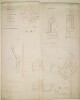
‘Plans and Sections of the several REDOUBTS and connecting RAMPART and DITCH forming the proposed NEW LINE OF WORKS across the Isthmus of ADEN’
1 of 21
‘PLANS and SECTIONS of the proposed SEA DEFENCES on SEERA ISLAND, ADEN’
2 of 21
‘Plans and Sections of the sea defences on Marshag, Aden’
3 of 21
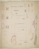
‘PLAN of the DEFENSIBLE BARRACK or MILITARY POST intended for the Table Land immediately overlooking The Raving or Valey of the Wells. ADEN’ and ‘BATTERY and DEFENCES on SEERA MOLE, ADEN’
4 of 21
‘OUTLINE PLAN and SECTIONS of the Island of SEERA on the S.E. side of The Peninsula of ADEN’
5 of 21
‘OUTLINE PLAN and SECTIONS of the Promontory of MARSHAG on the S.E. side of the Peninsula of ADEN’
6 of 21
‘Plan of RAS-ul-GIRREFF shewing the junction with the proposed LINE OF WORKS across the ISTHMUS with the Tunnel and projected Scarping and ultimate Batteries on the hill’ and ‘Plan of GIBUL HUDEED and the end of the Spur from DURUB-ul-HOSH shewing the junction with the projected LINE OF WORKS across the ISTHMUS with the ultimate Defences on GIBUL HUDEED and the Pier’
7 of 21
‘Sketch in Outline of the Isthmus at Aden showing the manner in which the Special Committee propose to defend the Flanks of their Position’
8 of 21
‘Skeleton plan of a survey of the eastern portion of the peninsula of Aden’
9 of 21
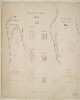
‘PLAN AND SECTIONS of SEERA MOLE in the FRONT BAY of ADEN’
10 of 21
‘SURVEY of the Northern or Munsooree Range together with the Isthmus of the Peninsula of ADEN’
11 of 21
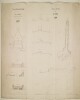
‘Transverse sections of No. 9 A. B. of Ras-ul Girreff’
12 of 21
« Previous
Next »
1
2