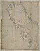
1. ‘Chart of the Gulf of Persia. Constructed from the Trigonometrical Surveys Made by Order of The Hon.ble the Court of Directors of the United English East India Company; by George Barnes Brucks, Commander H.C. Marine. 1830. Engraved by R. Bateman, 85 Long Acre’ Contributor: James Horsburgh (publisher)Richard Bateman (artist)George Edward Brucks (surveyor) Date: 1832/1832 Language: EnglishArabic Geographic region: Persian Gulf Extent: 1 map on 2 sheets
2. ‘Trigonometrical Plan of the Back-water at Amulgawein by Lieut.t G.B. Brucks under the direction of Lieut.t J.M. Guy, H.C.Marine. 1822’ Contributor: John M. Guy (surveyor)George Edward Brucks (surveyor)Michael Houghton (artist) Date: 1822/1822 Language: EnglishArabic Geographic region: Amulgawein Extent: 1 map
3. Chart of the Gulf of Persia. Constructed from the Trigonometrical Surveys Made by Order of The Hon.ble the Court of Directors of the United English East India Company; by George Barnes Brucks, Commander H.C. Marine Contributor: Richard Bateman (artist)George Edward Brucks (surveyor)James Horsburgh (publisher) Date: 1832/1832 Language: EnglishArabic Extent: 1 map