1. ‘Qatar Peninsular Reconnaissance. 11-10-35’ Date: 1935/1935 Language: English Geographic region: Shatt al ʻArabQatar Extent: 1 map
2. ‘Sketch showing untaxed Property of Sheikh of Kuwait in Shatt Al Arab Delta’ Date: 1930/1930 Language: English Geographic region: Shatt al ʻArab Extent: 1 map
3. ‘Rough sketch showing Iraq territorial waters boundary’ Date: 1933/1933 Language: English Geographic region: Shatt al ʻArab Extent: 1 map
4. ‘Rough sketch showing Iraq territorial waters boundary’ Date: 1933/1933 Language: English Geographic region: Shatt al ʻArab Extent: 1 map
5. ‘Sketch map of Qatar Peninsula’ Date: 1935/1935 Language: English Geographic region: QatarShatt al ʻArab Extent: 1 map
6. 'Sketch of APPROACHES TO KUWEIT HARBOUR AND SHATT AL ARAB' Contributor: Admiralty (publisher) Date: 1909/1909 Language: English Geographic region: KuwaitShatt al Arab Extent: 1 map
7. 'Sketch of Approaches to Kuweit Harbour and Shatt Al Arab, compiled from various authorities' Date: 1908/1908 Language: English Geographic region: Shatt al ArabKuwait Harbour Extent: 1 map
8. ‘Sketch Map of the Mouth of the Shatt-El-Arab’ Date: 1905/1905 Language: English Geographic region: Shatt-el-Arab Extent: 1 map
9. ‘Plan II. Mesopotamia. The Shatt Al Arab’ Date: 1921/1921 Language: English Geographic region: Shatt al ʻArab Extent: 1 map
10. ‘PLAN SHOWING SHATT EL ARAB FROM KURNA TO BASRA, AND RESPECTIVE POSITIONS APPROXIMATELY OF LYNCH DOCK AT MAGIL, THE BAGDAD RAILWAY MATERIAL DEPÔT, AND THE TOWN OF BASRA’ Date: 1912/1912 Language: English Geographic region: Shatt al ʻArab Extent: 1 map
11. ‘Qatar Peninsula’ Date: 1937/1937 Language: English Geographic region: QatarShatt al ʻArab Extent: 1 map
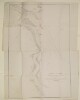
12. 'Sketch of the Course of the Shat Ul 'Arab from the Entrance to Mahomerah' Contributor: James Felix Jones (surveyor) Date: 1857/1857 Language: EnglishPersian Geographic region: Shatt al ʻArab Extent: 1 map