Skip to search
Skip to main content
Skip to first result
Digital Library of the Middle East
Show facets
Hide facets
English
العربية
Contact us
Contact us
To contact us about any matter related to DLME, please use the form below.
Message
Your name
Ignore this text box. It is used to detect spammers. If you enter anything into this text box, your message will not be sent.
Your email
Cancel
Digital Library of the Middle East
Preserve. Access. Inspire.
Home
Explore
Contributors
About
Search in
Everything
Title
Creator / Contributor
Identifier
search for
Search
Home
Search results
Search
Search Constraints
Start Over
You searched for:
Type
Image:Maps
✖
Remove constraint Type: Image:Maps
Language
English
✖
Remove constraint Language: English
« Previous |
1
-
12
of
1,302
|
Next »
Sort
by Creator
Relevance
Title
Creator
Date (old to new)
Date (new to old)
Number of results to display per page
12
per page
per page
12
per page
24
per page
48
per page
96
per page
View results as:
List
Gallery
Slideshow
Search Results
×
Distribution of Social Agencies in Cairo
1 of 1302
Allied-Axis Position in the Near East - Autumn 1941
2 of 1302
Egypt.
3 of 1302
View of Proposed Development - Midan Ismail
4 of 1302
Maps from "Cairo and its environs"
5 of 1302
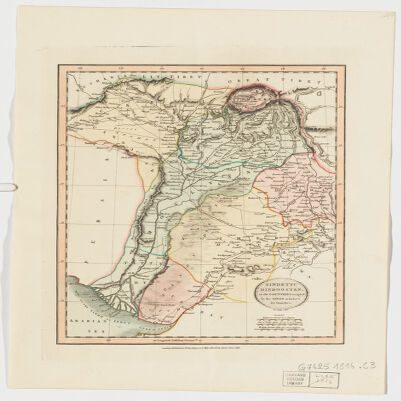
Sindetic Hindoostan or the countries occupied by the Sinde or Indus and its branches
6 of 1302
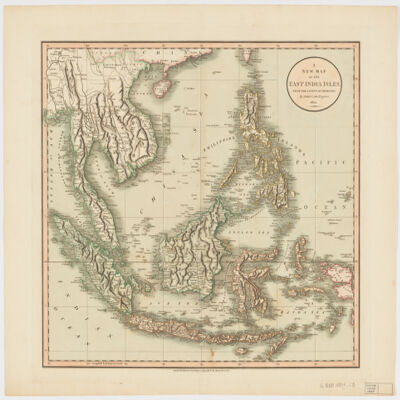
A new map of the East India Islesfrom the latest authorities
7 of 1302
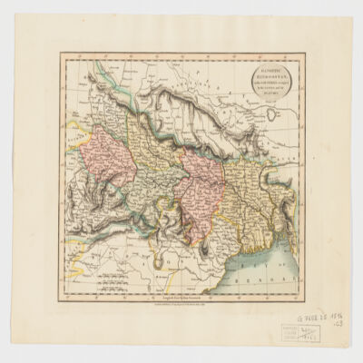
Gangetic Hindoostan or the countries occupied by the Ganges and the branches
8 of 1302
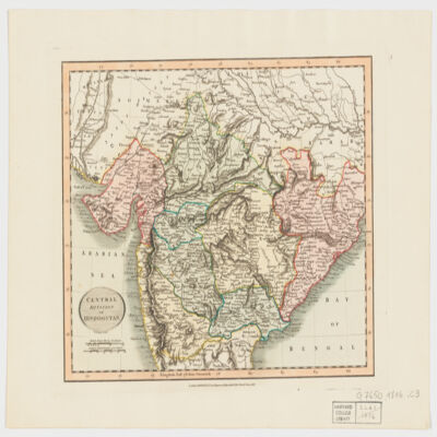
Central division of Hindoostan
9 of 1302
A map of Ancient Aegypt from Celarius.
10 of 1302
Guide plan of Cairo and district.
11 of 1302
Residential map of Gezîra: (Zamâlik area).
12 of 1302
« Previous
Next »
1
2
3
4
5
…
108
109