1. "Get out' banners" Creator: Photographer: Eldiwany, Ahmed Date: 2011-02-11 Language: ArabicEnglish Geographic region: CairoAl-Qāhirah governorateEgyptAfrica Medium: digital images Extent: 720 x 540 px.
2. "Libertyhuman dignitydemocracy' banner" Creator: Photographer: Eldiwany, Ahmed Date: 2011-02-11 Language: ArabicEnglish Geographic region: CairoAl-Qāhirah governorateEgyptAfrica Medium: digital images Extent: 720 x 540 px.
3. "Shift Delete Mubārak' banner" Creator: Photographer: Eldiwany, Ahmed Date: 2011-02-11 Language: ArabicEnglish Geographic region: CairoAl-Qāhirah governorateEgyptAfrica Medium: digital images Extent: 720 x 540 px.
4. 'Pocket No. 25: Enclosure to Part III of Volume I of the Persian Gulf Gazetteer: Chart showing the Pearl Banks along the Arabian Shore of the Persian Gulf between Ras Tanura and Debai' Date: 1915/1915 Language: EnglishArabic Extent: 1 map
7. 'ANNEXE B. SOUTH ARABIA ANGLO-TURKISH BOUNDARY.' Date: 1914/1914 Language: EnglishArabic Geographic region: YemenAden Protectorate Extent: 1 map on 4 sheets
8. 'ANNEXE B. SOUTH ARABIA ANGLO-TURKISH BOUNDARY. SHEET NO. 1' Date: 1914/1914 Language: EnglishArabic Geographic region: YemenAden Protectorate Extent: 1 map on 4 sheets
9. 'ANNEXE B. SOUTH ARABIA ANGLO-TURKISH BOUNDARY. SHEET NO. 2' Date: 1914/1914 Language: EnglishArabic Geographic region: YemenAden Protectorate Extent: 1 map on 4 sheets
10. 'ANNEXE B. SOUTH ARABIA ANGLO-TURKISH BOUNDARY. SHEET NO. 3' Date: 1914/1914 Language: EnglishArabic Geographic region: YemenAden Protectorate Extent: 1 map on 4 sheets
11. 'South Arabia, Anglo-Turkish Boundary: Sheet No. 1' Date: 1905/1905 Language: EnglishArabic Extent: 1 folio
12. 'South Arabia, Anglo-Turkish Boundary: Sheet No. 2' Date: 1905/1905 Language: EnglishArabic Extent: 1 folio
13. 'South Arabia, Anglo-Turkish Boundary: Sheet No. 3' Date: 1905/1905 Language: EnglishArabic Extent: 1 folio
14. 'South Arabia, Anglo-Turkish Boundary: Sheet No. 4' Date: 1905/1905 Language: EnglishArabic Extent: 1 folio
17. ‘Chart of the Gulf of Persia. Constructed from the Trigonometrical Surveys Made by Order of The Hon.ble the Court of Directors of the United English East India Company; by George Barnes Brucks, Commander H.C. Marine. 1830. Engraved by R. Bateman, 85 Long Acre’ Contributor: James Horsburgh (publisher)Richard Bateman (artist)George Edward Brucks (surveyor) Date: 1832/1832 Language: EnglishArabic Geographic region: Persian Gulf Extent: 1 map on 2 sheets
18. ‘Arabic Characters to Accompany and for Insertion in the Chart of the Persian Gulf’ Date: 1825/1825 Language: EnglishArabic Extent: 1 item
19. 2 men holding banners Creator: Photographer: Rowe, Amy; Rowe, Martin Date: 2011-02-01 Language: ArabicEnglish Geographic region: CairoAl-Qāhirah governorateEgyptAfrica Medium: digital images Extent: 3008 x 2000 px.
20. Alexandria, Department of Survey and Mines Creator: Egypt. Maṣlaḥat al-Misāḥah wa-al-Manājim Date: 1940 Language: EnglishArabic Geographic region: Alexandria; Egypt
21. Anti-Mubarak graffiti Creator: Photographer: Rowe, Amy; Rowe, Martin Date: 2011-02-01 Language: ArabicEnglish Geographic region: CairoAl-Qāhirah governorateEgyptAfrica Medium: digital images Extent: 3008 x 2000 px.
22. Anti-Mubārak banners Creator: Photographer: Rowe, Amy; Rowe, Martin Date: 2011-02-08 Language: ArabicEnglish Geographic region: CairoAl-Qāhirah governorateEgyptAfrica Medium: digital images Extent: 2592 x 1944 px.
23. Anti-Mubārak poster Creator: Photographer: Rowe, Amy; Rowe, Martin Date: 2011-02-02 Language: ArabicEnglish Geographic region: CairoAl-Qāhirah governorateEgyptAfrica Medium: digital images Extent: 3008 x 2000 px.
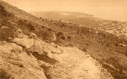
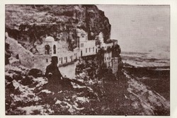
24. At the foot of Mount Carmel Contributor: "Ma'lufIsa Iskandar1869-1956collector." Date: 1925-1940 Language: EnglishArabicHebrew
25. Boy holding banners Creator: Photographer: Rowe, Amy; Rowe, Martin Date: 2011-02-01 Language: ArabicEnglish Geographic region: CairoAl-Qāhirah governorateEgyptAfrica Medium: digital images Extent: 3008 x 2000 px.
26. Cairo Creator: Egypt. Maṣlaḥat al-Misāḥah Date: 1930 Language: EnglishArabic Geographic region: Cairo; Egypt
27. Cairo, 1:1000 Creator: Egypt. Maṣlaḥat al-Misāḥah Date: 1929-1986 Language: ArabicEnglish Geographic region: Cairo; Egypt
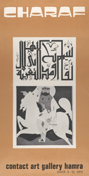
28. Charaf Contributor: Rafic Charaf Date: 1975 Language: EnglishArabic Geographic region: Beirut, Lebanon
29. Demonstrators holding banners and Egyptian flags Creator: Photographer: Eldiwany, Ahmed Date: 2011-02-11 Language: ArabicEnglish Geographic region: CairoAl-Qāhirah governorateEgyptAfrica Medium: digital images Extent: 720 x 540 px.
30. El-Maadi Creator: Egypt. Maṣlaḥat al-Misāḥah Date: 1945 Language: EnglishArabic Geographic region: Maadi; Cairo; Egypt
31. Graffiti on base of Ṭalʻat Ḥarb monument Creator: Photographer: Eldiwany, Ahmed Date: 2011-02-11 Language: ArabicEnglish Geographic region: CairoAl-Qāhirah governorateEgyptAfrica Medium: digital images Extent: 540 x 720 px.
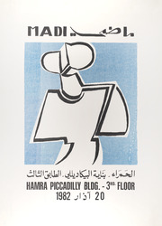
32. Madi Contributor: Hussein Madi Date: 1982 Language: ArabicEnglish Geographic region: Beirut, Lebanon
33. Man holding a banner Creator: Photographer: Rowe, Amy; Rowe, Martin Date: 2011-02-02 Language: ArabicEnglish Geographic region: CairoAl-Qāhirah governorateEgyptAfrica Medium: digital images Extent: 2816 x 2112 px.
34. Man holding a banner featuring a cartoon of Mubārak Creator: Photographer: Eldiwany, Ahmed Date: 2011-02-11 Language: ArabicEnglish Geographic region: CairoAl-Qāhirah governorateEgyptAfrica Medium: digital images Extent: 720 x 540 px.
35. Man holding a sign shaped like a shoe Creator: Photographer: Eldiwany, Ahmed Date: 2011-02-11 Language: ArabicEnglish Geographic region: CairoAl-Qāhirah governorateEgyptAfrica Medium: digital images Extent: 540 x 720 px.
36. Man holding an anti-Mubārak banner Creator: Photographer: Rowe, Amy; Rowe, Martin Date: 2011-02-02 Language: ArabicEnglish Geographic region: CairoAl-Qāhirah governorateEgyptAfrica Medium: digital images Extent: 2816 x 2112 px.
37. Men holding a banner seated on the statue of Ṭalʻat Ḥarb Creator: Photographer: Eldiwany, Ahmed Date: 2011-02-11 Language: ArabicEnglish Geographic region: CairoAl-Qāhirah governorateEgyptAfrica Medium: digital images Extent: 720 x 540 px.
38. Pro-justice anti-Mubārak Banner Creator: Photographer: Rowe, Amy; Rowe, Martin Date: 2011-02-01 Language: ArabicEnglish Geographic region: CairoAl-Qāhirah governorateEgyptAfrica Medium: digital images Extent: 3008 x 2000 px.
40. The Mount of Temptation Contributor: "Ma'lufIsa Iskandar1869-1956collector." Date: 1925-1940 Language: EnglishArabic
41. Two women holding banners Creator: Photographer: Rowe, Amy; Rowe, Martin Date: 2011-02-08 Language: ArabicEnglish Geographic region: CairoAl-Qāhirah governorateEgyptAfrica Medium: digital images Extent: 2592 x 1944 px.
42. Woman holding two banners Creator: Photographer: Rowe, Amy; Rowe, Martin Date: 2011-02-02 Language: ArabicEnglish Geographic region: CairoAl-Qāhirah governorateEgyptAfrica Medium: digital images Extent: 2816 x 2112 px.
43. Yemeni man Creator: Aḥmad Ṭūghān\r\nAhmed Toughan\r\n Date: 1965 Language: ArabicEnglish Medium: Photocopy, printed hand drawing, black and white, dated inscription by Ṭūghān in Arabic and English
44. 'SKETCH MAP OF QATAR PENINSULA' Contributor: Bahrain Political Agency (creator) Date: 1934/1936 Language: EnglishArabic Geographic region: Kuwait Extent: 1 map sheet
45. 'SKETCH MAP OF QATAR PENINSULA' Contributor: Bahrain Political Agency (creator) Date: 1934/1936 Language: EnglishArabic Geographic region: Kuwait Extent: 1 map sheet
46. Sketch Map of Gwadur and Surrounding Region Date: 1941/1951 Language: EnglishArabic Extent: 1 map
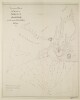
47. Sketch map of Pearl Banks between Koweit and Ras Tanura Date: 1906/1906 Language: EnglishArabic Extent: 1 map
48. ‘Trigonometrical Plan of the Back-water at Amulgawein by Lieut.t G.B. Brucks under the direction of Lieut.t J.M. Guy, H.C.Marine. 1822’ Contributor: John M. Guy (surveyor)George Edward Brucks (surveyor)Michael Houghton (artist) Date: 1822/1822 Language: EnglishArabic Geographic region: Amulgawein Extent: 1 map