"Photographer's description: Pictures taken during the Egyptian Revolution. Text in image: ثروة المبارك (صحيفة الجارديان) – ثروة مبارك 15 مليار دولار – ثروة سوزان 3-5 مليار دولار – ثروة جمال 17 مليار دولار- ثروة علاء 8 مليار دولار- مجموع الثروة تقريبا 50 مليار دولار – الدين الخارجى 33 مليار دولار- الدين المحلى 123 مليار دولار – اذا الشعب يوما أراد الحياة فلابد أن يستجيب البقرمع الاعتذار لأبى القاسم الشابى .Translation of Text in image: Fortune of the Mubāraks (The Guardian Newspaper): -Mubārak 15 Billion Dollars -Suzanne 3-5 Billion Dollars -Gamal 17 Billion Dollars -Alaa 8 Billion Dollars Total of 50 Billion Dollars External debt: 30 Billion Dollars Local debt: 123 Billion Dollars . If one day the people want to live then the cows must obey with apologies to Abi Kassem Al Shaby."
"Photographer's description: Pictures taken during the Egyptian Revolution. Text in image: (ارحل).Get Out; Get Out; Out. رمسيس Ramses. Translation of Text in image: Leave."
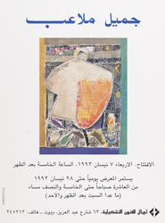
https://libraries.aub.edu.lb/xtf/data/posters/ark86073b3b33p/thumb.jpgprinted on paper : 41 x 30 cmJamil Malaeb : "Painting Exhibition"Painting reproduced on poster by G. Molaeb. Launching 7 April 1993, continues till 28 April 1993. Ajial for Plastic Arts, Abdel Aziz street. Beirut. Nakhal for printing and advertising.
"Photographer's description: Pictures taken during the Egyptian Revolution. Text in image: عيش يتاكل - حرية - كرامة - انسانية. Translation of Text in image: Bread(edible)- Liberty- Human Dignity. Text in image on reverse: DEMOCRACY."
"Demonstrators in the crowd on the groud are making peace signs. Photographer's description: Pictures taken during the Egyptian Revolution. Text in image: مطالبنا: اسقاط الرئيس- حل مجلس الشعب و الشورى الزورين- انهاء حالة الطوارئ فورا- تشكيل حكومة وحدة وطنية انتقالية دستورية لاجراء انتخابات رئاسية- محاكمات فورية للمسئولين عن قتل شهداء الثورة- محاكمات عاجلة للفاسدين سارقى ثروات البلد. Translation of Text in image: Our Demands: Bring down the the President - Dissolutuon of the fraudful parliament and the Shurra Council - end the state of emergency immediately - to form a government of national unity and constitutional transition for presidential elections - Instant trials for those responsible for killing of the martyrs of the revolution - speedy trials for the corrupt thieves’ that stole the country's wealth."
"Photographer's description: Pictures taken during the Egyptian Revolution. Text in image: مبارك SHIFT DEL. Translation of Text in image: Mubārak SHIFT DEL."
Genre/Subject Matter:This photograph shows four men and a camel standing in a flat, stony area. Behind them tall hills rise. The title suggests that one of the men is Sharif Yahya, ‘a son of Sharif Ahmed, whose father was the famous Grand-Sharif Abdulmutalib [bin Ghalib (1880–82)], who died in 1886’.The camel’s reigns are held by Yahya’s slave; to his left, is Yahya himself, in his riding habit, while the two men on the far left are sharifs of a lower rank.The sharif on the left wears a white
thawbunderneath a dark-coloured outer robe. At his waist a scimitar or long
janbiya– the curved dagger that is traditionally worn at the waist in countries on the Arabian Peninsula – is held in place by a belt. The sharif second from left wears white trousers, a dark-coloured outer robe and striped shirt with a
janbiyaat his waist. Both men wear white keffiyehs held in place by dark-coloured agals and sandals. Each holds a stick in his right hand.Yahya and his slave both also wear keffiyehs held in place by dark-coloured agals but while Yahya’s is dark, his slave’s is white. Both men wear belts held up at the torso by decorated neck halters. Yahya holds a stick in his left hand; his slave holds a long-barrelled rifle upright by the upper barrel.The camel is shown bearing a ‘saddle cloth, richly embroidered with silver [thread], or
batāt’. Tassels hang from a decorative harness as well as from the saddle itself.The negative has had hand-work applied, causing it to take on a drawing-like quality in places.Inscriptions:Above image, on the right, in ink: ‘XVII’1 collotype printDimensions:185 x 241 mmFormat:Collotype print, pasted into volumeCondition:The print is in good condition with minor surface dirt and light abrasions throughout.Foliation:‘XVII’Process:Collotype
Genre/Subject Matter:This landscape view shows ‘the eastern part of valley of Muna (Mina)’ from an elevated position, seven kilometres east of the Masjid al-Haram in Mecca. Muna (Mina) is a station of the hadj, where pilgrims camp out on the 8th, 11th, 12th (and some on the 13th) of
Dhul-Hijjah, as can be seen in this image.Right of centre, along the horizon, eight arches are set into a pale-coloured building. Otherwise no other permanent structures are evident, however, the rest of the flat plain that takes up the middle ground is dotted with many and varying tents, people, beasts of burden, such as horses, camels and donkeys. Small flocks of sheep or goats are visible in the foreground to the right of centre.A ridge of hills rises along the horizon, with the highest point to the right of centre.Arabic script written directly into the image has been erased subtly, but is visible upon close inspection in the lower left of the image as well as in the central sky area of the image.This is the second of two photographs taken from the same vantage point, which form a panoramic view over the valley. The first is X463/11.Inscriptions:Above image, on the right, in ink: ‘XI’Temporal Context:According to Durkje van der Wal in his publication
Christiaan Snouck Hurgronje: The First Western Photographer in Mecca, 1884-1885(Amsterdam : Manfred & Hanna Heiting Fund, Rijksmuseum, 2011, pp. 43-51), the photographs in this publication that pertain to the hadj (this image included) likely date to August 1888 since this was the period of the last hadj before February 1889, the date Christiaan Snouck Hurgronje received the final consignment of images.1 collotype printDimensions:186 x 243 mmFormat:Collotype print, pasted into volumeCondition:The print is in good condition with minor surface dirt and light abrasions throughout.Foliation:‘XI’Process:Collotype
Genre/Subject Matter:This landscape view shows ‘the western part of valley of Muna (Mina), which extends from west to east, during the annual gathering of pilgrims [the hadj]’ from an elevated position northeast of the Masjid al-Khayf in Muna, seven kilometres east of the Masjid al-Haram in Mecca. Muna (Mina) is a station of the hadj, where pilgrims camp out on the 8th, 11th, 12th (and some on the 13th) of
Dhul-Hijjah, as can be seen in this image.See Photo 174/9 for a comparative view from a similar vantage point but with a closer view of the Masjid al-Khayf, which here appears in the left of the background. The structure to the right of the iwan-like entryway, which appears damaged in the latter view, here appears intact. In the far middle ground at right two and three-storey structures can be seen. A ridge of hills rises along the horizon.The middle ground is occupied by tents, while in the foreground there are a wide variety of beasts of burden, such as horses, camels and donkeys, standing, tethered or couched.The negative has had hand-work applied, creating a drawing-like quality, particularly in the background, where the original plate may have been over-exposed.Arabic script written directly into the image has been erased subtly, but is visible upon close inspection in the lower right of the image as well as in the central sky area of the image.This is the first of two photographs taken from the same vantage point, which form a panoramic view over the valley. The second is X463/12.Inscriptions:Above image, on the right, in ink: ‘X’Temporal Context:According to Durkje van der Wal in his publication
Christiaan Snouck Hurgronje: The First Western Photographer in Mecca, 1884-1885(Amsterdam : Manfred & Hanna Heiting Fund, Rijksmuseum, 2011, pp. 43-51), the photographs in this publication that pertain to the hadj (this image included) likely date to August 1888 since this was the period of the last hadj before February 1889, the date Christiaan Snouck Hurgronje received the final consignment of images.1 collotype printDimensions:185 x 237 mmFormat:Collotype print, pasted into volumeCondition:The print is in good condition with minor surface dirt and light abrasions throughout.Foliation:‘X’Process:Collotype
Distinctive Features:An outline map entitled 'Chart showing the Pearl Banks along Arabian Shore of the Persian Gulf between Ras Tanura and Dabai' issued as an enclosure to Part II of Volume I of the ‘Persian Gulf Gazetteer'. Shows the southern coast of the Persian Gulf between Ras Tanura and Dabai [Dubai] with the location of the pearl banks indicated. Each of the pearl banks is marked with a number.Bottom left-hand corner below neat line: ‘Reg. No. 1605 E., 14.-V.-225’.1 mapDimensions:361 x 585 mm, on sheet 457 x 683 mm
This maps, dawn in colour, indicates the territory of Kuwait, and its major settlements in English and Arabic.1 MapMaterials: Bromide hand coloured in watercolourDimensions: 410 x 340 mm
Map of Kuwait produced (according to a letter on folio 409 of IOR/L/PS/12/3811) by the Anglo-Persian Oil Company (APOC).The map shows main settlements (with place names in both English and Arabic), and gives some indication of relief. The boundaries of Kuwait are shown by means of a line of thick dashes and dots, and are explained in the letter on folio 409.1 mapMaterials: printed on paper.Dimensions: 320 x 400mm, on sheet 330 x 410mm.
Genre/Subject MatterThis image shows a view over the city of Mecca from an elevated position east of the Masjid al-Haram, or Grand Mosque. Parts of the city due south of the mosque are visible in the middle ground. (Compare, for example, X463/1.)In the left of the image on the horizon, the fortified structure known as ‘Jiyad Castle’ is visible. The large building on the right is identified in the title as the ‘Hamidiyah’, a two-storey building which is described in the title of a photograph in Christiaan Snouck Hurgronje’s earlier publication of 1888,
Bilder-Atlas zu Mekka(1781.b.6/4) as a government building built by Governor General Othman Pascha. This was likely constructed during the reign of the Ottoman Sultan Abdulhamid II (1876–1909) and was therefore relatively new.The two-storey pale-coloured building to the left of this is identified as the ‘printing house’ (cf. X463/6).Derelict or semi-derelict structures make up the foreground while hills rise in the background.This is the first of four photographs taken from the same vantage point, which form a panoramic view over the city of Mecca. The second, third and fourth are X463/3, X463/4 and X463/5 respectively.InscriptionsAbove image, on the right, in ink: ‘II’Lower centre and upper centre: Illegible, partially erased Arabic script1 collotype printDimensions:190 x 243 mmFormat:Collotype print, pasted into volumeCondition:The print is in good condition with minor surface dirt and light abrasions, though no surface losses in the lower right of centre.Foliation:‘II’Process:Collotype
Genre/Subject Matter:This landscape view shows an expansive camping ground near Mecca at a place called Sarif (Saref or ‘èn-Nawwārijjeh’, according to Snouck Hurgronje), described as ‘the grave of our lady Maymūna [the last of nine wives married to the prophet Mohammed] and camp of the Meccan pilgrims who travelled there’. Snouck Hurgonje, in the second volume of his publication
Mekkadescribes the place, as well as the festival of ‘Sittanā Mèjmūnah’ in detail.Much of the foreground and middle ground is littered with tents of varying shapes and sizes. Several low-lying hills are evident in the background, while a pathway snaking from left through the centre into the distance is described as ‘the way to Mecca’ in the title.Tradition relates that she requested to be buried at this location, where she married Mohammed.This photograph is described as a ‘third view’, however, it does not appear to have been taken from the same vantage point as the two previous photographs.Inscriptions:Above image, on the right, in ink: ‘IXa’Temporal Context:According to Durkje van der Wal in his publication
Christiaan Snouck Hurgronje: The First Western Photographer in Mecca, 1884-1885(Amsterdam : Manfred & Hanna Heiting Fund, Rijksmuseum, 2011, pp. 43-51), the photographs in this publication that pertain to the hadj (this image included) likely date to August 1888 since this was the period of the last hadj before February 1889, the date Christiaan Snouck Hurgronje received the final consignment of images.1 collotype printDimensions:103 x 145 mmFormat:Collotype print, pasted into volumeCondition:The print is in good condition with minor surface dirt and light abrasions throughout.Foliation:‘IXa’Process:Collotype
Genre/Subject MatterThis image shows the city of Mecca from an elevated position due east of the Masjid al-Haram, or Grand Mosque. Parts of the city due north of the Masjid al-Haram are visible in the middleground.A large two-storey, fortified building is situated immediately below the horizon on the foothills of the northern ridge, to the right of the image. The northernmost part of the Masjid al-Haram is visible just below the central point on the left edge of the image.Derelict or semi-derelict structures make up the lower left foreground while a long ridge is visible in the background.This is the third of four photographs taken from the same vantage point, which form a panoramic view over the city of Mecca. The first, second and fourth are X463/2, X463/3 and X463/5 respectively.The negative has had hand-work applied, creating a drawing-like quality along the left-hand edge.InscriptionsAbove image, on the right, in ink: ‘IV’Lower centre and upper centre: illegible, partially erased Arabic script1 collotype printDimensions:188 x 245 mmFormat:Collotype print, pasted into volumeCondition:The print is in good condition with minor surface dirt and light abrasions, though no surface losses in the lower right of centre.Foliation:‘IV’Process:Collotype
Genre/Subject Matter:This landscape view shows an expansive camping ground near Mecca at a place called Sarif (Saref or ‘èn-Nawwārijjeh’, according to Snouck Hurgronje), described as ‘the grave of our lady Maymūna [the last of nine wives married to the prophet Mohammed] and camp of the Meccan pilgrims who travelled there’. Snouck Hurgonje, in the second volume of his publication
Mekkadescribes the place, as well as the festival of ‘Sittanā Mèjmūnah’ in detail.Much of the foreground, middle ground and background is littered with tents of varying shapes and sizes. In the foreground bushes can be seen and in the middle ground and background pilgrims are grouped together. A ridge of hills rises to the left and extends into the far distance on the right along the horizon.Tradition relates that she requested to be buried at this location, where she married Mohammed. A group of pilgrims form a circle to the right of the centre of the image. At centre, the camera has captured the movement of pilgrims walking.The negative has had hand-work applied, creating a drawing-like quality in places, particularly in the background.This is the second of two photographs taken from the same vantage point, which form a panoramic view over the camp. The first is X463/7.Inscriptions:Above image, on the right, in ink: ‘VIII’Temporal Context:According to Durkje van der Wal in his publication
Christiaan Snouck Hurgronje: The First Western Photographer in Mecca, 1884-1885(Amsterdam : Manfred & Hanna Heiting Fund, Rijksmuseum, 2011, pp. 43-51), the photographs in this publication that pertain to the hadj (this image included) likely date to August 1888 since this was the period of the last hadj before February 1889, the date Christiaan Snouck Hurgronje received the final consignment of images.1 collotype printDimensions:188 x 244 mmFormat:Collotype print, pasted into volumeCondition:The print is in good condition with minor surface dirt and light abrasions throughout.Foliation:‘VIII’Process:Collotype
Genre/Subject MatterThis image shows the Caaba and Sanctuary at Mecca from an elevated position due east of the Masjid al-Haram, or Grand Mosque. Parts of the northwest and southwest of the city of Mecca are visible in the middleground. (Compare, for example, ‘Picture of the City of Mecca the Great’ Photo 174/3 from almost the same vantage point.)Due to the relatively slow shutter speed used by the photographer, the movement of the pilgrims performing
tawaf– the ritual of circumambulation of the Caaba seven times in a counter-clockwise direction during the hadj or umrah, starting from the black stone – is captured here as indistinct blurring of the figures closest to the Caaba on the left. There is a range of activity occurring through the mostly empty expanse around the Caaba. White, straight lines to the right and left of the Caaba as well as some activity near the cloisters on the right may indicate some form of construction work underway.A large two-storey building is situated immediately below the horizon on the foothills of the northern ridge.In the immediate foreground a wall or parapet is out of focus. Derelict or semi-derelict structures make up the lower left foreground while hills rise in the background.This is the second of four photographs taken from the same vantage point, which form a panoramic view over the city of Mecca. The first, third and fourth are X463/2, X463/4 and X463/5 respectively.The negative has had hand-work applied, creating a drawing-like quality.InscriptionsAbove image, on the right, in ink: ‘III’Lower centre and upper centre: Illegible, partially erased Arabic script1 collotype printDimensions:186 x 240 mmFormat:Collotype print, pasted into volumeCondition:The print is in good condition with minor surface dirt and light abrasions, though no surface losses in the lower right of centre.Foliation:‘III’Process:Collotype
Genre/Subject MatterThis street-view shows the front entrance of a pale-coloured building in Mecca described as the Printers. The title suggests that it had been ‘built in recent years’. The style of the building is clearly Ottoman and is similar to the Hamidiyya, which was built close by during the reign of Sultan Abdulhamid II (1876–1909).The pale-coloured building at left, of which only the corner can be seen is almost certainly the Hamidiyya, as the two buildings were located adjacent to one another, as can clearly be seen in X463/2.Notable features include a plaque above the door featuring Arabic script, a decorative lamp on the right hand corner of the building and a series of rainwater spouts to compensate for what may be a flat roof.In front of the build two benches, made of naturally bent wood as well as another structure are unoccupied, but nearer to the camera several men sit or stand near a series of benches in front to of a building on the right, some beneath an awning, which may point to the presence of a café or some other informal meeting place.To the right of these men, a group of four boys stand and look towards the camera. A further awning, out of focus due to its proximity to the camera, is evident in the upper right corner of the image.In the left foreground three figures in motion are captured. Though two of their faces have been roughly re-inscribed into the negative, adding to the ghost-like quality of the figures, it is clear the one furthest from the camera is a woman wearing a headscarf while the figure closest to the camera is a man wearing a turban.Behind the two-storey Printers one taller building in a style more common in Mekka can clearly be seen, as well as a large two-storey
rawashin.Aside from merely the faces of the figures, the negative has had hand-work applied, creating a drawing-like quality in places.InscriptionsAbove image, on the right, in ink: ‘VI’1 collotype printDimensions:165 x 235 mmFormat:Collotype print, pasted into volumeCondition:The print is in good condition with minor surface dirt and light abrasions, though no surface losses in the lower right of centre.Foliation:‘VI’Process:Collotype
This map is enclosed in a printed copy of the Anglo-Ottoman Convention of 1914. It depicts the line of demarcation of the boundary determined to separate the Yemen from the territory of the nine cantons of Aden (shown in blue). Also included is an enlarged inset map of the Shekh Sa'id [Ra’s Shaykh Sa‘īd] peninsula.The map's borders are lettered and numbered. Areas on the map are marked with Roman numerals and listed in a table of references. Another table provides a key to symbols and abbreviations. Place names and symbol and abbreviation references are printed in English and Arabic. As well as boundaries the map indicates hydrology, settlements, cultivation and roads. Relief is shown by contours and spot heights.This map is sheet four of four. Also included is an index to adjoining sheets and a note on the survey's sources.Small printed text near below the map states that it was surveyed by the Anglo-Turkish Boundary Commission, under Colonel Robert Alexander Wahab and Colonel Mustapha Remzi Bey, and printed at the Ordnance Survey Office, Southampton, 1914. The map also states the names of the British and Ottoman signatories of the Anglo-Ottoman Convention: E Grey [Edward Grey, Secretary of State for Foreign Affairs] and I Hakky [Ibrahim Hakki Pasha, Ottoman representative].1 map on 4 sheetsMaterials: Printed on paper.Dimensions: 935 x 621mm, on sheet 1081 x 689mm.
This map is enclosed in a printed copy of the Anglo-Ottoman Convention of 1914. It depicts the line of demarcation of the boundary determined to separate the Yemen from the territory of the nine cantons of Aden (shown in blue).The map's borders are lettered and numbered and are used to reference places in an accompanying table. Areas on the map are marked with Roman numerals and are listed in a second table of references. A third table provides a key to symbols and abbreviations. Place names and symbol and abbreviation references are printed in English and Arabic. The map also indicates hydrology, settlements, cultivation and roads. Relief is shown by contours and spot heights.This map is sheet one of four. Also included is an index to adjoining sheets and a note on the survey's sources.Small printed text near below the map states that it was surveyed by the Anglo-Turkish Boundary Commission, under Colonel Robert Alexander Wahab and Colonel Mustapha Remzi Bey, and printed at the Ordnance Survey Office, Southampton, 1914. The map also states the names of the British and Ottoman signatories of the Anglo-Ottoman Convention: E Grey [Edward Grey, Secretary of State for Foreign Affairs] and I Hakky [Ibrahim Hakki Pasha, Ottoman representative].1 map on 4 sheetsMaterials: Printed on paper.Dimensions: 485 x 865mm, on sheet 680 x 980mm.
This map is enclosed in a printed copy of the Anglo-Ottoman Convention of 1914. It depicts the line of demarcation of the boundary determined to separate the Yemen from the territory of the nine cantons of Aden (shown in blue).The map's borders are lettered and numbered and are used to reference places in an accompanying table. Areas on the map are marked with Roman numerals and are listed in a second table of references. A third table provides a key to symbols and abbreviations. Place names and symbol and abbreviation references are printed in English and Arabic. The map also indicates hydrology, settlements, cultivation and roads. Relief is shown by contours and spot heights.This map is sheet two of four. Also included is an index to adjoining sheets and a note on the survey's sources.Small printed text near below the map states that it was surveyed by the Anglo-Turkish Boundary Commission, under Colonel Robert Alexander Wahab and Colonel Mustapha Remzi Bey, and printed at the Ordnance Survey Office, Southampton, 1914. The map also states the names of the British and Ottoman signatories of the Anglo-Ottoman Convention: E Grey [Edward Grey, Secretary of State for Foreign Affairs] and I Hakky [Ibrahim Hakki Pasha, Ottoman representative].1 map on 4 sheetsMaterials: Printed on paper.Dimensions: 803 x 554mm, on sheet 989 x 670mm.
This map is enclosed in a printed copy of the Anglo-Ottoman Convention of 1914. It depicts the line of demarcation of the boundary determined to separate the Yemen from the territory of the nine cantons of Aden (shown in blue).The map's borders are lettered and numbered and are used to reference places in an accompanying table. Areas on the map are marked with Roman numerals and are listed in a second table of references. A third table provides a key to symbols and abbreviations. Place names and symbol and abbreviation references are printed in English and Arabic. The map also indicates hydrology, settlements, cultivation and roads. Relief is shown by contours and spot heights.This map is sheet three of four. Also included is an index to adjoining sheets and a note on the survey's sources.Small printed text near below the map states that it was surveyed by the Anglo-Turkish Boundary Commission, under Colonel Robert Alexander Wahab and Colonel Mustapha Remzi Bey, and heliozincographed at the Survey of India Offices, Calcutta. The map also states the names of the British and Ottoman signatories of the Anglo-Ottoman Convention: E Grey [Edward Grey, Secretary of State for Foreign Affairs] and I Hakky [Ibrahim Hakki Pasha, Ottoman representative].1 map on 4 sheetsMaterials: Printed on paper.Dimensions: 936 x 560mm, on sheet 1081 x 633mm.
Genre/Subject Matter:This landscape view shows ‘the west side of the Mount [‘Arafah]’ as well as the Plain of Arafat or ‘Arafah. Located 21 km southeast of the Masjid al-Haram, the plain, which extends 6km from east to west and 12 km from north to south, and the 70 metre high granite hill at the centre of it are stations of the hadj. Mount Arafat is located northeast of the plain and is also known as Jabal al-Rahmah or Mount of Mercy.On the ninth day of
Dhul-Hijjah, known as the Day of Arafat, just before noon, pilgrims gather on the plain to perform
wuqufor ‘standing before God’, as can be seen in this image: this is a pillar of the hadj and must be undertaken in order the pilgrimage to be valid. In this image the background and middle ground are populated by pilgrims and their tents while in the left middle ground beasts of burden, including horses, camels and donkeys can be seen.A boy standing by the tent in the foreground at left and facing the camera has a shaved head and wears the two piece garb, consisting of two white seamless sheets, associated with being in the state of
ihram. At right a camel is couched; this is the same camel visible in X463/14.The negative has had hand-work applied, creating a drawing-like quality throughout where the original plate may have been over-exposed and where the photographer wished to pick up some small details, such as the face of the boy at left.Arabic script written directly into the image has been erased subtly, but is visible upon close inspection in the lower right of the image as well as in the central sky area of the image.This is the third (left hand) of three photographs taken from the same vantage point, which form a panoramic view over the plain. The first and second are X463/14 and X463/15 respectively.Inscriptions:Above image, on the right, in ink: ‘XV’Temporal Context:According to Durkje van der Wal in his publication
Christiaan Snouck Hurgronje: The First Western Photographer in Mecca, 1884-1885(Amsterdam: Manfred & Hanna Heiting Fund, Rijksmuseum, 2011, pp. 43-51), the photographs in this publication that pertain to the hadj (this image included) likely date to August 1888 since this was the period of the last hadj before February 1889, the date Christiaan Snouck Hurgronje received the final consignment of images.1 collotype printDimensions:190 x 243 mmFormat:Collotype print, pasted into volumeCondition:The print is in good condition with minor surface dirt and light abrasions throughout.Foliation:‘XV’Process:Collotype
Genre/Subject Matter:This landscape view shows the 'Mount‘Arafah, during the annual gathering of pilgrims [hadj] (as seen from the south)’ as well as the Plain of Arafat or ‘Arafah. Located 21km southeast of the Masjid al-Haram, the plain, which extends 6km from east to west and 12km from north to south, and the 70 metre high granite hill at the centre of it – visible here on the horizon at centre – are stations of the hadj. Mount Arafat is located northeast of the plain and is also known as Jabal al-Rahmah or Mount of Mercy.On the ninth day of
Dhul-Hijjah, known as the Day of Arafat, just before noon, pilgrims gather on the plain to perform
wuqufor ‘standing before God’, as can be seen in this image: this is a pillar of the hadj and must be undertaken in order the pilgrimage to be valid. In this image the background and middle ground are populated by pilgrims’ tents.Most of the pilgrims visible here – male and female – are wearing the two piece garb, consisting of two white seamless sheets, associated with being in the state of
ihram. The men have clearly shaved their heads as a part of the ritual cleansing ceremony undertaken at the beginning of the hadj in order to enter into the state of
ihram.In the foreground, two camels are couched at left, an awning or tent billows in the wind and a crouching man turns to face the camera, though most other figures face away from it.The negative has had hand-work applied, creating a drawing-like quality throughout , where the original plate may have been over-exposed.Arabic script written directly into the image has been erased subtly, but is visible upon close inspection in the lower centre of the image as well as in the central sky area of the image.This is the first (central) of three photographs taken from the same vantage point, which form a panoramic view over the plain. The second and third are X463/15 and X463/16 respectively.Inscriptions:Above image, on the right, in ink: ‘XIII’Temporal Context:According to Durkje van der Wal in his publication
Christiaan Snouck Hurgronje: The First Western Photographer in Mecca, 1884-1885(Amsterdam : Manfred & Hanna Heiting Fund, Rijksmuseum, 2011, pp. 43-51), the photographs in this publication that pertain to the hadj (this image included) likely date to August 1888 since this was the period of the last hadj before February 1889, the date Christiaan Snouck Hurgronje received the final consignment of images.1 collotype printDimensions:193 x 245 mmFormat:Collotype print, pasted into volumeCondition:The print is in good condition with minor surface dirt and light abrasions throughout.Foliation:‘XIII’Process:Collotype
A printed map of the border between the British Protectorate of Aden and the Ottoman Vilayet of Yemen. The map is one of four that fit together to show the border area in its entirety.The map was surveyed by the Anglo-Turkish Boundary Commission under Colonel R A Wahab and Colonel Mustapha Remzi Bey.The map has all place names listed in English and Arabic.1 folioDimensions: 700mm x 1,110mmMaterials: 1 paper folio
A printed map of the border between the British Protectorate of Aden and the Ottoman Vilayet of Yemen. The map is one of four that fit together to show the border area in its entirety.The map was surveyed by the Anglo-Turkish Boundary Commission under Colonel R A Wahab and Colonel Mustapha Remzi Bey.The map has all place names listed in English and Arabic.1 folioDimensions: 700mm x 1,110mmMaterials: 1 paper folio
A printed map of the border between the British Protectorate of Aden and the Ottoman Vilayet of Yemen. The map is one of four that fit together to show the border area in its entirety.The map was surveyed by the Anglo-Turkish Boundary Commission under Colonel R A Wahab and Colonel Mustapha Remzi Bey.The map has all place names listed in English and Arabic.1 folioDimensions: 700mm x 1,110mmMaterials: 1 paper folio
A printed map of the border between the British Protectorate of Aden and the Ottoman Vilayet of Yemen. The map is one of four that fit together to show the border area in its entirety.The map was surveyed by the Anglo-Turkish Boundary Commission under Colonel R A Wahab and Colonel Mustapha Remzi Bey.The map has all place names listed in English and Arabic.1 folioDimensions: 700mm x 1,110mmMaterials: 1 paper folio
A printed map of the Haushabi and Subaihi border regions of the British Protectorate of Aden. The map is signed by Colonel R A Wahab, the Commissioner of the Aden Boundary Commission. The map includes a list of place names in English and Arabic.1 folioDimensions: 680mm x 550mmMaterials: 1 paper folio that has been lined with cloth support at a later date.
A printed map of the Subaihi border region between the British Protectorate of Aden and the Ottoman Vilayet of Yemen.The place names on the map are listed in English and Arabic.1 folioDimensions: 1050mm x 840mmMaterials: 1 paper folio lined with a cloth support.
Imprint:Published by James Horsburgh, Hydrographer to the East India Company.Distinctive Features:Relief shown by hachures. Depth shown by soundings.Nautical chart of the Persian Gulf compiled from the surveys carried out by the Bombay Marine’s officers between 1820 and 1829, with place names inserted in both English and Arabic.Includes an engraved note on the survey with dates and names of the officers responsible for surveying respective parts of the coast.Contains dedication to the Court of Directors of the United East India Company from George Barnes Brucks.Inscriptions:On verso of the western portion of the map, in pencil, extensive annotations on discrepancies in latitude and longitude values.1 map on 2 sheetsDimensions:1460 x 1160 mm, on sheets 863 x 673 mm
Distinctive Features:Hand drawn table compiled by the East India Company Chart Office to accompany the Chart of the Persian Gulf with transliterated Arabic place names inserted in black ink.Inscriptions:On recto in the upper right-hand corner in an annotation in black ink: ‘Reced. Pr. Upton Castle 3 May 1825’On verso in the centre of the sheet is an annotation in pencil: ‘The names marked with + are not exactly spelt in this list as they are marked on the Charts & Plans of the same places’.1 itemMaterials:Pen and ink on paper with additions in pencilDimensions:sheet 302 x 484 mm
Genre/Subject Matter:This landscape view shows the ‘the grave of our lady Maymūna [the last of nine wives married to the prophet Mohammed] and surrounding area’ at a place near Mecca called Sarif (Saref or ‘èn-Nawwārijjeh’, according to Snouck Hurgronje). Snouck Hurgonje, in the second volume of his publication
Mekkadescribes the place, as well as the festival of ‘Sittanā Mèjmūnah’ in detail.The white-washed low-lying wall – broken only by an arched entryway in the middle – forms an enclosure with two white-washed buildings facing one another. This small cluster of structures is the building visible from afar in X463/7. Both buildings are flat-roofed with rounded crenellations. The building on the right features a low, white-washed onion-dome. Tradition relates that Maymūna requested to be buried at this location, where she married Mohammed.In the left of the foreground rows of awnings cover a long stall beside which people are seated, in the shade. Tents, animals, people and bundles occupy the rest of the foreground as well as the background. Five rocky outcrops are visible in the background along the horizon.Inscriptions:Above image, on the right, in ink: ‘IXb’Temporal Context:According to Durkje van der Wal in his publication
Christiaan Snouck Hurgronje: The First Western Photographer in Mecca, 1884-1885(Amsterdam : Manfred & Hanna Heiting Fund, Rijksmuseum, 2011, pp. 43-51), the photographs in this publication that pertain to the hadj (this image included) likely date to August 1888 since this was the period of the last hadj before February 1889, the date Christiaan Snouck Hurgronje received the final consignment of images.1 collotype printDimensions:103 x 145 mmFormat:Collotype print, pasted into volumeCondition:The print is in good condition with minor surface dirt and light abrasions throughout.Foliation:‘IXb’Process:Collotype
Genre/Subject Matter:This landscape view shows an expansive camping ground near Mecca at a place called Sarif (Saref or ‘èn-Nawwārijjeh’, according to Snouck Hurgronje), described as ‘the grave of our lady Maymūna [the last of nine wives married to the prophet Mohammed] and camp of the Meccan pilgrims who travelled there’. Snouck Hurgonje, in the second volume of his publication
Mekkadescribes the place, as well as the festival of ‘Sittanā Mèjmūnah’ in detail.Much of the foreground, middle ground and background is littered with tents of varying shapes and sizes. In the foreground bushes can be seen and in the middle ground and background pilgrims are grouped together. Hills rise to the right and left of the horizon.In the centre background a white-washed low-lying structure with a central onion-dome can be seen. This is likely the grave of Maymūna. Tradition relates that she requested to be buried at this location, where she married Mohammed.The negative has had hand-work applied, creating a drawing-like quality in places, particularly in the background and middle ground, where the original plate may have been over-exposed.This is the first of two photographs taken from the same vantage point, which form a panoramic view over the camp. The second is X463/8.Inscriptions:Above image, on the right, in ink: ‘VII’Temporal Context:According to Durkje van der Wal in his publication
Christiaan Snouck Hurgronje: The First Western Photographer in Mecca, 1884-1885(Amsterdam : Manfred & Hanna Heiting Fund, Rijksmuseum, 2011, pp. 43-51), the photographs in this publication that pertain to the hadj (this image included) likely date to August 1888 since this was the period of the last hadj before February 1889, the date Christiaan Snouck Hurgronje received the final consignment of images.1 collotype printDimensions:185 x 240 mmFormat:Collotype print, pasted into volumeCondition:The print is in good condition with minor surface dirt and light abrasions throughout.Foliation:‘VII’Process:Collotype
Genre/Subject Matter:The image shows a richly ornamented interior scene in the bridal chamber. The virgin bride is placed onto the throne (seat) on the first night of marriage,
laylat al-duk̲h̲la.The interior consists of a roughly square space, with nine equally sized recesses on three walls. The bridal throne (
arīkah) is located in the middle of the three recesses that are visible in the lower centre of the image. A close-up view of the throne and the left-hand recess alongside it can be seen in the second of two images – X463/20 – presented together.An arched portico, around which detailed cloth or tile decoration can be seen, separates the camera from the bridal chamber. Although in each of the nine recesses glass lanterns hang, natural light illuminates the decoration visible around the arch, while a further lower ceiling – just visible in the upper part of the image – is shrouded in darkness.A glass chandelier hangs low on a long cord in the space lit by natural light in the middle-ground.This is the first of two related images.Inscriptions:Above the top image, on the right, in ink: ‘XVIIIa’1 collotype printDimensions:101 x 130 mmFormat:Collotype print, pasted into volumeCondition:The print is in good condition with minor surface dirt and light abrasions throughout.Foliation:‘XVIIIa’Process:Collotype
Genre/Subject Matter:The image shows a richly ornamented interior scene in the bridal chamber. The virgin bride is placed onto the throne (seat) on the first night of marriage,
laylat al-duk̲h̲la; in this image the bridegroom is seated in her place.The bridal throne (
arīkah) is located in the central of three recesses, two of which are visible in this image. A wider view of the bridal chamber can be seen in the first of two images – X463/19 – presented together.The arch-surrounds are decorated with richly embroidered cloth. The arch in which the bridegroom sits is edged with a shiny, spherical balls. A large, tassel-edged, embroidered circular hanging is visible in the right-hand recess.The bridegroom faces the camera with his hands on his knees. He wears a white turban, mid-coloured robe and a striped shawl tossed over his right shoulder.A glass chandelier that is visible in the previous image (X463/19) is here out of focus in the upper part of the image. A further hanging light feature, directly above the bridegroom, is also out of focus, while two further chandelier-like features are affixed to the walls either side of the bridegroom. Further light is provided by the glass lanterns hanging directly in the centre of the two recesses visible.This is the second of two related images.Inscriptions:Above the top image, on the right, in ink: ‘XVIIIa’1 Collotype printDimensions:156 x 110 mmFormat:Collotype print, pasted into volumeCondition:The print is in good condition with minor surface dirt and light abrasions throughout.Foliation:‘XVIIIb’Process:Collotype
Genre/Subject Matter:This landscape view shows ‘[a] pilgrims’ camp in the Plain east of Mount ‘Arafah’. Located 21 km southeast of the Masjid al-Haram, the plain, which extends 6 km from east to west and 12 km from north to south, and the 70 metre high granite hill at the centre of it are stations of the hadj. Mount Arafat is located northeast of the plain and is also known as Jabal al-Rahmah or Mount of Mercy.In this image the plain is populated by a wide variety of tents while in the foreground three camels are couched around one low-lying tent. A figure crouches alongside the camel at centre.The negative has had hand-work applied, creating a drawing-like quality where the original plate may have been over-exposed, particularly in the right and along the horizon.Arabic script written directly into the image has been erased subtly, but is visible upon close inspection in the lower right of the image as well as in the central sky area of the image.Inscriptions:Above image, on the right, in ink: ‘XVI’Temporal Context:According to Durkje van der Wal in his publication
Christiaan Snouck Hurgronje: The First Western Photographer in Mecca, 1884-1885(Amsterdam : Manfred & Hanna Heiting Fund, Rijksmuseum, 2011, pp. 43-51), the photographs in this publication that pertain to the hadj (this image included) likely date to August 1888 since this was the period of the last hadj before February 1889, the date Christiaan Snouck Hurgronje received the final consignment of images.1 collotype printDimensions:186 x 240 mmFormat:Collotype print, pasted into volumeCondition:The print is in good condition with minor surface dirt and light abrasions throughout.Foliation:‘XVI’Process:Collotype
Genre/Subject MatterThis image shows a roughly due south facing view inside the Masjid al-Haram in Mecca during the
Çalāt(prayers) and should be compared to Christiaan Snouck Hurgronje’s description of the
Çalātin volume II (1889) of his publication
Mekka, p. 88:‘[…] according to custom, the Imam chooses an extract from the Qur’an to be read during the Çalāt, which is accompanied by prostration; the solemnity is increased due to the fact that the ‘standing’ position of the congregation, which accompanies recitation during the Çalāt, is interrupted in a moment by an extraordinary prostration.’The image should also be compared with the print from a photograph of a similar view (1781.b.6/2) published in Christiaan Snouck Hurgronje’s 1888 publication
Bilder-Atlas zu Mekka.Also in view are: the Caaba; Gate of the Banī Shaybah; Building housing the Zamzam well; Stairs to the Caaba;
Maqām Ibrahīm, which is also the
Maqām el-Schāfi’ī’; Minbar;
Maqām al-Mālikī; outside of the Masjid al-Haram, the front-side of the Hamidiyah (likely a building constructed during the reign of the Ottoman Sultan Abdulhamid II) is visible; and a fortified structure known as ‘Jiyad Castle’, on the low hill in the background on the left.There are also several Ottoman-era buildings featuring intricate tile or brickwork visible outside the mosque.A large number of pilgrims, the majority of which are men, are shown standing and facing the Caaba.Arabic script written directly into the image has been erased subtly, but is visible upon close inspection in the lower centre of the image as well as in the central sky area of the image.InscriptionsAbove image, on right, in ink: ‘I’Lower centre and upper centre: illegible, partially erased Arabic scriptTemporal Context:Since the shadows beneath the feet of the pilgrims are not very deep and are angled fractionally to the east, it is likely the photograph was taken soon after midday.According to Durkje van der Wal in his publication
Christiaan Snouck Hurgronje: The First Western Photographer in Mecca, 1884-1885(Amsterdam : Manfred & Hanna Heiting Fund, Rijksmuseum, 2011, pp. 42-51), the photographs in this publication that pertain to the hadj (this image included) likely date to August 1888 since this was the period of the last hadj before February 1889, the date Christiaan Snouck Hurgronje received the final consignment of images.1 collotype printDimensions:184 x 236 mmFormat:Collotype print, pasted into volumeCondition:The print is in good condition with minor surface dirt and light abrasions, though no surface losses in the lower right of centre.Foliation:‘I’Process:Collotype
Genre/Subject Matter:This landscape view shows ‘the pilgrims’ station, Muzdal’fah, situated between Muna (Mina) and ‘Arafah’. Muzdal’fah is a station of the hadj, where pilgrims camp gather on the 9th of
Dhul-Hijjah, as can be seen in this image.Here pilgrims pray, perform
wuquf(standing before God) and may collect stones for the stoning of the Jamarat at Mina (Muna). Left of centre, along the horizon, a lone white-washed structure, featuring a minaret, appears to be the only building on the plain. Just below the horizon, groups of people and trains of camels to the right and left of the image are visible. A group stands with their backs to the camera in the foreground. Either mist or over-exposure has rendered the horizon blurry. In the far distance ridges of hills are visible, however.The negative has had hand-work applied, creating a drawing-like quality, particularly in the background and around the three figures to the left in the foreground.Arabic script written directly into the image has been erased subtly, but is visible upon close inspection in the lower centre of the image as well as in the central sky area of the image.Inscriptions:Above image, on the right, in ink: ‘XII’Temporal Context:According to Durkje van der Wal in his publication
Christiaan Snouck Hurgronje: The First Western Photographer in Mecca, 1884-1885(Amsterdam : Manfred & Hanna Heiting Fund, Rijksmuseum, 2011, pp. 43-51), the photographs in this publication that pertain to the hadj (this image included) likely date to August 1888 since this was the period of the last hadj before February 1889, the date Christiaan Snouck Hurgronje received the final consignment of images.1 collotype printDimensions:190 x 245 mmFormat:Collotype print, pasted into volumeCondition:The print is in good condition with minor surface dirt and light abrasions throughout.Foliation:‘XII’Process:Collotype
Genre/Subject MatterThis image shows the city of Mecca from an elevated position due east of the Masjid al-Haram, or Grand Mosque. Parts of the city due north of the Masjid al-Haram are visible in the middleground.A large two-storey, fortified building is situated immediately below the horizon on the foothills of the northern ridge, to the far left of the image: this is the same building noted in X463/4.A sloping bank of scree make up the lower right foreground and middleground, while in the distant background a chain of hills is visible.This is the fourth of four photographs taken from the same vantage point, which form a panoramic view over the city of Mecca. The first, second and third are X463/2, X463/3 and X463/4 respectively.The negative has had hand-work applied, creating a drawing-like quality in places.InscriptionsAbove image, on the right, in ink: ‘V’Lower centre and upper centre: illegible, partially erased Arabic script1 collotype printDimensions:189 x 243 mmFormat:Collotype print, pasted into volumeCondition:The print is in good condition with minor surface dirt and light abrasions, though no surface losses in the lower right of centre.Foliation:‘V’Process:Collotype
"Phototgraphers' description: photos and video of Jan 29-Feb 112011BOLLOCKS TO YOU MUBARAK WE Hate You. Translation of Text in image: Demanding the arrest of Mubārak the assasin and his gang."
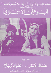
https://libraries.aub.edu.lb/xtf/data/posters/ark86073b3xp7b/thumb.jpgprinted on paper : 82 x 56 cmAbu Ali al-Asmarani . A play. The Orly Cinema Theater presents for the tenth week with great success: 1974. Starring Nidal Al-Ashqar and Antoine Kerbage. Music by Ziad Rahbani. Directed by Berj Vazlian.
This text included excerpts of the sayings of Saint John Chrysostom, translated from Greek to Arabic, and thirty-four spiritual essays. The manuscript was composed by Butrus Girgis, and it was handwritten by Yusuf Hanna in 1843. It includes decca, a typical form of Coptic Orthodox illustration. Saint John Chrysostom, the author, served as the patriarch of Constantinople, a position forced upon him in 389 C.E. Born in Antioch circa 347 C.E., he devoted several years to monastic life, spending part of this time as a hermit. Chrysostom means "golden-mouthed."
Three sheets of Alexandria from 1940 map published by the Department of Survey & Mines. Sections consist of Abu Qîr, El Muntazah, and Alexandria. Sheet numbers 95/525, 94/495, 95/510Scale: 1:25,000
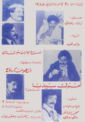
https://libraries.aub.edu.lb/xtf/data/posters/ark86073b3q34g/thumb.jpgprinted on cardboard : 50 x 35 cmAmrak sydna. A play. Starring Antoine Kerbage, Elias Elias, Maha al-Ashkar, Maggie Badawi. Music by Ziad Rahbani. Fashion by Papo Lahoud. Directed by Zohrab Yaqoubian. At the Casino of Lebanon Theater, January 30, 1985.
"Photographer's description: Photos and videos taken in Tahrir Square from 1st Feb./4th Feb./6th Feb./8th Feb./10th Feb./11th Feb./18th Feb./ and so on. Text in Image: مؤهلات مبارك: 1. دبلومة فى البرود 2. دكتوراه فى الخيانة.3. ماجيستير فى البطاله 4. زماله فى تعذيب المواطن 5. شهاده معتمدة من سجون ابو غريب 6. زماله فى المحسوبية 7. زماله الاعتقالات السياسيه 8. صديق وفى لإسرائيل 9. عميل أمين للأمريكان 10. يتحدث العبرية بطلاقه 11. خائن للوحده العربيه 12. منتهى الصلاحية. Translation of text in image: Mubārak's qualifications: 1. Diploma in coldness 2. Ph. D. in treason 3. Master's in unemployment 4. Fellowship in torture 5. Certificate approved by Abu Ghraib Prison 6. Fellowship in favoritism 7. Fellowship in political arrests 8. Good friend to Israel 9. A loyal spy to the Americans 10. Speaks Hebrew fluently 11. Traitor to the Arab unity 12. Expired."
"Photographer's description: Pictures taken during the Egyptian Revolution. Text in image: مستعد لعلاج مبارك من الزهايمر و فصام بارانويا - امضاء استشارى نفسية بالعباسية . Translation of Text in image: Willing to treat Mubārak for Alzheimer's and Paranoia- signed by a psychiatrist in Al ʻAbbāsīyah."
"Phototgraphers' description: photos and video of Jan 29-Feb 112011Why wait till SeptemPer?..We can make it.. It's possible..No.. Mubarak No.. Cry LOL. Translation of text in image: The money is with me and the metal is also with meYou will give back the money and the metal is on your handsLeave for your mother's lifeI elect Popeye for president but just leaveGhandi is telling you to leaveThe country's good."
Text in image: شكرا للجزيرة - أخذ فلوسنا مبارك و مجوعنا لا لمبارك. Translation of Text in image: Thanks to Al Jazeera-Mubārak took our money and starved us, No to Mubārak.
https://libraries.aub.edu.lb/xtf/data/postcards/ark86073b3b01w/thumb.jpg1 photomechanical print (postcard) : color ; 9 x 14 cm.Title from item.Captioned in English, Arabic and Hebrew.
"Photographer's description: Pictures taken during the Egyptian Revolution. Text in image: خبر عاجل- أم مصرية تضحى بابناءها مقابل اقالة الرئيس واسقاط النظام لفاسد و مبارك يضحى بشعب مصر مقابل كبريائه. Translation of Text in image: Breaking news- An Egyptian mother sacrifices her children for the ousting of the president and Mubārak is sacrificing the Egyptian people for his pride."
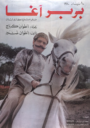
https://libraries.aub.edu.lb/xtf/data/posters/ark86073b3zk80/thumb.jpgprinted on cardboard : 88 x 58 cmBarbar Agha. A play, Starring Antoine Kerbage. Written by Antoine Ghandour. April 10, 1980, at the Casino de Liban.
This manuscript includes books of the Old Testament with notes and commentary about their interpretation according to the Coptic Orthodox faith. Chapters from the books of Joshua, Judges, Samuel, First Kings, and Second Kings are included.
This manuscript features three books of the Torah or the Pentateuch, including Leviticus, Numbers, and Deuteronomy. The book is described as the property of Fahim Moftah.
"Phototgraphers' description: photos and video of Jan 29-Feb 112011We never belive you. Translation of Text in image: Martyrs of elabaraLeave you bloody serial killer."
Map of Cairo published by the Survey of Egypt. Revised in 1927, first edition in 1930. Sheet 81/630. Location labels are in Arabic, while reference is in both English and Arabic. Map contains markings and text in red, blue, and green which were added by an unknown person. The writing discusses canals and drainage proposals in the area.Scale: 1:25,000