1 - 2 of 2
Number of results to display per page
Search Results

1. ‘Diary of Gertrude Bell, 1911.’
- Description:
- The second of two oblong duodecimo volumes containing abbreviated notes recorded by Gertrude Margaret Lowthian Bell, during the course of a journey through Syria, Turkey and Iraq, from Damascus to Aleppo via Baghdad. The volume covers the period 19 April to 23 May 1911, covering the journey from the vicinity of Dara, in Turkey, to Bell’s arrival in Aleppo. The notes record: places passed or visited; times of arrival and departure; temperature and atmospheric pressure readings; some description of the topographic character of the places passed through; and copies of Greek, Syriac, and Nabatean tomb inscriptions.The volume also includes:drawings depicting two anthropomorphic figures, possibly of stone carvings from a tomb at Kermati [Kayabali], above a drawing of three arches. All three drawings have dimensions indicated (ff 3v-4)Folios 25-37 are blank.1 volume (37 folios)Foliation: the main foliation sequence (used for referencing) commences at the inside front cover with i, and terminates at the inside back cover with 38; these numbers are written in pencil, and are located in the top right corner of the recto side of each folio.
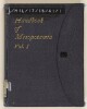
2. ''Handbook of Mesopotamia. Vol. I. 1916''
- Description:
- This volume is A Handbook of Mesopotamia, Volume I, General(Admiralty War Staff Intelligence Division: August 1916). It is an introductory volume containing matter of a general nature giving an account of conditions in Mesopotamia. The volume includes a note on official use, title page and ''Note''. There is a page of ''Contents'' and includes the following chapters and sections:Chapter 1: Boundaries and Physical Features;Chapter 2: Climate;Chapter 3: Minerals;Chapter 4: Fauna and Flora;Chapter 5: Hygiene;Chapter 6: History;Chapter 7: Inhabitants;Chapter 8: Religions;Chapter 9: Administration;Chapter 10: Irrigation of Irak Iraq;Chapter 11: Agriculture;Chapter 12: Commerce and Industry;Chapter 13: Currency, Weights and Measures;Chapter 14: Communication and Transport;Transliteration of Arabic, Persian and Turkish Names;Vocabularies;Index.There is a List of Maps which includes:Map 1: Administrative Divisions and Chief Towns;Map 2: Racial Divisions;Map 3: Area Available for Irrigation.1 volume (186 folios)The volume is arranged according to numbered chapters. There is a page of contents and an alphabetically arranged index at the end of the volume. A list of maps appears following the table of contents.Foliation: The foliation sequence commences at the first folio and terminates at the last folio; these numbers are written in pencil, are circled, and are located in the top right corner of the recto side of each folio.Pagination: The volume also contains an original printed pagination sequence.