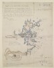
1. ‘Part of the Ruweïs at Jebál’ Contributor: C.G. Constable (surveyor) Date: 1862/1862 Language: English Geographic region: Masandam Peninsula Extent: 1 map sheet
2. ‘COPY FROM A TRACING OF A PORTION OF THE CHART OF THE SHATT EL ARAB – MAGHIL TO BASRA, SUPPLIED BY LIEUTENANT-COMMANDER CAMPBELL OF THE R.I.M.S. “COMET”.’ Date: 1912/1912 Language: English Geographic region: Shatt al ʻArab Extent: 1 map
3. 'Sketch map of British Guiana showing area suggested for Assyrian settlement' Date: 1934/1934 Language: English Extent: 1 map
4. 'SKETCH MAP To illustrate proposed settlement of Syria - Trans-Jordan Frontier' (with amendments) Date: 1931/1931 Language: English Extent: 1 map
5. 'MAP TO SHOW THE LIMITS OF KOWEIT AND ADJACENT COUNTRY' Date: 1907/1917 Language: English Geographic region: Koweit Extent: 1 map
6. 'Sketch map shewing communications between KERMAN and SAIDABAD.' Contributor: Simla Drawing Office, General Staff, India (publisher) Date: 1922/1922 Language: English Geographic region: Saidabad Extent: 1 map
7. 'Sketch Map of Part of S-W Persia showing routes by Captains Burton and Vaughan, 1897' Date: 1898/1898 Language: English Extent: 1 map
8. 'PLAN TO ILLUSTRATE THE ROUTES AVAILABLE FOR THE ARMS TRADE THROUGH THE PERSIAN MEKRAN COAST' Date: 1907/1907 Language: English Extent: 1 map
10. ‘South Arabia. Anglo-Turkish Boundary. Sheet No. 3’ Date: 1914/1914 Language: English Geographic region: Yemen Extent: 1 map
12. 'Skeleton of Curzon's Map of PERSIA showing Routes Examined for the Central Persia Telegraph Line' Date: 1899/1899 Language: English Extent: 1 map
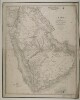
13. ‘Arabia. By William Henry F. Plate’ Contributor: J & C Walker, engravers (publisher)William Henry F. Plate (publisher) Date: 1847/1847 Language: English Geographic region: Arabian Peninsula Extent: 1 map sheet
15. Blueprint map of a section of the Iran-Baluchistan border Date: 1938/1938 Language: English Geographic region: Kastag Extent: 1 map
16. ‘Sketch map of the Kermanshah Consulate District’ Date: 1909/1909 Language: English Geographic region: Kermānshāhan (province) Extent: 1 map
17. ‘17. Shaikh Saad and Kut-Al-Amara. Situation 4 a.m. 24th February 1917’ Date: 1925/1925 Language: English Extent: 1 map
18. 'Chart showing pearl banks along the Arabian shore of the Persian Gulf north of Ras Tanurah' Date: 1937/1937 Language: English Geographic region: Persian Gulf Extent: 1 chart
20. 'MAP 21 TO ILLUSTRATE OPERATIONS ON THE TIGRIS FRONT, MAY TO 12TH. DECEMBER, 1916.' Contributor: Ordnance Survey (publisher) Date: 1925/1925 Language: English Extent: 1 map
21. 'Sketch map showing Motor Road from Kuwait to Riyadh' Date: 1938/1938 Language: English Extent: 1 map (3 sheets)
22. A sketch map of Persian Gulf region for use in clerical examinations Date: 1931/1939 Language: English Extent: 1 map sheet
23. The districts of Persian Mekran Date: 1907/1907 Language: English Geographic region: Mekran Coast Extent: 1 map
25. ‘[Plan] OF THE WORKS ON THE SUMMIT OF THE CONICAL HILL IN REAR OF RAS-MORBAT’ Contributor: J. Kilner (surveyor) Date: 1846/1846 Language: English Geographic region: Aden Extent: 1 sheet
26. ‘Geological Sketch map of Qatar Peninsula’ Date: 1934/1934 Language: English Geographic region: Qatar Extent: 1 map
27. 'MAP SHOWING SELECTION BY THE BAHREIN PETROLEUM COMPANY LIMITED UNDER CONCESSION DATED DECEMBER 2ND 1925. BAHREIN ISLAND. PERSIAN GULF' Date: 1925/1935 Language: English Extent: 1 map
28. 'WEST INDIA ISLANDS AND CARIBBEAN SEA. SHEET I. COMPRISING FLORIDA STRAIT, BAHAMA ISLANDS AND GREATER ANTILLES. Compiled from most recent surveys. 1876. With corrections to 1937.' Date: 1947/1947 Language: English Extent: 1 map
29. ‘20. Diagram of situation on 7th March’ Date: 1925/1925 Language: English Geographic region: Baghdad Extent: 1 map
30. ‘TRACING SHOWING THE ROUTE AND COAST LINE FROM MOGOO BAY TO THE TOWN OF BUNDER ABBAS’ Date: 1864/1864 Language: English Geographic region: Bunder AbbasKishm Extent: 1 map
31. ‘Road map, present operation. Province of Hasa, Saudi Arabia. B-1132’ Date: 1940/1940 Language: English Geographic region: Al-Hasa Extent: 1 map
32. ‘Map of the Countries lying between the Euphrates and Indus on the East and West, and the Oxus and Terek and Indian Ocean on the North and South. By John Macdonald Kinneir’ Contributor: Sir Knight John Kinneir Macdonald (author)Aaron Arrowsmith (author)Andrew Scott Waugh (author) Date: 1856/1856 Language: English Geographic region: Middle East Extent: 1 map on 4 sheets
33. Sketch representing the rivers Naurab, Hermand and Shela, surrounding Zabul Date: 1939/1939 Language: English Extent: 1 map
34. Sketch map showing the projected line of the proposed route of the Trans-Persian Railway through Persia, Russia and Baluchistan Date: 1912/1912 Language: English Extent: 1 map
36. 'MAP 5' Contributor: Simla Drawing Office, General Staff, India (publisher) Date: 1917/1917 Language: English Geographic region: Dehbīd Extent: 1 map
38. Sketch map of Trucial Oman Contributor: Cornelius James Pelly (surveyor) Date: 1942/1942 Language: English Geographic region: Trucial States Extent: 1 map
39. Map of the Masandam Peninsula by Bertram Thomas Date: 1926/1926 Language: English Geographic region: Masandam Peninsula Extent: 1 map
40. ‘Trigonometrical Survey of the shores of, and the Soundings off the Entrance to Abothubbee Back-water on the Arabian side of the Persian Gulf by Lieut.s J.M. Guy and G.B. Brucks, H.C. Marine. 1823. Drawn by Lieut.t M. Houghton H.C.M.’ Contributor: Michael Houghton (artist)George Edward Brucks (surveyor)John M. Guy (surveyor) Date: 1823/1823 Language: English Geographic region: Abothubbee Extent: 1 map
41. 'Map showing tribes and new boundary of the Aden Protectorate' Date: 1906/1906 Language: English Extent: 1 map
43. 'Plan of Mosul and Surrounding Country, Corrected from Jones' Survey' Date: 1889/1889 Language: English Extent: 1 map
45. ‘Chart Intended as an Accompaniment to the Book of Directions for Navigating to, from, and in the East Indies. Engraved by John Bateman’ Contributor: John Bateman (artist)James Horsburgh (publisher) Date: 1830/1830 Language: English Geographic region: Arabian Sea Extent: 1 map
47. 'Entwurf zu dem Kriegsschauplatze in Asyr vor dem Jahr 1824' Contributor: Karl Ritter (author)Hermann Delius (author)Dietrich Reimer (author)Carl Zimmermann (author) Date: 1846/1846 Language: German Geographic region: ʻAsīr Region Extent: 1 map sheet
48. 'Sketch map showing territorial dispositions of the Persian Army' Contributor: Survey of India (publisher) Date: 1925/1925 Language: English Geographic region: Persian Gulf Extent: 1 map