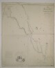
1. ‘Map of the countries between the Mediterranean Sea and the Gulf of Persia on the line of the Euphrates, Tigris, Kuran. Compiled and drawn by Lieut. Felix Jones J.N. Assist. Surveyor, from the original Surveys made by the late expedition under Commander H. Blosse Lynch assisted by Leutts. Chris D. Campbell M.W. Lynch, Felix Johnes, William B. Selby & Henry Grounds of the Indian Navy’ Contributor: James Felix Jones (surveyor) Date: 1847/1847 Language: English Geographic region: Middle East Extent: 1 map sheet
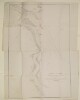
2. 'Sketch of the Course of the Shat Ul 'Arab from the Entrance to Mahomerah' Contributor: James Felix Jones (surveyor) Date: 1857/1857 Language: EnglishPersian Geographic region: Shatt al ʻArab Extent: 1 map