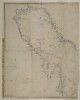
1. Chart of the Gulf of Persia. Constructed from the Trigonometrical Surveys Made by Order of The Hon.ble the Court of Directors of the United English East India Company; by George Barnes Brucks, Commander H.C. Marine Contributor: Richard Bateman (artist)George Edward Brucks (surveyor)James Horsburgh (publisher) Date: 1832/1832 Language: EnglishArabic Extent: 1 map
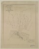
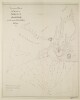
2. ‘Trigonometrical Plan of the Entrance of the Back-water at Aymaun by Lieut.t R. Cogan under the direction of Lt. J.M. Guy, H.C. Marine. 1822. Drawn by M. Houghton’ Contributor: Robert Cogan (surveyor)John M. Guy (surveyor)Michael Houghton (artist) Date: 1822/1822 Language: EnglishArabic Geographic region: Aymaun Extent: 1 map
3. ‘Arabic Characters to Accompany and for Insertion in the Chart of the Persian Gulf’ Date: 1825/1825 Language: EnglishArabic Extent: 1 item
4. ‘Chart of the Gulf of Persia. Constructed from the Trigonometrical Surveys Made by Order of The Hon.ble the Court of Directors of the United English East India Company; by George Barnes Brucks, Commander H.C. Marine. 1830. Engraved by R. Bateman, 85 Long Acre’ Contributor: James Horsburgh (publisher)Richard Bateman (artist)George Edward Brucks (surveyor) Date: 1832/1832 Language: EnglishArabic Geographic region: Persian Gulf Extent: 1 map on 2 sheets
5. 'South Arabia, Anglo-Turkish Boundary: Sheet No. 3' Date: 1905/1905 Language: EnglishArabic Extent: 1 folio
6. 'ANNEXE B. SOUTH ARABIA ANGLO-TURKISH BOUNDARY.' Date: 1914/1914 Language: EnglishArabic Geographic region: YemenAden Protectorate Extent: 1 map on 4 sheets
7. 'South Arabia, Anglo-Turkish Boundary: Sheet No. 4' Date: 1905/1905 Language: EnglishArabic Extent: 1 folio
10. Title deed plan of land at Umm al Hasam, Manamah Contributor: James Orton (correspondent)Francis Warden (correspondent) Date: 1944/1944 Language: Arabic Geographic region: JufairJazīreh-ye HengāmManamaBūshehrAbū-ShahrHormuz Isle Extent: 1 plan
11. ‘Trigonometrical Plan of the Back-water at Sharja by Lieut.t R. Cogan under the direction of Lt. J.M. Guy, H.C.Marine. 1822’ Contributor: Robert Cogan (surveyor)Michael Houghton (artist)John M. Guy (surveyor) Date: 1822/1822 Language: EnglishArabic Geographic region: Sharjah Extent: 1 map
13. Copy of Arabic plan showing site acquired by the British Government for Naval Base Juffair, Manama Date: 1929/1939 Language: Arabic Extent: 1 map
14. 'SKETCH MAP OF QATAR PENINSULA' Contributor: Bahrain Political Agency (creator) Date: 1934/1936 Language: EnglishArabic Geographic region: Kuwait Extent: 1 map sheet
15. A map of pearl banks in Persian Gulf Date: 1940/1940 Language: Arabic Geographic region: Persian Gulf Extent: 1 map
16. 'South Arabia, Anglo-Turkish Boundary: Sheet No. 1' Date: 1905/1905 Language: EnglishArabic Extent: 1 folio
17. 'ANNEXE B. SOUTH ARABIA ANGLO-TURKISH BOUNDARY. SHEET NO. 2' Date: 1914/1914 Language: EnglishArabic Geographic region: YemenAden Protectorate Extent: 1 map on 4 sheets
18. 'ANNEXE B. SOUTH ARABIA ANGLO-TURKISH BOUNDARY. SHEET NO. 1' Date: 1914/1914 Language: EnglishArabic Geographic region: YemenAden Protectorate Extent: 1 map on 4 sheets
19. Title deed plan of land at Ghosaibia, Manamah Contributor: James Orton (correspondent)Francis Warden (correspondent) Date: 1944/1944 Language: Arabic Geographic region: JufairJazīreh-ye HengāmManamaBūshehrAbū-ShahrHormuz Isle Extent: 1 plan
20. 'SKETCH MAP OF QATAR PENINSULA' Contributor: Bahrain Political Agency (creator) Date: 1934/1936 Language: EnglishArabic Geographic region: Kuwait Extent: 1 map sheet
21. Sketch map of Pearl Banks between Koweit and Ras Tanura Date: 1906/1906 Language: EnglishArabic Extent: 1 map
22. 'South Arabia, Anglo-Turkish Boundary: Sheet No. 2' Date: 1905/1905 Language: EnglishArabic Extent: 1 folio
23. ‘Trigonometrical Plan of the Back-water at Amulgawein by Lieut.t G.B. Brucks under the direction of Lieut.t J.M. Guy, H.C.Marine. 1822’ Contributor: John M. Guy (surveyor)George Edward Brucks (surveyor)Michael Houghton (artist) Date: 1822/1822 Language: EnglishArabic Geographic region: Amulgawein Extent: 1 map
24. Copy of Arabic plan showing site acquired by the British Government for Naval Base Juffair, Manama Date: 1929/1939 Language: Arabic Extent: 1 map