1. Carte de la Tunisie Creator: Institut géographique national (France) (Creator) Date: Date Issued: 1895 Language: FrenchArabicLatin Geographic region: Place of Production: fr, France, ParisTunisia Extent: 1 map on 2 sheets : col. ; 110 x 65 cm., sheet 58 x 71 cm.
2. Carte de la Tunisie Creator: Institut géographique national (France) (Creator) Date: Date Issued: 1895 Language: FrenchArabicLatin Geographic region: Place of Production: fr, France, ParisTunisia Extent: 1 map on 2 sheets : col. ; 110 x 65 cm., sheet 58 x 71 cm.
3. Carte de la Tunisie Creator: Institut géographique national (France) (Creator) Date: Date Issued: 1895 Language: FrenchArabicLatin Geographic region: Place of Production: fr, France, ParisTunisia Extent: 1 map on 2 sheets : col. ; 110 x 65 cm., sheet 58 x 71 cm.
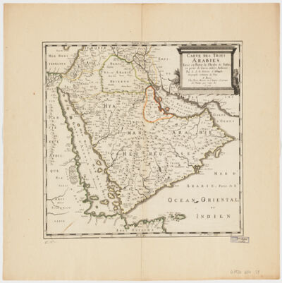
4. Carte des trois Arabiestirée en partie de l'Arabe de Nubie, en partie de diuers autres autheurs Creator: Sanson, Nicolas, 1600-1667 (المنشئ) Date: Date Issued: 1654 Language: French Geographic region: Place of Production: fr, France, ParisArabian Peninsula Extent: 1 map : hand col. ; 39 x 47 cm.
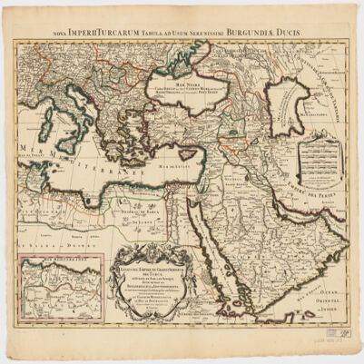
5. Estats de l'Empire du grand Seigneur des Turcs en Europe, en Asie, et en Afriquedivisé en tous ses Beglerbeglicz ou Gouvernements; où sont aussi remarqués les Estats qui luy sont Tributaires Creator: Jaillot, Alexis Hubert, 1632?-1712 (المنشئ) Date: Date Issued: 1696 Language: Latin Geographic region: Place of Production: fr, France, ParisTurkeyMiddle EastAfrica, NorthEurope, SouthernNorth AfricaSouthern Europe Time period: Ottoman Empire, 1288-1918 Extent: 1 map : hand colored ; 44 x 60 cm
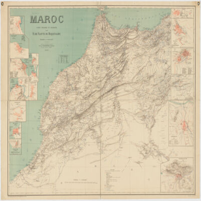
6. Maroc Creator: Flotte de Roquevaire, R. de. (المنشئ) Date: Date Issued: 1908 Language: French Geographic region: Place of Production: fr, France, ParisMoroccoAlgeriaWestern Sahara Extent: 1 map : col. ; 101 x 132 cm.
7. Palestine ancienne & moderne d'après les sources les plus authentiques Creator: Andriveau-Goujon, E. (Eugène), 1832-1897 (المنشئ) Date: Date Issued: 1876 Language: FrenchLatinArabicHebrew Geographic region: Place of Production: fr, France, ParisPalestineLebanon Extent: 1 map : col. ; 62 x 46 cm.
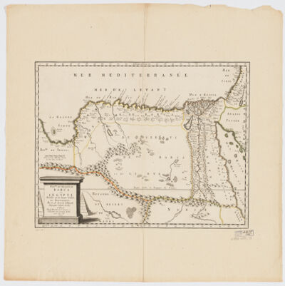
8. Royme., et désert de Barca et l'Égypte divisée en ses douze Cassifs, ou Gouvernemens Creator: Sanson, Nicolas, 1600-1667 (المنشئ) Date: Date Issued: 1655 Language: French Geographic region: Place of Production: fr, France, ParisEgyptLibya Extent: 1 map : hand col. ; 32 x 50 cm.