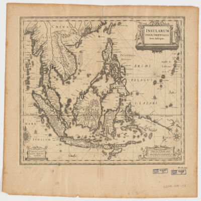
1. Insularum Indiae Orientalisnova descriptio Creator: Jansson, Jan, 1588-1664 (المنشئ) Date: Date Issued: [1650?] Language: Latin Geographic region: Place of Production: ne, Netherlands, AmstelodamiSoutheast AsiaEast Indies Extent: 1 map ; 37 x 48 cm.
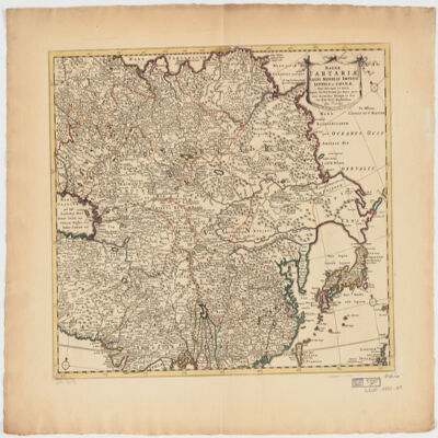
2. Magnae Tartariae, magni Mogolis Imperii, Iaponiae et Chinaenova descriptio ex tabula Creator: Wit, Frederik de. (المنشئ) Date: Date Issued: [ca. 1725?] Language: Latin Geographic region: Place of Production: ne, Netherlands, AmstelodamiAsia Extent: 1 map : hand col. ; 41 x 52 cm.
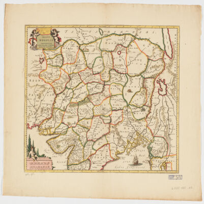
3. Magni Mogolis Imperium de novo correctum et divisum Creator: Wit, Frederik de. (المنشئ) Date: Date Issued: [1707?] Language: Latin Geographic region: Place of Production: ne, Netherlands, AmstelodamiMogul EmpireSouth AsiaAsia, Central Extent: 1 map : hand col. 40 x 50 cm.
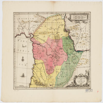
4. Syriæ Sive Soriænova et accurata descriptio Date: Date Issued: [1708?] Language: Latin Geographic region: Place of Production: ne, Netherlands, AmstelodamiSyriaLebanon Extent: 1 map : hand col. ; 41 x 49 cm.
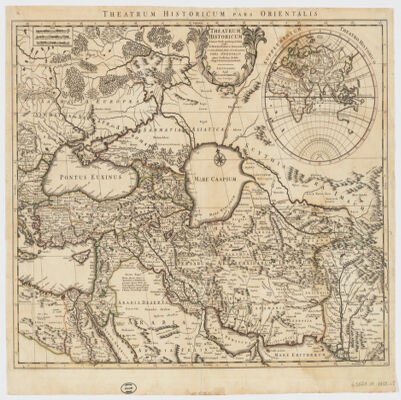
5. Theatrum historicum ad annum Christi quadrigentesimũin quo tũ Imperii Romani tũ Barbarorum circumincolentium status ob oculos ponitur pars orientalis Creator: L'Isle, Guillaume de, 1675-1726 (المنشئ) Date: Date Issued: [between 1759 and 1799] Language: Latin Geographic region: Place of Production: ne, Netherlands, AmstelodamiEastern Hemisphere Extent: 1 map : hand col. ; 47 x 60 cm.