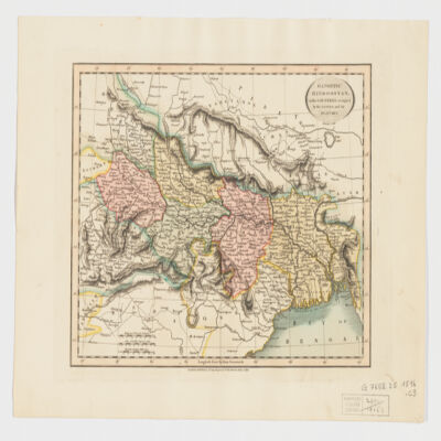
41. Gangetic Hindoostan or the countries occupied by the Ganges and the branches Creator: Cary, John, approximately 1754-1835 (المنشئ) Date: Date Issued: June 1, 1816 Language: English Geographic region: Place of Production: enk, England, LondonIndia, NortheasternBangladeshNepal Extent: 1 map : hand col. ; 22 x 27 cm.
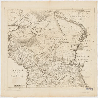
42. General Charte der Laender Zwischen dem Schwarzen und Caspischen MeereCircassien, Georgien, Armenien, Wüste von Astrachan und Caucasus hauptsoechlich die Grosse und Kleine Kabarda Creator: Treuttel, Jean-Georges, 1744-1826 (المنشئ) Date: Date Issued: [between 1765 and 1800?] Language: GermanFrench Geographic region: Place of Production: gw, Germany, StrasburgRussia (Federation)GeorgiaCaucasus, South Extent: 1 map ; 46 x 57 cm.
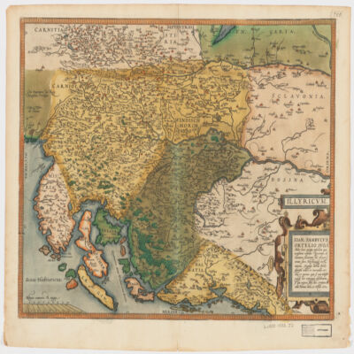
43. Illyricvm Creator: Zsámboki, János, 1531-1584 (المنشئ) Date: Date Issued: Oct. 25, 1572 Language: Latin Geographic region: Place of Production: au, Austria, ViennæBalkan PeninsulaSloveniaCroatiaBosnia and Herzegovina Extent: 1 map : hand col. ; 36 x 46 cm.
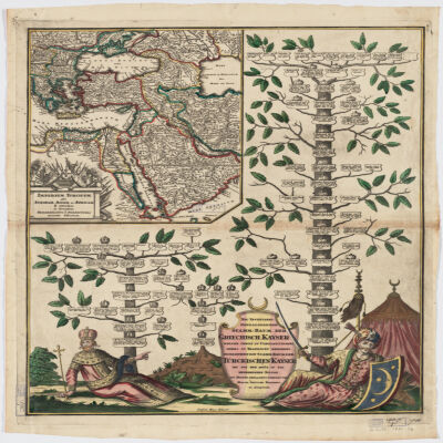
44. Imperium Turcicum per Europam, Asiam Et Africam se extendens et secundum Beglerbegatus sive Praefecturas accurate distinctum Creator: Seutter, Matthaeus, 1678-1756 (المنشئ) Date: Date Issued: [1720?] Language: GermanLatin Geographic region: Place of Production: gw, Germany, AugspurgTurkeyIslamic countries Extent: 1 map : hand col. ; 27 x 25 cm., on sheet 61 x 52 cm.
45. Indian Ocean Region, ca. 1690 (Raster Image) Date: 201110 Geographic region: AfghanistanAlgeriaAngolaArmeniaAustraliaAzerbaijanBahrainBangladeshBhutanBotswanaBritish Indian Ocean TerritoryBruneiBurmaBurundiCambodiaCameroonCentral Africian RepublicChadChinaChristmas IslandCocos (Keeling) IslandsComorosCongo, Democratic Republic of theCongo, Republic of theDjiboutiEgyptEritreaEthiopiaGabonGlorioso IslandsGuamIndiaIndonesiaIranIraqIsraelJapanJordanJuan de Nova IslandKazakhstanKenyaKuwaitKyrgyzstanLaosLesothoLibyaMadagascarMalawiMalaysiaMaldivesMauritiusMayotteMozambiqueNamibiaNepalNigerNigeriaNorth KoreaNorthern Mariana IslandsOmanPakistanPalauPapua New GuineaPhilippinesQatarReunionRwandaSaudi ArabiaSeychellesSingaporeSomaliaSouth AfricaSouth KoreaSri LankaSudanSwazilandSyriaTajikistanTanzaniaThailandTimor-LesteTurkeyTurkmenistanUgandaUnited Arab EmiratesUzbekistanVietnamYemenZambiaZimbabweIndian OceanAsiaSouth AsiaSoutheast AsiaAfrica, East177.31452253.283629-65.180727-13.682351
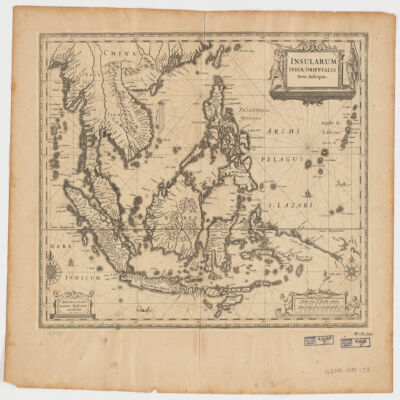
46. Insularum Indiae Orientalisnova descriptio Creator: Jansson, Jan, 1588-1664 (المنشئ) Date: Date Issued: [1650?] Language: Latin Geographic region: Place of Production: ne, Netherlands, AmstelodamiSoutheast AsiaEast Indies Extent: 1 map ; 37 x 48 cm.
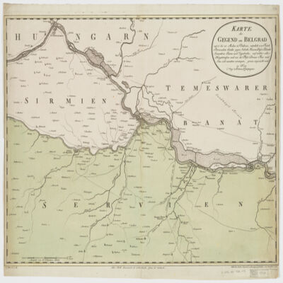
47. Karte der Gegend um Belgradauf 15 bis 20 Meilen in Umkreis, nämlich von Futak Peterwardein Semlin gegen Sabatz, Hassan Bassa Palanka Semendria Rama und Uypalanka, auf welcher alle Hauptstrassen und wie die Flüsse Donau Theis und Sau sich zusammen vereinigen, genau angezeicht sind Creator: Mansfeld. (المنشئ) Date: Date Issued: 1788 Language: German Geographic region: Place of Production: au, Austria, WienSerbiaHungary Extent: 1 map : hand col. ; 47 x 67 cm.
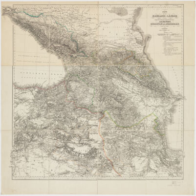
48. Karte der Kaukasus-Länder und der angränzenden Türkischen und Persischen Provinzen Armenien, Kurdistan, und Azerbeidjan Creator: Kiepert, Heinrich, 1818-1899 (المنشئ) Date: Date Issued: 1854 Language: German Geographic region: Place of Production: gw, Germany, BerlinCaucasus Extent: 1 map : hand col., dissected and mounted on linen ; 69 x 75 cm.
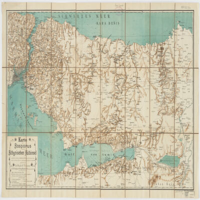
49. Karte des Bosporus und der Bithynischen Halbinsel Creator: Fitzner, Rudolph, 1864- (المنشئ) Date: Date Issued: [1900?] Language: German Geographic region: Place of Production: gw, Germany, Rostockİstanbul İli (Turkey)Kocaeli İli (Turkey)Sakarya İli (Turkey)Bosporus (Turkey) Extent: 1 map : col. ; 47 x 87 cm.
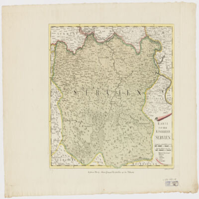
50. Karte von dem Königreich Serbien Creator: Müller, F. (المنشئ) Date: Date Issued: [1790?] Language: German Geographic region: Place of Production: au, Austria, WienSerbia Extent: 1 map : hand col. ; 36 x 43 cm.