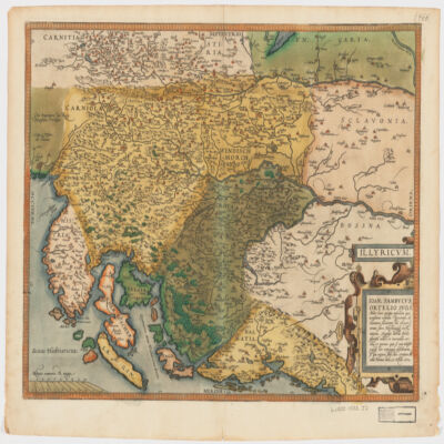
1. Illyricvm Creator: Zsámboki, János, 1531-1584 (المنشئ) Date: Date Issued: Oct. 25, 1572 Language: Latin Geographic region: Place of Production: au, Austria, ViennæBalkan PeninsulaSloveniaCroatiaBosnia and Herzegovina Extent: 1 map : hand col. ; 36 x 46 cm.
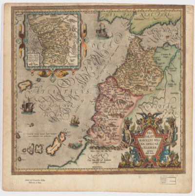
2. Fessae, et Marocchi Regna Africae celeberr Creator: Ortelius, Abraham, 1527-1598 (المنشئ) Date: Date Issued: 1595 Language: Latin Geographic region: Place of Production: be, Belgium, [Antwerp]MoroccoGibraltar, Strait ofCanary Islands Extent: 1 map : hand col. ; 37 x 48 cm.
3. Africa, 1611 or 1612 (Raster Image) Date: 201204 Geographic region: AfricaMiddle EastEurope87.69118444.063898-44.943919-57.577607
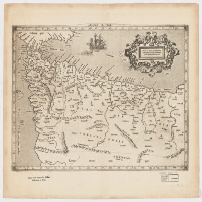
4. Africae I Tab Creator: Mercator, Gerhard, 1512-1594 (المنشئ) Date: Date Issued: 1619?] Language: Latin Geographic region: Place of Production: xx, No place, unknown, or undetermined, [S.lAfrica, North Extent: 1 map ; 31 x 45 cm.
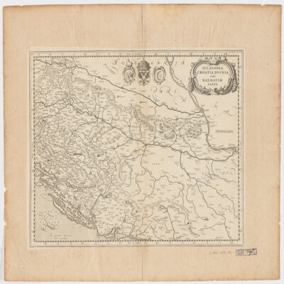
5. Sclavonia, Croatia, Bosnia cum Dalmatiæ parte Creator: Mercator, Gerhard, 1512-1594 (المنشئ) Date: Date Issued: 1630?] Language: Latin Geographic region: Place of Production: ne, Netherlands, [AmsterdamBalkan PeninsulaCroatiaBosnia and HerzegovinaSerbia Extent: 1 map ; 34 x 44 cm.
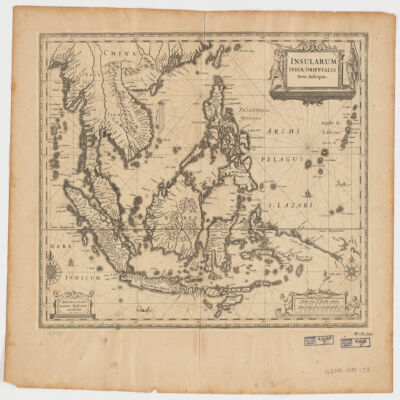
6. Insularum Indiae Orientalisnova descriptio Creator: Jansson, Jan, 1588-1664 (المنشئ) Date: Date Issued: [1650?] Language: Latin Geographic region: Place of Production: ne, Netherlands, AmstelodamiSoutheast AsiaEast Indies Extent: 1 map ; 37 x 48 cm.
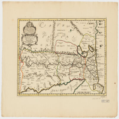
7. Ægyptus antiqua divisa in Nomos Creator: Duval, P. (Pierre), 1619-1682 (Creator) Date: Date Issued: 1652?] Language: LatinFrench Geographic region: Place of Production: ne, Netherlands, [AmsterdamEgypt Extent: 1 map : hand col. ; 35 x 50 cm.
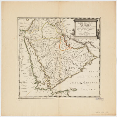
8. Carte des trois Arabiestirée en partie de l'Arabe de Nubie, en partie de diuers autres autheurs Creator: Sanson, Nicolas, 1600-1667 (المنشئ) Date: Date Issued: 1654 Language: French Geographic region: Place of Production: fr, France, ParisArabian Peninsula Extent: 1 map : hand col. ; 39 x 47 cm.
9. World Map, 1654 (Raster Image) Date: 201404 Geographic region: EarthNorthern HemisphereSouthern HemisphereEastern HemisphereWestern HemisphereAfricaAsiaAustraliaEuropeNorth AmericaSouth AmericaArctic regions18090-90-180
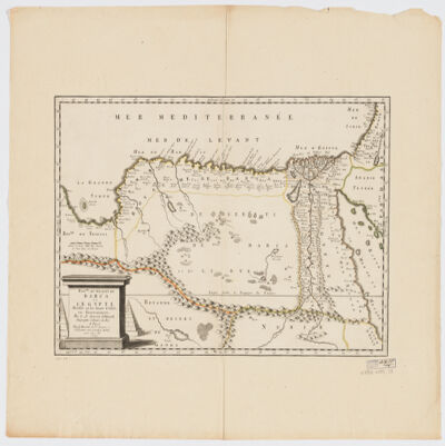
10. Royme., et désert de Barca et l'Égypte divisée en ses douze Cassifs, ou Gouvernemens Creator: Sanson, Nicolas, 1600-1667 (المنشئ) Date: Date Issued: 1655 Language: French Geographic region: Place of Production: fr, France, ParisEgyptLibya Extent: 1 map : hand col. ; 32 x 50 cm.
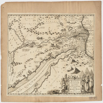
11. Ægypti recentior descriptioÆgyptis & Turcis Elchibith, Arabibus Mesre & Misri, Hebræis Mitsraim Date: Date Issued: 1659?] Language: LatinHebrewArabic Geographic region: Place of Production: ne, Netherlands, [AmstelodamiEgyptNile River Valley Extent: 1 map ; 39 x 50 cm.
12. A generall mapp of the Coast of Barbarie, where in are the Kingdoms, and Estates of Morocco, Fez, Algiers, Tunis and Tripolialso the Kingdoms, Estates and Deserts of Barca, Egipt, Libya, Biledulgerid, Segelmesse and Darha: with the circumjacent counteries Creator: Sanson, Nicolas, 1600-1667 (المنشئ) Date: Date Issued: 1667?] Language: EnglishFrench Geographic region: Place of Production: enk, England, [LondonMoroccoTunisiaAlgeriaMauritania Extent: 1 map on 2 sheets ; 28 x 106 cm, sheets 35 x 57 cm and 35 x 59 cm.