1. 'Pocket No. 25: Enclosure to Part III of Volume I of the Persian Gulf Gazetteer: Chart showing the Pearl Banks along the Arabian Shore of the Persian Gulf between Ras Tanura and Debai' Date: 1915/1915 Language: EnglishArabic Extent: 1 map
4. 'ANNEXE B. SOUTH ARABIA ANGLO-TURKISH BOUNDARY.' Date: 1914/1914 Language: EnglishArabic Geographic region: YemenAden Protectorate Extent: 1 map on 4 sheets
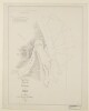
5. 'ANNEXE B. SOUTH ARABIA ANGLO-TURKISH BOUNDARY. SHEET NO. 1' Date: 1914/1914 Language: EnglishArabic Geographic region: YemenAden Protectorate Extent: 1 map on 4 sheets
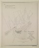
6. 'ANNEXE B. SOUTH ARABIA ANGLO-TURKISH BOUNDARY. SHEET NO. 2' Date: 1914/1914 Language: EnglishArabic Geographic region: YemenAden Protectorate Extent: 1 map on 4 sheets
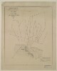
7. 'ANNEXE B. SOUTH ARABIA ANGLO-TURKISH BOUNDARY. SHEET NO. 3' Date: 1914/1914 Language: EnglishArabic Geographic region: YemenAden Protectorate Extent: 1 map on 4 sheets
8. 'South Arabia, Anglo-Turkish Boundary: Sheet No. 1' Date: 1905/1905 Language: EnglishArabic Extent: 1 folio
9. 'South Arabia, Anglo-Turkish Boundary: Sheet No. 2' Date: 1905/1905 Language: EnglishArabic Extent: 1 folio
10. 'South Arabia, Anglo-Turkish Boundary: Sheet No. 3' Date: 1905/1905 Language: EnglishArabic Extent: 1 folio
11. 'South Arabia, Anglo-Turkish Boundary: Sheet No. 4' Date: 1905/1905 Language: EnglishArabic Extent: 1 folio
14. ‘Chart of the Gulf of Persia. Constructed from the Trigonometrical Surveys Made by Order of The Hon.ble the Court of Directors of the United English East India Company; by George Barnes Brucks, Commander H.C. Marine. 1830. Engraved by R. Bateman, 85 Long Acre’ Contributor: James Horsburgh (publisher)Richard Bateman (artist)George Edward Brucks (surveyor) Date: 1832/1832 Language: EnglishArabic Geographic region: Persian Gulf Extent: 1 map on 2 sheets
15. ‘Arabic Characters to Accompany and for Insertion in the Chart of the Persian Gulf’ Date: 1825/1825 Language: EnglishArabic Extent: 1 item
16. Alexandria Creator: Egypt. Maṣlaḥat al-Misāḥah Date: 1953 Language: Arabic Geographic region: Alexandria; Egypt
17. Alexandria, Department of Survey and Mines Creator: Egypt. Maṣlaḥat al-Misāḥah wa-al-Manājim Date: 1940 Language: EnglishArabic Geographic region: Alexandria; Egypt
18. Banha Creator: Egypt. Maṣlaḥat al-Misāḥah Date: 1945 Language: Arabic Geographic region: Banhā; Al Qalyūbīyah; Egypt
19. Cairo Creator: Egypt. Maṣlaḥat al-Misāḥah Date: 1930 Language: EnglishArabic Geographic region: Cairo; Egypt
20. Cairo Creator: Egypt. Maṣlaḥat al-Misāḥah. Date: 1952 Language: Arabic Geographic region: Cairo; Egypt
21. Cairo Abbasiya Creator: Egypt. Maṣlaḥat al-Misāḥah. Date: 1938 Language: Arabic Geographic region: Cairo; Egypt
22. Cairo Bulaq, Zamalek, Downtown Creator: Egypt. Maṣlaḥat al-Misāḥah. Date: 1951 Language: Arabic Geographic region: Cairo; Egypt
23. Cairo Dahab Island, Dar al-Salaam Creator: Egypt. Maṣlaḥat al-Misāḥah. Date: 1952 Language: Arabic Geographic region: Cairo; Egypt
24. Cairo Heliopolis Creator: Egypt. Maṣlaḥat al-Misāḥah. Date: 1951 Language: Arabic Geographic region: Heliopolis; Cairo; Egypt
25. Cairo Heliopolis Creator: Egypt. Maṣlaḥat al-Misāḥah. Date: 1952 Language: Arabic Geographic region: Heliopolis; Cairo; Egypt
26. Cairo Jazīrat Warrāq al Ḩaḑar Creator: Egypt. Maṣlaḥat al-Misāḥah. Date: 1940 Language: Arabic Geographic region: Warrāq al Ḥaḍar, Jazīrat; Giza; Egypt
27. Cairo Zamalek, Agouza, Imbaba Creator: Egypt. Maṣlaḥat al-Misāḥah. Date: 1952 Language: Arabic Geographic region: Cairo; Egypt
29. Cairo, 1:1000 Creator: Egypt. Maṣlaḥat al-Misāḥah Date: 1929-1986 Language: ArabicEnglish Geographic region: Cairo; Egypt
30. Carte de la Tunisie Creator: Institut géographique national (France) (Creator) Date: Date Issued: 1895 Language: FrenchArabicLatin Geographic region: Place of Production: fr, France, ParisTunisia Extent: 1 map on 2 sheets : col. ; 110 x 65 cm., sheet 58 x 71 cm.
31. Carte de la Tunisie Creator: Institut géographique national (France) (Creator) Date: Date Issued: 1895 Language: FrenchArabicLatin Geographic region: Place of Production: fr, France, ParisTunisia Extent: 1 map on 2 sheets : col. ; 110 x 65 cm., sheet 58 x 71 cm.
32. Carte de la Tunisie Creator: Institut géographique national (France) (Creator) Date: Date Issued: 1895 Language: FrenchArabicLatin Geographic region: Place of Production: fr, France, ParisTunisia Extent: 1 map on 2 sheets : col. ; 110 x 65 cm., sheet 58 x 71 cm.
33. El-Maadi Creator: Egypt. Maṣlaḥat al-Misāḥah Date: 1945 Language: EnglishArabic Geographic region: Maadi; Cairo; Egypt
34. Khariṭat al-Wajh al-Baḥarī lil-aqālīm al-Miṣrīyah Creator: Ṣabbāgh, Amīn, cartographer Date: 1872 Language: Arabic Geographic region: Egypt
35. Kharīṭat madīnat al-Iskandarīyah Creator: Egypt. Maṣlaḥat al-Misāḥah. Date: 1934 Language: Arabic Geographic region: Alexandria; Egypt
36. Luxor Creator: Egypt. Maṣlaḥat al-Misāḥah Date: 1931 Language: Arabic Geographic region: Luxor; Al Uqşur; Egypt
37. Map of the tropical lakes with the locations of the dams and waters reservoirs Creator: Egypt. Maṣlaḥat al-Misāḥah Date: 1948 Language: Arabic Geographic region: Uganda; Africa
38. Maps from "Fī Miṣr al-Islāmīyah" Creator: Ḥasan, Zakī Muḥammad; Zakī, ʻAbd al-Raḥmān Date: 1937 Language: Arabic Geographic region: Cairo; Egypt
39. Maps from "Tārīkh Miṣr al-siyāsī fī al-azminah al-ḥadīthah" Creator: Rifʻat, Muḥammad Date: 1950 Language: Arabic
40. Maps from "Tārīkh al-barīd fī Miṣr" Creator: Egypt. Maṣlaḥat al-Barīd Date: 1934 Language: ArabicFrench Geographic region: Egypt
41. Maps from "al-Qāhirah" Creator: Zakī, ʻAbd al-Raḥmān, author. Date: 1943 Language: Arabic Geographic region: Cairo; Egypt
42. Maps from "al-Thawrah al-ʻUrābīyah wa-al-iḥtilāl al-Injilīzī" Creator: Rāfiʻī, ʻAbd al-Raḥmān Date: 1937 Language: Arabic Geographic region: Egypt
43. Maps from "Ṣawt Miṣr" Creator: Muʼmin, Muṣṭafá. Date: 1951 Language: Arabic Geographic region: Egypt; Sudan
44. Mediterranean Battle of Abu Kir, 1 August 1798 Creator: Rifʻat, Muḥammad Date: 1950 Language: Arabic Geographic region: Abū QīrEgypt
45. Nile main stream, between Halfa and Khartoum with the locations of the second and fourth water falls Creator: Egypt. Maṣlaḥat al-Misāḥah Date: 1949 Language: Arabic Geographic region: Egypt; Sudan
46. Palestine ancienne & moderne d'après les sources les plus authentiques Creator: Andriveau-Goujon, E. (Eugène), 1832-1897 (المنشئ) Date: Date Issued: 1876 Language: FrenchLatinArabicHebrew Geographic region: Place of Production: fr, France, ParisPalestineLebanon Extent: 1 map : col. ; 62 x 46 cm.
47. Ramleh (El Raml) Creator: Egypt. Maṣlaḥat al-Misāḥah Date: 1938 Language: Arabic Geographic region: Alexandria; Egypt
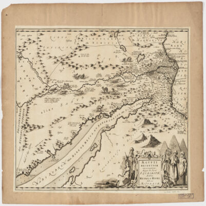
48. Ægypti recentior descriptioÆgyptis & Turcis Elchibith, Arabibus Mesre & Misri, Hebræis Mitsraim Date: Date Issued: 1659?] Language: LatinHebrewArabic Geographic region: Place of Production: ne, Netherlands, [AmstelodamiEgyptNile River Valley Extent: 1 map ; 39 x 50 cm.
49. 'SKETCH MAP OF QATAR PENINSULA' Contributor: Bahrain Political Agency (creator) Date: 1934/1936 Language: EnglishArabic Geographic region: Kuwait Extent: 1 map sheet
50. 'SKETCH MAP OF QATAR PENINSULA' Contributor: Bahrain Political Agency (creator) Date: 1934/1936 Language: EnglishArabic Geographic region: Kuwait Extent: 1 map sheet
51. Title deed plan of land at Umm al Hasam, Manamah Contributor: James Orton (correspondent)Francis Warden (correspondent) Date: 1944/1944 Language: Arabic Geographic region: JufairJazīreh-ye HengāmManamaBūshehrAbū-ShahrHormuz Isle Extent: 1 plan
52. Title deed plan of land at Ghosaibia, Manamah Contributor: James Orton (correspondent)Francis Warden (correspondent) Date: 1944/1944 Language: Arabic Geographic region: JufairJazīreh-ye HengāmManamaBūshehrAbū-ShahrHormuz Isle Extent: 1 plan
53. Sketch Map of Gwadur and Surrounding Region Date: 1941/1951 Language: EnglishArabic Extent: 1 map
54. Sketch map of Pearl Banks between Koweit and Ras Tanura Date: 1906/1906 Language: EnglishArabic Extent: 1 map
55. ‘Trigonometrical Plan of the Back-water at Amulgawein by Lieut.t G.B. Brucks under the direction of Lieut.t J.M. Guy, H.C.Marine. 1822’ Contributor: John M. Guy (surveyor)George Edward Brucks (surveyor)Michael Houghton (artist) Date: 1822/1822 Language: EnglishArabic Geographic region: Amulgawein Extent: 1 map
56. ‘Trigonometrical Plan of the Back-water of Debai by Lieut.t R. Cogan under the direction of Lt. J.M. Guy, H.C.Marine. 1822. Drawn by M. Houghton’ Contributor: Robert Cogan (surveyor)John M. Guy (surveyor)Michael Houghton (artist) Date: 1822/1822 Language: EnglishArabic Geographic region: Debai Extent: 1 map
57. ‘Trigonometrical Plan of the Back-water at Sharja by Lieut.t R. Cogan under the direction of Lt. J.M. Guy, H.C.Marine. 1822’ Contributor: Robert Cogan (surveyor)Michael Houghton (artist)John M. Guy (surveyor) Date: 1822/1822 Language: EnglishArabic Geographic region: Sharjah Extent: 1 map
58. ‘Trigonometrical Plan of the Entrance of the Back-water at Aymaun by Lieut.t R. Cogan under the direction of Lt. J.M. Guy, H.C. Marine. 1822. Drawn by M. Houghton’ Contributor: Robert Cogan (surveyor)John M. Guy (surveyor)Michael Houghton (artist) Date: 1822/1822 Language: EnglishArabic Geographic region: Aymaun Extent: 1 map
59. A map of pearl banks in Persian Gulf Date: 1940/1940 Language: Arabic Geographic region: Persian Gulf Extent: 1 map
60. Copy of Arabic plan showing site acquired by the British Government for Naval Base Juffair, Manama Date: 1929/1939 Language: Arabic Extent: 1 map
61. Copy of Arabic plan showing site acquired by the British Government for Naval Base Juffair, Manama Date: 1929/1939 Language: Arabic Extent: 1 map
62. Copy of Arabic plan showing site acquired by the British Government for Naval Base Juffair, Manama Date: 1929/1939 Language: Arabic Extent: 1 map
63. Chart of the Gulf of Persia. Constructed from the Trigonometrical Surveys Made by Order of The Hon.ble the Court of Directors of the United English East India Company; by George Barnes Brucks, Commander H.C. Marine Contributor: Richard Bateman (artist)George Edward Brucks (surveyor)James Horsburgh (publisher) Date: 1832/1832 Language: EnglishArabic Extent: 1 map